Bottineau in Minneapolis in Hennepin County, Minnesota — The American Midwest (Upper Plains)
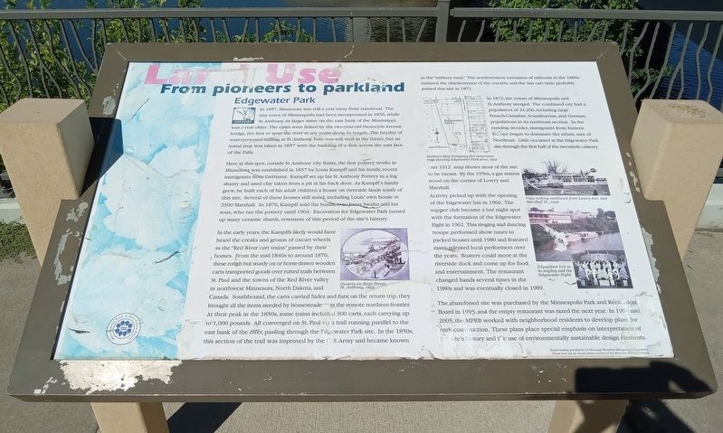
Land Use
From pioneers to parkland
— Edgewater Park —
In 1857, Minnesota was still a year away from statehood. The tiny town of Minneapolis had been incorporated in 1856, while St. Anthony, its larger sister on the east bank of the Mississippi, was a year older. The cities were linked by the two-year-old Hennepin Avenue bridge, the first to span the river at any point along its length. The heyday of waterpowered milling at St. Anthony Falls was still well in the future, but an initial step was taken in 1857 with the building of a dam across the east face of the Falls.
Here at this spot, outside St. Anthony city limits, the first pottery works in Minnesota was established in 1857 by Louis Kampff and his family, recent immigrants from Germany. Kampff set up his St. Anthony Pottery in a log shanty and used clay taken from a pit at his back door. As Kampff's family grew, he built each of his adult children a house on the riverside lands south of this site. Several of these houses still stand, including Louis' own house at 2300 Marshall. In 1876, Kampff sold the business to Jonas Swahn and his sons, who ran the pottery until 1904. Excavation for Edgewater Park turned up many ceramic shards, remnants of this period of the site's history.
Oxcarts on Main Street, St. Anthony, 1855
In the early years, the Kampffs likely would have heard the creaks and groans of oxcart wheels as the "Red River cart trains" passed by their homes. From the mid-1840s to around 1870, these rough but sturdy ox or horse-drawn wooden carts transported goods over rutted trails between St. Paul and the towns of the Red River valley in northwest Minnesota, North Dakota, and Canada. Southbound, the carts carried hides and furs; on the return trip, they brought all the items needed by homesteaders on the remote northern frontier. At their peak in the 1850s, some trains included 300 carts, each carrying up to 1,000 pounds. All converged on St. Paul via a trail running parallel to the east bank of the river, passing through the Edgewater Park site. In the 1850s, this section of the trail was improved by the U.S. Army and became known as the "military road." The northwestern extension of railroads in the 1860s initiated the obsolescence of the oxcarts, and the last cart train probably passed this site in 1871.
In 1872, the towns of Minneapolis and St. Anthony merged. The combined city had a population of 24,296, including large French-Canadian, Scandinavian, and German populations in its northeast section. In the ensuing decades, immigrants from Eastern Europe began to dominate the ethnic mix of Northeast. Little occurred at the Edgewater Park site through the first half of the twentieth century.
Sanborn Map Company
fire insurance map showing Edgewater Park area, 1912
This 1912 map shows most of the site to be vacant. By the 1950s, a gas station stood on the corner of Lowry and Marshall.
View looking southwest from Lowry Ave. and Marshall St., 1956
Edgewater Inn in its heyday and the Edgewater Eight
Activity picked up with the opening of the Edgewater Inn in 1960. The supper club became a hot night spot with the formation of the Edgewater Eight in 1962. This singing and dancing troupe performed show tunes to packed houses until 1980 and featured many talented local performers over the years. Boaters could moor at the riverside dock and come up for food and entertainment. The restaurant changed hands several times in the 1980s and was eventually closed in 1989.
The abandoned site was purchased by the Minneapolis Park and Recreation Board in 1993, and the empty restaurant was razed the next year. In 1996 and 2005, the MPRB worked with neighborhood residents to develop plans for park construction. These plans place special emphasis on interpretation of the site's history and the use of environmentally sustainable design elements.
Project funding provided by the Mississippi Watershed Management Organization.
Oxcart train and gas station photos courtesy of the Minnesota Historical Society.
Erected by the Minneapolis Park and Recreation Board.
Topics. This historical marker is listed in these topic lists: Entertainment • Industry & Commerce • Roads & Vehicles • Settlements & Settlers. A significant historical year for this entry is 1857.
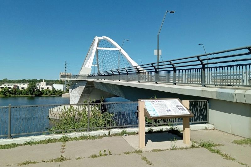
Location. 45° 0.778′ N, 93° 16.369′ W. Marker is in Minneapolis, Minnesota, in Hennepin County. It is in Bottineau. Marker is at the intersection of Marshall Street NE and Lowry Avenue N., on the right when traveling south on Marshall Street NE. The marker is in Edgewater Park, adjacent to the Lowry Bridge. Touch for map. Marker is at or near this postal address: 2420 Marshall Street NE, Minneapolis MN 55418, United States of America. Touch for directions.
Other nearby markers. At least 8 other markers are within one mile of this marker, measured as the crow flies. Ecology (about 300 feet away, measured in a direct line); Marshall Terrace (approx. ¾ mile away); Orth Brewery Plaza (approx. 0.9 miles away); Sheridan Veterans Memorial (approx. 0.9 miles away); MLB ★ Minnesota Twins Rod Carew All★Star Field (approx. 0.9 miles away); Carl Ripken, Sr. (approx. 0.9 miles away); Park Planning and the Grand Rounds (approx. one mile away); Columbia Park and Golf Course (approx. one mile away). Touch for a list and map of all markers in Minneapolis.
Credits. This page was last revised on December 24, 2023. It was originally submitted on December 21, 2023, by McGhiever of Minneapolis, Minnesota. This page has been viewed 47 times since then and 12 times this year. Photos: 1, 2. submitted on December 21, 2023, by McGhiever of Minneapolis, Minnesota. • J. Makali Bruton was the editor who published this page.

