San Fernando in Los Angeles County, California — The American West (Pacific Coastal)
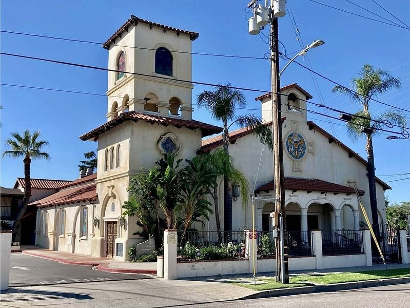
Trinity Church

Photographed by Craig Baker
1. Trinity Church Marker
Topics. This historical marker is listed in these topic lists: Architecture • Religion & Religious Structures. A significant historical date for this entry is January 17, 1994.
Location. 34° 16.746′ N, 118° 26.961′ W. Marker is in San Fernando, California, in Los Angeles County. It is at the intersection of O'Melveny Avenue and San Fernando Mission Boulevard on O'Melveny Avenue. Touch for map. Marker is at or near this postal address: 1150 O'Melveny Ave, San Fernando CA 91340, United States of America. Touch for directions.

Regionally, this marker is in The Valley (the San Fernando Valley), in Greater Los Angeles, and in the Transverse Ranges. It is also on the
this page online
Other nearby markers. At least 8 other markers are within walking distance of this marker: Father Junipero Serra (approx. 0.4 miles away); Casa de Lopez (approx. 0.4 miles away); Mission Dam (approx. 0.4 miles away); Cesar Chávez (approx. 0.7 miles away); Armenian-American Veterans Garden (approx. ¾ mile away); Armenian History Timeline (approx. ¾ mile away); Khatchkar (approx. 0.8 miles away); Moai from Easter Island (approx. 0.8 miles away). Touch for a list and map of all markers in San Fernando.
Photographed by Craig Baker
2. Trinity Church and Marker
The marker is at the base of the tower.
Credits. This page was last revised on March 18, 2025. It was originally submitted on December 21, 2023, by Craig Baker of Sylmar, California. This page has been viewed 419 times since then and 61 times this year. Photos: 1, 2. submitted on December 21, 2023, by Craig Baker of Sylmar, California.
