Near Fort Towson in Choctaw County, Oklahoma — The American South (West South Central)
The Treaty of Doaksville, 1837
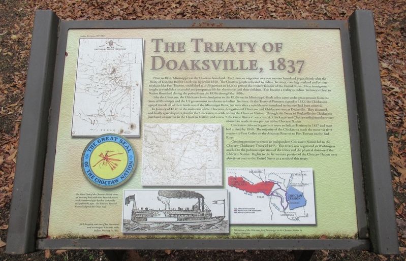
Prior to 1830, Mississippi was the Choctaw homeland. The Choctaw migration to a new western homeland began shortly after the Treaty of Dancing Rabbit Creek was signed in 1830. The Choctaw people relocated to Indian Territory, traveling overland and by river to places like Fort Towson, established as a US garrison in 1824, to protect the western frontier of the United States. These immigrants sought to establish a successful and prosperous life for themselves and their children. This became a reality as Indian Territory's Choctaw Nation flourished during the period from the 1830s through the 1850s.
Like the Choctaw, the Chickasaw homeland prior to the 1830s was in Mississippi. Both tribes came under great pressure from the State of Mississippi and the US government to relocate to Indian Territory. In the Treaty of Pontotoc signed in 1832, the Chickasaws agreed to cede all of their lands east of the Mississippi River, but only after a suitable new homeland in the west had been selected.
In January of 1837, at the invitation of the Choctaw, delegations of Choctaw and Chickasaws met at Doaksville. They discussed, and finally agreed upon a plan for the Chickasaw to settle within the Choctaw Nation. Through the Treaty of Doaksville the Chickasaws purchased an interest in the Choctaw Nation, and a new "Chickasaw District" was created. Chickasaw and Choctaw tribal members were allowed to reside in any portion of the Choctaw Nation.
Chickasaw citizens began their move to Indian Territory in 1837 and most had arrived by 1840. The majority of the Chickasaws made the move via river steamer to Fort Coffee on the Arkansas River or to Fort Towson on the Red River.
Growing pressure to create an independent Chickasaw Nation led to the Choctaw-Chickasaw Treaty of 1855. This treaty was negotiated in Washington and led to the political separation of the tribes and the physical division of the Choctaw Nation. Rights to the far western portion of the Choctaw Nations were also given over to the United States as a result of this treaty.
[Captions:]
Indian Territory, 1837-1855
The Great Seal of the Choctaw Nation shows an unstrung bow with three bunched arrows with a combined pipe-hatchet, and smoke rising from the pipe. The Choctaw General Council adopted this Great Seal.
The Cleopatra, was one of five steamboats used to transport Choctaws to the Indian Territory in 1831.
Relocation of the Choctaws from Mississippi to the Choctaw Nation in Indian Territory.
Erected by Oklahoma Historical Society.
Topics. This historical marker is listed in these topic lists: Government & Politics
• Native Americans • Settlements & Settlers. A significant historical year for this entry is 1837.
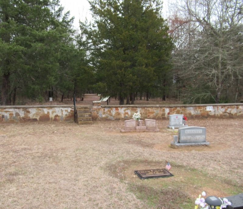
Location. 34° 2.051′ N, 95° 16.287′ W. Marker is near Fort Towson, Oklahoma, in Choctaw County. Marker can be reached from Red Road north of U.S. 70, on the right when traveling north. The marker is located at a trail at the back of the Fort Towson Cemetery. Inside the cemetery on the back wall is a set of stairs that leads into the Old Doaksville Townsite History Trail. The marker is located along the trail. Touch for map. Marker is in this post office area: Fort Towson OK 74735, United States of America. Touch for directions.
Other nearby markers. At least 8 other markers are within walking distance of this marker. Archaeology at Doaksville (a few steps from this marker); The End of Doaksville (within shouting distance of this marker); The Old Stone Jail (about 300 feet away, measured in a direct line); ...A Small But Pleasant Looking Village (about 300 feet away); Roads and Rivers (about 300 feet away); Why The Mound? (about 300 feet away); A Store on Commercial Row (about 400 feet away); The Doaksville Hotel (about 400 feet away). Touch for a list and map of all markers in Fort Towson.
Credits. This page was last revised on December 26, 2023. It was originally submitted on December 23, 2023, by Jason Armstrong of Talihina, Oklahoma. This page has been viewed 78 times since then and 36 times this year. Photos: 1. submitted on December 23, 2023, by Jason Armstrong of Talihina, Oklahoma. 2. submitted on December 25, 2023, by Jason Armstrong of Talihina, Oklahoma. • Devry Becker Jones was the editor who published this page.

