Panora in Guthrie County, Iowa — The American Midwest (Upper Plains)
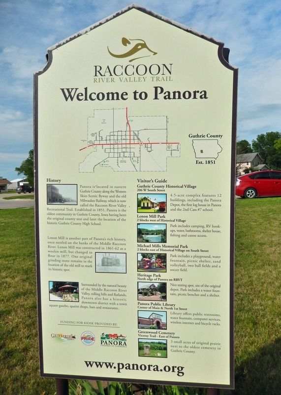
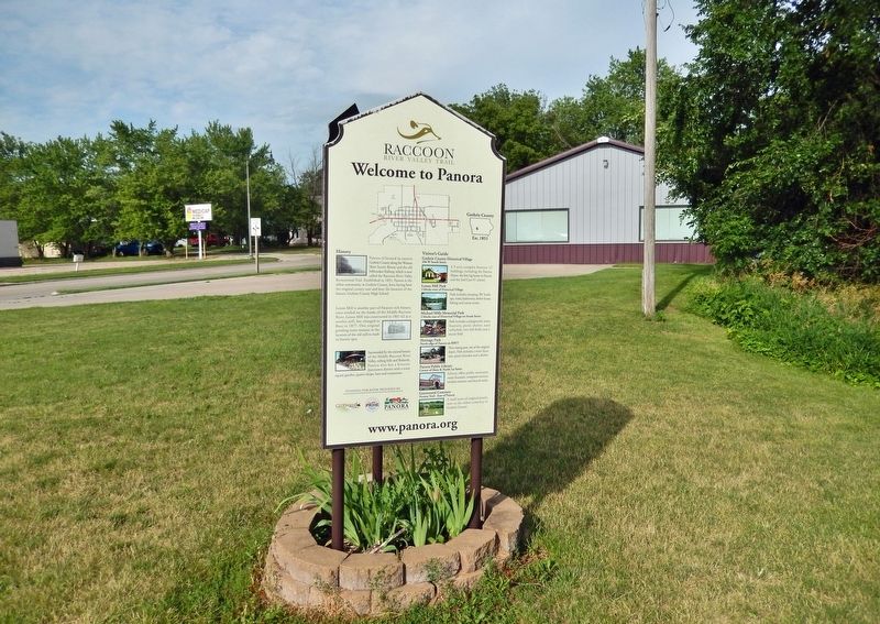
Welcome to Panora
— Raccoon River Valley Trail —
Est. 1851
History
Panora is located in eastern Guthrie County along the Western Skies Scenic Byway and the old Milwaukee Railway, which is now called the Raccoon River Valley Recreational Trail. Established in 1851, Panora is the oldest community in Guthrie County, Iowa having been the original county seat and later the location of the historic Guthrie County High School.
Lenon Mill is another part of Panora's rich history, once nestled on the banks of the Middle Raccoon River. Lenon Mill was constructed in 1861-62 as a woolen mill, but changed to flour in 1877. One original grinding stone remains in the location of the old mill to mark its historic spot.
Surrounded by the natural beauty of the Middle Raccoon River Valley, rolling hills and flatlands, Panora also has a historic downtown district with a town square gazebo, quaint shops, bars and restaurants.
Visitor's Guide
Guthrie County Historical Village
206 W South Street
4.5-acre complex features 12 buildings, including the Panora Depot, the first log house in Panora and the 2nd Cass #7 school.
Lenon Mill Park
2 blocks west of Historical Village
Park includes camping, RV hook-ups, water, bathrooms, shelter house, fishing and canoe access.
Michael Mills Memorial Park
2 blocks east of Historical Village on South Street
Park includes a playground, water fountain, picnic shelter, sand volleyball, two ball fields and a soccer field.
Heritage Park
North edge of Panora on RRVT
Nice resting spot, site of the original depot. Park includes a water fountain, picnic benches and a shelter.
Panora Public Library
Corner of Main & North 1st Street
Library offers public restrooms, water fountain, computer services, wireless internet and bicycle racks.
Greenwood Cemetery
Viceroy Trail - East of Panora
3 small acres of original prairie next to the oldest cemetery in Guthrie County.
www.panora.org
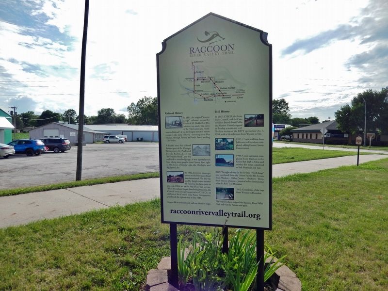
Railroad History
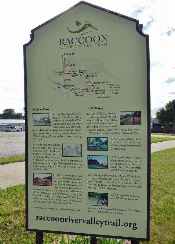
In 1881, the original "narrow gauge" railroad, owned by Fredrick M. Hubbell of Des Moines, ran under the name of the "Des Moines and Northwestern Railroad". It was the longest stretch of narrow gauge in the state of Iowa — running from Des Moines, through Panora, to Fonda, Iowa, totaling 113.8 miles.
A decade later, this railroad became part of the Chicago, Milwaukee, St. Paul, and Pacific Railroad, or the "Milwaukee Road", and was widened to standard gauge. It was a popular rail line, taking many people from Central Iowa right to the shores of Storm Lake, the Okobojis, and Big Spirit Lake.
By 1952, however, passenger service on the Milwaukee Road was discontinued. The line was used by freight trains another 35 years but the farm crisis in the mid-1980s led to the end of any rail service. When the railroad began abandoning the route, the Central Iowa Energy Cooperative (CIECO), an affiliate of the Central Iowa Power Cooperative, purchased the right-of-way in late 1987.
Its new life as a recreational trail was about to begin.
Trail History
In 1987, CIECO, the Iowa Trails Council, and the Conservation Boards from Dallas and Guthrie Counties agreed to develop a multi-use trail. The first section of the RRVT opened on Oct. 7, 1989, with a 34-mile route from Waukee to Yale.
1997: 12 mile addition from Jefferson to Herndon completed, adding Greene County Conservation.
1999: 5-mile extension completed from Waukee to the Green Belt Trail in Clive, and another five miles completed to link Herndon and Yale.
2007: The right-of-way for the 33-mile "North Loop" was purchased from the Union Pacific RR. It runs from Waukee — Dallas Center — Minburn — Perry, then west to Dawson — Jamaica before intersecting with the RRVT in Herndon.
2012: Completion of the loop from Waukee to Herndon.
We hope you have enjoyed the Raccoon River Valley Trail and visit the Panora area again.
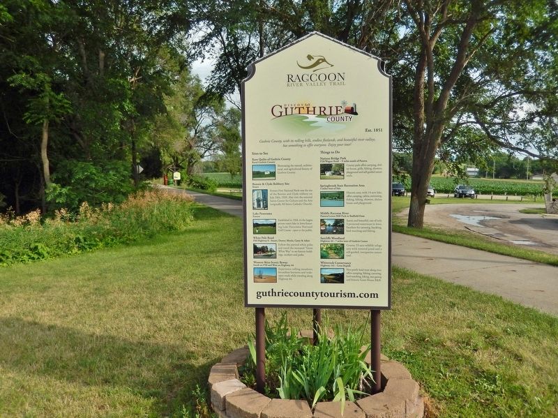
Sites to See
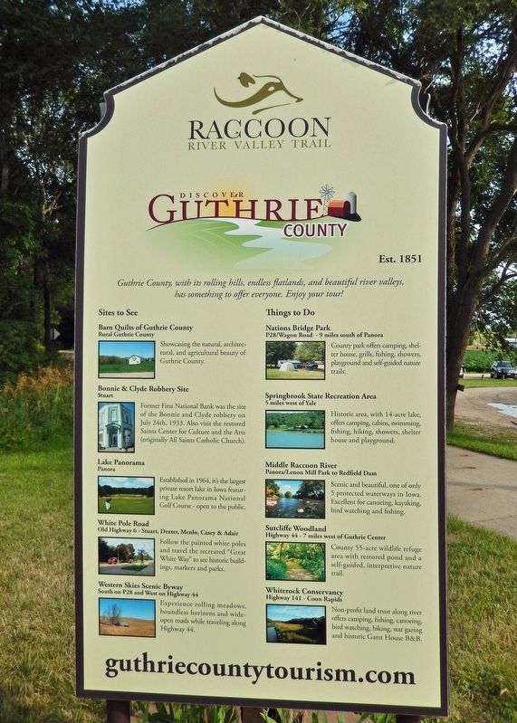
Barn Quilts of Guthrie County
Rural Guthrie County
Showcasing the natural, architectural, and agricultural beauty of Guthrie County.
Bonnie & Clyde Robbery Site
Stuart
Former First National Bank was the site of the Bonnie and Clyde robbery on July 24th, 1933. Also visit the restored Saints Center for Culture and the Arts (originally All Saints Catholic Church).
Lake PanoramaPanora
Established in 1964, it's the largest private resort lake in Iowa featuring Lake Panorama National Golf Course - open to the public.
White Pole Road
Old Highway 6 - Stuart, Dexter, Menlo, Casey & Adair
Follow the painted white poles and travel the recreated "Great White Way" to see historic buildings, markers and parks.
Western Skies Scenic Byway
South on P28 and West on Highway 44
Experience rolling meadows, boundless horizons and wide open roads while traveling along Highway 44.
Things to Do
Nations Bridge Park
P28/Wagon
Road - 9 miles south of Panora
County park offers camping, shelter house, grills, fishing, showers, playground and self-guided nature trails.
Springbrook State Recreation Area
5 miles west of Yale
Historic area, with 14-acre lake, offers camping, cabins, swimming, fishing, hiking, showers, shelter house and playground.
Middle Raccoon River
Panora/Lenon Mill Park to Redfield Dam
Scenic and beautiful, one of only 5 protected waterways in Iowa. Excellent for canoeing, kayaking, bird watching and fishing.
Sutcliffe Woodland
Highway 44 - 7 miles west of Guthrie Center
County 55-acre wildlife refuge area with restored pond and a self-guided, interpretive nature trail.
Whiterock Conservancy
Highway 141 - Coon Rapids
Non-profit land trust along river offers camping, fishing, canoeing, bird watching, hiking, star gazing and historic Garst House B&B.
Topics. This historical marker is listed in these topic lists: Industry & Commerce • Parks & Recreational Areas • Railroads & Streetcars • Settlements & Settlers. A significant historical year for this entry is 1851.
Location. 41° 41.491′ N, 94° 21.421′ W. Marker
is in Panora, Iowa, in Guthrie County. Marker is on East Main Street (State Highway 44) just east of Southeast 6th Street, on the right when traveling east. The marker is located along the Raccoon River Valley Trail, at the Panora trailhead. Touch for map. Marker is at or near this postal address: 600 East Main Street, Panora IA 50216, United States of America. Touch for directions.
Other nearby markers. At least 6 other markers are within 13 miles of this marker, measured as the crow flies. Western Skies Scenic Byway (approx. 0.4 miles away); Prominent Pioneers Memorial (approx. 7.6 miles away); Women Pioneers Memorial (approx. 7.6 miles away); Co. H. 39th Iowa Volunteer Infantry (approx. 10.8 miles away); Fighting Slavery - Aiding Runaways (approx. 11 miles away); First National Bank (approx. 13.1 miles away).
Credits. This page was last revised on December 28, 2023. It was originally submitted on December 28, 2023, by Cosmos Mariner of Cape Canaveral, Florida. This page has been viewed 59 times since then and 19 times this year. Photos: 1, 2, 3, 4, 5, 6. submitted on December 28, 2023, by Cosmos Mariner of Cape Canaveral, Florida.
