Iron Hill Park near Newark in New Castle County, Delaware — The American Northeast (Mid-Atlantic)
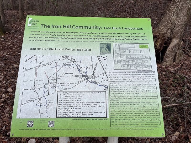
The Iron Hill Community: Free Black Landowners
Iron Hill Museum & Science Center
— Delaware Academy of Science —

Photographed By Devry Becker Jones (CC0), December 30, 2023
1. The Iron Hill Community: Free Black Landowners Marker
"Almost all of the Africans who came to America before 1865 were enslaved… Struggling to establish stable lives despite harsh conditions. Once they were legally free, their troubles were far from over, since African Americans were subject to many legal and practical limitations… and hampered by limited economic opportunity. Slowly, they built up their world: started families, founded churches, established communities." The Archaeology of African-American Life in St. Georges Hundred, Delaware, 1770-1940, John Beddel & Jason Shellhammer.
Iron Hill Free Black Land Owners 1834 - 1868
The free Black community at Iron Hill began to develop in the mid-1830s, as those recently manumitted began to acquire house and garden properties sold by white farmers, Edward Hamman and John Wright on the east side of Whittaker Road. By the 1840 United State Census, the families of Oliver Gustus, James Gustus, James Wallace, Benjamin Smith, and Zebulon James had formed a community there. All of the families were employed in agriculture.
The portion of the community along the west side of Whittaker Road did not develop until April 1841 when Solomon Grier, William Walker, and Daniel Parker pooled up their resources to purchase 39.5 acres from the estate of William Kincaid for $650. Grier, Walker and Parker subdivided their property into 13-acre lots fronting Whittaker Road. William Walker and his wife Hester deeded 1/4 acre of land for $5.00 to St Daniel's (AUME) Church in 1852.
From 1833 thru 1865, small farms were established along Old Baltimore Pike in the vicinity of Ott's Chapel/Pleasant Valley Road, (Thomas Lum, Levi Green, William Irons).
In March 1858, Joseph James and Benjamin Greer purchased 33 acres from Sarah Livingston, another widow of a white farmer. They subdivided the property in half, into east and west portions. Greer also sold five acres on the north side of his property along Ironside Road to Dolphin Lewis in August 1859. Elizabeth Lum acquired a house on the east side of Ott's Chapel Road near Joseph James's house. She may have moved to a house on Ott's Chapel Road after her husband Thomas died and their children took over the management of the family farm, around 1857. Elizabeth Lum, Joseph James, Samuel James, and Lewis appear to have had houses constructed along present-day Smith Way by 1868 with Lum's house near the intersection with Ott's Chapel Road and Lewis's house near this intersection with Ironside Road. Mary C. Fesak (primary author); Michael J. Emmons, Jr., & Catherine Morrissey, CHAD, U of De, Oct. 2020, St. Daniels Church Nat'l Register Nomination

Photographed By Devry Becker Jones (CC0), December 30, 2023
2. The Iron Hill Community: Free Black Landowners Marker
Erected by Delaware Academy of Science.
Topics. This historical marker is listed in these topic lists: African Americans • Agriculture • Churches & Religion • Settlements & Settlers. A significant historical month for this entry is March 1858.
Location. 39° 37.889′ N, 75° 45.537′ W. Marker is near Newark, Delaware, in New Castle County. It is in Iron Hill Park. Marker can be reached from South Old Baltimore Pike east of Whittaker Road, on the right when traveling west. Touch for map. Marker is at or near this postal address: 1355 S Old Baltimore Pike, Newark DE 19702, United States of America. Touch for directions.
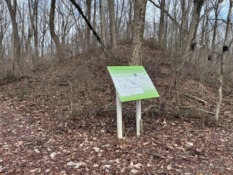
Other nearby markers. At least 8 other markers are within walking distance of this marker. What is the mound behind this sign? (here, next to this marker); Ninety Years Recording the Black Population of Pencader Hundred: The U.S. Census (a few steps from this marker); The Civil War 1861 - 1865 (within shouting distance of this marker); Iron Mining on Iron and Chestnut Hills, A Timeline (within shouting distance of this marker); Site of the First Iron Hill School (within shouting distance of this marker); Education for ALL, Past and Present: Iron Hill School, No. 112C / Iron Hill School #112C (within shouting distance of this marker); Historic Roads of Newark, Delaware / Petrified Log from Central Delaware (about 300 feet away, measured in a direct line); Iron Hill School #112-C (about 300 feet away). Touch for a list and map of all markers in Newark.
Credits. This page was last revised on January 2, 2024. It was originally submitted on December 30, 2023, by Devry Becker Jones of Washington, District of Columbia. This page has been viewed 88 times since then and 55 times this year. Photos: 1. submitted on December 30, 2023, by Devry Becker Jones of Washington, District of Columbia. 2. submitted on December 31, 2023, by Devry Becker Jones of Washington, District of Columbia.