Sandy in Salt Lake County, Utah — The American Mountains (Southwest)
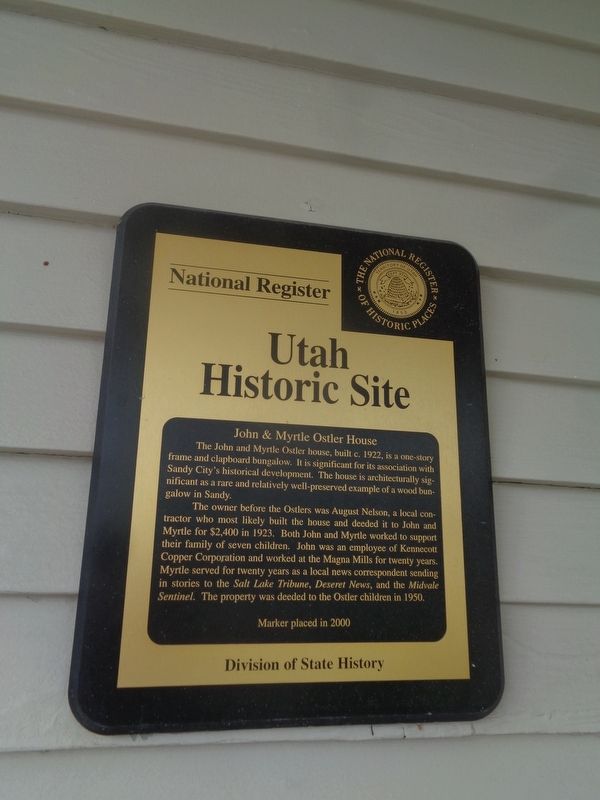
John & Myrtle Ostler House
Utah Historic Site
Photographed by Jason Voigt, May 8, 2023
1. John & Myrtle Ostler House Marker
The owner before the Ostlers was August Nelson, a local contractor who most likely built the house and deeded it to John and Myrtle for $2,400 in 1923. Both John and Myrtle worked to support their family of seven children. John was an employee at Kennecott Copper Corporation and worked at the Magna Mills for twenty years. Myrtle served for twenty years as a local news correspondent sending in stories to the Salt Lake Tribune, Deseret News, and the Midvale Sentinel. The property was deeded to the Ostler children in 1950.
Erected 2000 by Utah Division of State History.
Topics. This historical marker is listed in these topic lists: Architecture • Communications • Industry & Commerce. A significant historical year for this entry is 1922.
Location. 40° 35.507′ N, 111° 52.516′ W. Marker is in Sandy, Utah, in Salt Lake County.
this page online

Regionally, this marker is in the Wasatch Front and in Greater Salt Lake. It is also in the American Mountain West and on the Colorado Plateau. Globally, it is in North America, the Rocky Mountains, the Western Hemisphere, the Western World, and the Anglosphere. Historically, it finds itself in what was once New Spain and also Mexico’s Alta California.
Other nearby markers. At least 8 other markers are within walking distance of this marker: John & Elizabeth Oldham House (about 500 feet away, measured in a direct line); John & Johanna Anderson House (about 500 feet away); Niels & Mary Ann Thompson House (about 600 feet away); Sandy-Alta Railroad (approx. 0.2 miles away); Amos and Ida Jensen House (approx. ¼ mile away); Veterans Memorial (approx. ¼ mile away); Sandy Elementary (approx. 0.4 miles away); Church Takes Root in Sandy / Early Sandy Schools (approx. 0.4 miles away). Touch for a list and map of
Photographed by Jason Voigt, May 8, 2023
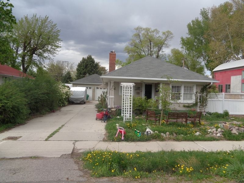
2. John & Myrtle Ostler House Marker
Marker is mounted on the house, which is private property
Credits. This page was last revised on December 31, 2023. It was originally submitted on December 31, 2023, by Jason Voigt of Glen Carbon, Illinois. This page has been viewed 274 times since then and 12 times this year. Photos: 1, 2. submitted on December 31, 2023, by Jason Voigt of Glen Carbon, Illinois.
