Oakville in Halton Region, Ontario — Central Canada (North America)
Heritage Homes of Trafalgar Road and George's Square
| — | Sixteen Mile Creek Trail | — |
Photographed by Tim Boyd, November 30, 2023
1. Heritage Homes of Trafalgar Road and George's Square Marker
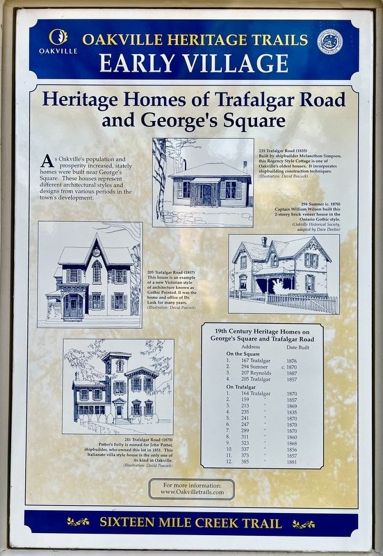
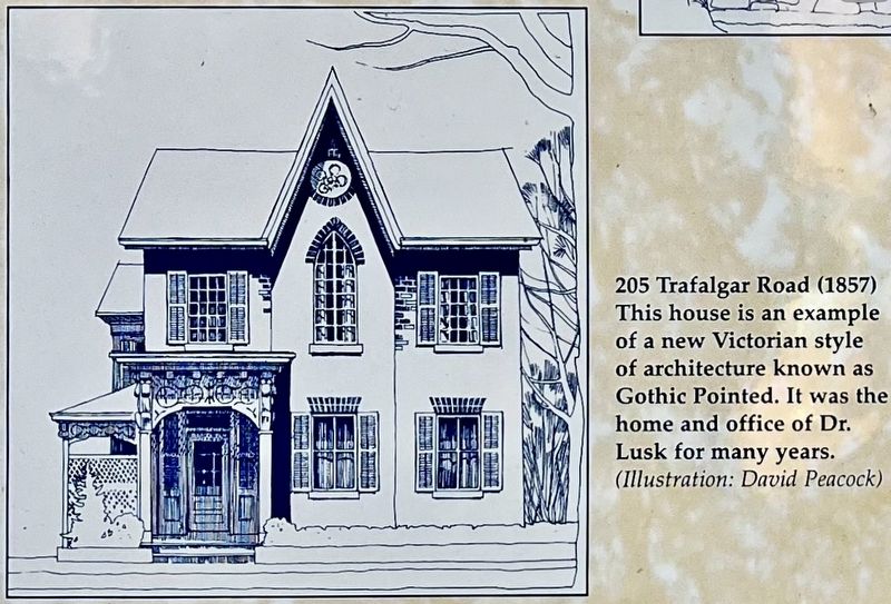
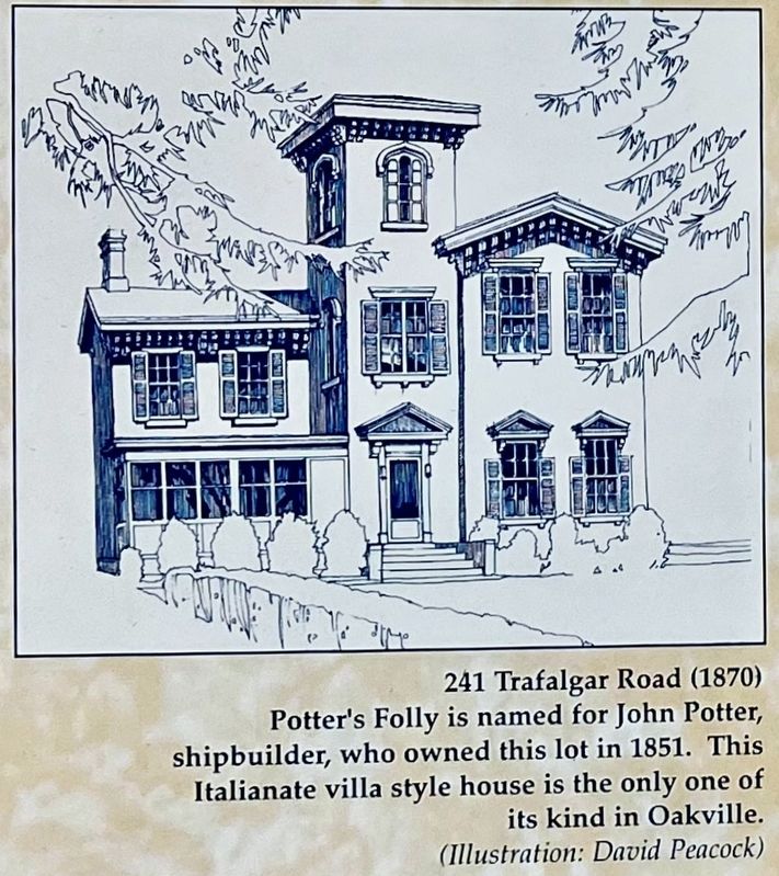
As Oakville’s population and prosperity increased, stately homes were built near George's Square. These houses represent different architectural styles and designs from various periods in the town's development.
19th Century Heritage Homes on George's Square and Trafalgar Road
Address Date Built
On the Square
1. 167 Trafalgar 1876
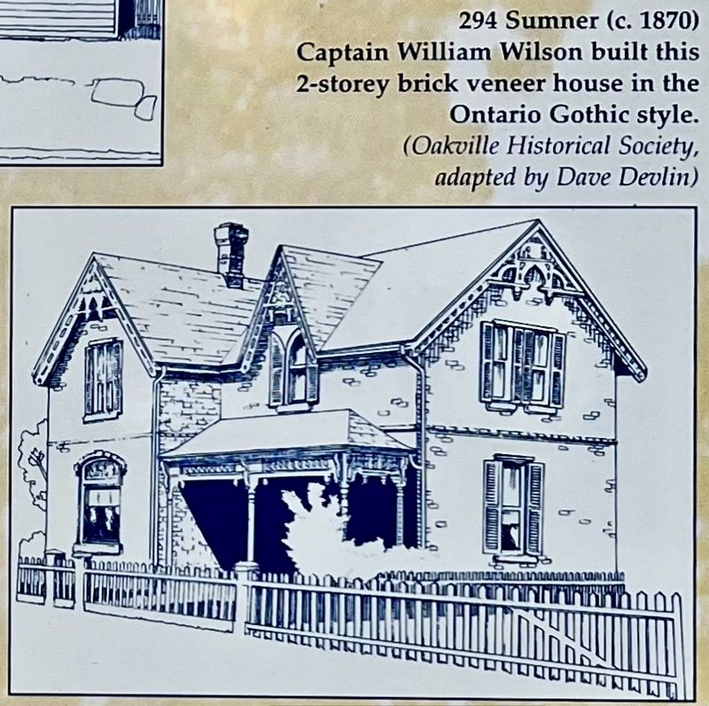
2. 294 Sumner c.1870
3. 207 Reynolds. 1887
4. 205 Trafalgar 1857
On Trafalgar
1. 164 Trafalgar 1870
2. 159 “ 1857
3. 213 “ 1869
4. 235 “ 1835
5. 241 “ 1870
6. 247 “ 1870
7. 289 “ 1870
8. 311 ” 1860
9. 323 ” 1868
10. 337 “ 1856
11. 373 “ 1857
12. 385 “ 1881
Erected by Town of Oakville.
Topics. This historical marker is listed in these topic lists: Architecture • Settlements & Settlers. A significant historical year for this entry is 1876.
Location. 43° 26.952′ N, 79° 40.151′ W. Marker is in Oakville, Ontario, in Halton Region. It is at the intersection of Trafalgar Road and Sumner Avenue, on the right when traveling north on Trafalgar Road. The marker is at the south-west corner of George’s Square. Touch for map. Marker is at or near this
this page online

Regionally, this marker is in Greater Toronto, specifically on the Golden Horseshoe, in the Hamilton-Halton-Brant Area, and specifically in the Toronto Metropolitan Area. It is also in Central Canada. Globally, it is in North America, on the Great Lakes, in the Western Hemisphere, in the Western World, and in the Anglosphere. Historically, it finds itself in what was once a British colony, the Viceroyalty of New France, the Haudenosaunee (Iroquois) Confederacy, and Rupert’s Land.
Other nearby markers. At least 8 other markers are within walking distance of this marker: The Underground Railroad (here, next to this marker); Churches Schools and Taverns (here, next to this marker); The Prosperous Years (here, next to this marker); An Isolated Township (here, next to this marker); Oakville and Trafalgar, 1806-1870 (here, next to this marker); Town Drinking Fountain (here, next to this marker); Oakville Cenotaph (within shouting distance of this marker); The Lorne Scots (about 90 meters away, measured in a direct line). Touch for a list and map
Photographed by Tim Boyd, November 30, 2023
2. Heritage Homes of Trafalgar Road and George's Square Marker
Photographed by Tim Boyd, November 30, 2023
3. Heritage Homes of Trafalgar Road and George's Square marker detail
Photographed by Tim Boyd, November 30, 2023
4. Heritage Homes of Trafalgar Road and George's Square marker detail
Photographed by Tim Boyd, November 30, 2023
5. Heritage Homes of Trafalgar Road and George's Square marker detail
Photographed by David Peacock
6. Heritage Homes of Trafalgar Road and George's Square marker detail
Credits. This page was last revised on January 3, 2024. It was originally submitted on January 2, 2024, by Tim Boyd of Hamilton, Ontario. This page has been viewed 142 times since then and 14 times this year. Photos: 1. submitted on January 2, 2024, by Tim Boyd of Hamilton, Ontario. 2, 3, 4, 5, 6. submitted on January 3, 2024, by Tim Boyd of Hamilton, Ontario. • Andrew Ruppenstein was the editor who published this page.
