Rossville in Walker County, Georgia — The American South (South Atlantic)
The Xzanders G. McFarland House and McFarland Gap
Chickamauga Campaign Heritage Trail
Inscription.
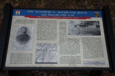
Mr. Xzanders Gordon McFarland of Walker County (Rossville Georgia) was a slave holder. So when the Civil War took his two oldest sons into the army, he gathered his slaves, his four teenage daughters and his stock and went to South Georgia for safety. His wife Lucy Ann McFarland being the staunch Presbyterian that she was would not leave her home. She had an old sick enslaved African and three small sons in the home. So when the soldiers came they told her that she would have to leave as they were going to burn her home. She told them that she had no place to go and they would just have to burn it. The soldiers went away then returned telling her that she would have to use part of her home for a hospital and nurse the men of both armies. This she did, thus saving the lives of those that were with her. Her oldest son was killed in the Battle of Missionary Ridge; the second was wounded during the war. After the War ended husband, daughters and second son returned home. Xzanders Gordon, his wife, four daughters, and the son, Chappel Montgomery McFarland, who was killed in the Battle of Missionary Ridge, and other members of the family are buried in the McFarland Cemetery near the home.
Following their defeat on the battlefield, most of the Federal soldiers had calmed by the time they got through McFarland Gap around 3:00 p.m., and were able to rest in the fields on Xzanders G. McFarland's farm. "I immediately took the Seventy-eighth Pennsylvania Volunteers and marched to the mouth of the gap, 2 miles from Rossville," General James Negley reported, "the first open ground where the troops could be collected and reorganized. I found Colonel Parkhurst here, with the Ninth Michigan Volunteers, energetically checking stragglers. He informed me that General Crittenden had passed some hours before, and had ordered him, with all the troops, to fall back to Chattanooga."
At approximately 4:00 p.m., Generals Negley, Davis and Sheridan, joined by Lieutant-Colonel Arthur Ducat, aide-de-camp to General Rosecrans, held a meeting at the McFarland house to discuss a plan of action for the rest of the day. Conflicting accounts make it difficult to determine the results of the ensuing "heated discussion." A contemporary account by Alfred L. Hough, a member of Negley's staff, reported that the officers "could come to no agreement for common action." Some of those present wanted to take their men back to the battlefield to reinforce the troops at Horseshoe Ridge under General George H. Thomas. None, however, were able to do so. It was determined to be advisable to proceed to Rossville, to prevent the enemy from obtaining possession of the crossroads. From there General Sheridan would move to the support of General
Thomas, via LaFayette road. The column reached Rossville at dark.
Erected by Chickamauga Campaign Heritage Trail. (Marker Number 30.)
Topics and series. This historical marker is listed in this topic list: War, US Civil. In addition, it is included in the Chickamauga Campaign Heritage Trail series list.
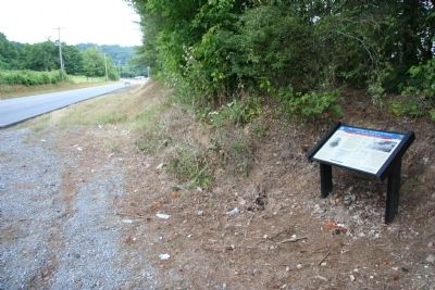
Location. 34° 57.429′ N, 85° 18.024′ W. Marker is in Rossville, Georgia, in Walker County. Marker is on McFarland Avenue north of Battlefield Parkway (Georgia Route 2), on the left when traveling north. This marker is located a short distance south of the Tennessee and Georgia state line and an even shorter distance northwest of the Chickamauga and Chattanooga National Military Park. Touch for map. Marker is in this post office area: Rossville GA 30741, United States of America. Touch for directions.
Other nearby markers. At least 8 other markers are within 2 miles of this marker, measured as the crow flies. McFarland's Gap (approx. 0.7 miles away); Chief John Ross (approx. 1.9 miles away); Home of John Ross (approx. 1.9 miles away); Rossville, McFarland House & Spring (approx. 1.9 miles away); John Ross Home (approx. 1.9 miles away); Geary's Division (approx. 2 miles away); Ireland's Brigade (approx. 2 miles away); Rossville Memorial Fountain (approx. 2 miles away). Touch for a list and map of all markers in Rossville.
Credits. This page was last revised on January 5, 2024. It was originally submitted on December 25, 2010, by Dale K. Benington of Toledo, Ohio. This page has been viewed 1,369 times since then and 60 times this year. Last updated on January 4, 2024, by Carl Gordon Moore Jr. of North East, Maryland. Photos: 1, 2. submitted on December 25, 2010, by Dale K. Benington of Toledo, Ohio. • J. Makali Bruton was the editor who published this page.

