San Saba in San Saba County, Texas — The American South (West South Central)
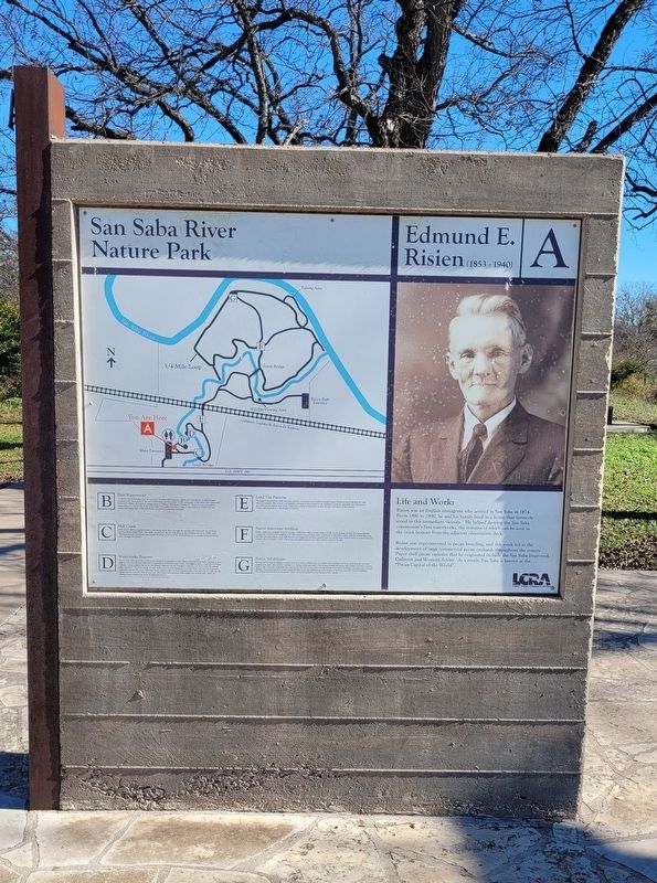
Edmund E. Risien
(1853-1940)
— A —
Risien was an English immigrant who arrived in San Saba in 1874. From 1880 to 1890, he and his family lived in a house that formerly stood in this immediate vicinity. He helped develop the San Saba community's first waterworks, the remains of which can be seen in the creek bottom from the adjacent observation deck.
Risien also experimented in pecan breeding, and this work led to the development of large commercial pecan orchards throughout the county. Paper shell pecan varieties that he originated include the San Saba Improved, Onliwon and Western Schley. As a result, San Saba is known as the "Pecan Capital of the World".
San Saba River Nature Park
B - First Waterworks
Archival research indicates that the mortared cut stone wall fragments, sluices and foundations of other former structures seen down slope in the bed of Mill Creek are the remains of the community of San Saba's first waterworks. Edmund E. Risien, Dr. James C. Rogan, John H. "Shorty" Brown and Thomas W. Ward were instrumental in constructing the waterworks in the early 1880s. The facility provided a water supply system for Risien's garden, public watering troughs at the courthouse and nearby residential customers.
C - Mill Creek
Mill Creek is fed by a spring located to the south, and it flows through the existing Mill Pond Park into LCRA's San Saba River Nature Park. The creek empties into the San Saba River at the northeast end of the LCRA park. The abundant and consistent water supply provided by the creek has attracted human occupation from prehistoric times through the present.
D - Waterworks Features
"In the year 1883, the writer of this article obtained permission to erect a dam, some 300 yards below the present one, making a five feet fall from this source, and originated the first water works. For eighteen years a water wheel driving a plunger pump supplied the town. My farthest customer was the Campbell residence, one block from the present school grounds. This little system of water works never had the advantage of a water tower, but kept up a pressure, night and day, just the same. The water wheel regulated that. It never stopped unless every one had the water cut off. There were no expensive belts to wear out. The pump was connected with a single pair of bevel gear, which for efficiency and economy has yet to be improved upon."
Quote by Edmund E. Risien from an undated newspaper article titled "Our City Water Works System"
E - Land Use Patterns
The slightly elevated spot under the giant oak tree is a burned rock midden (mound) feature dating to use of this area by
Nativ American people. The burned rock midden is thought to have formed as the prehistoric residents repeatedly used this spot as an earth oven for baking plant foods. Much later, a house constructed around the year 1900 stood at this location. Today, only the firebox of the chimney is present.
F - Native American Artifacts
Native Americans occupied Texas for at least 13,000 years before the first settlers of Old World heritage arrived. The nonperishable remains left behind at the campsites and other activity areas of these Native Americans in San Saba County typically include flint tools and flint chipping debris, along with burned rock fragments that lined campfire pits and earth ovens. Broken pieces of pottery and food remains that principally consist of bone and clam shell fragments are other artifacts found at the sites.
G - Native Inhabitants
Records left by Spanish explorers, missionaries and traders indicate that the Apache were moving into Texas, including the San Saba County area, from areas further northward in the late 1600s and early 1700s to hunt buffalo and escape their Native American enemies. Later in the 1700s, the Comanche also appeared in this area as they were moving southward in search of buffalo, mustangs and a warmer climate. The rapid migration of the Comanche into Texas was facilitated by their mastery of the horse and their warrior tradition. The artifact inventories of these historic Native American groups include European trade goods.
Erected by Lower Colorado River Authority (LCRA).
Topics. This historical marker is listed in these topic lists: Agriculture • Industry & Commerce. A significant historical year for this entry is 1874.
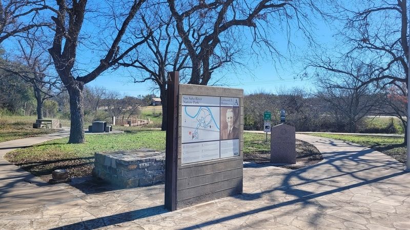
Location. 31° 11.79′ N, 98° 42.724′ W. Marker is in San Saba, Texas, in San Saba County. Marker is on East Wallace Street (U.S. 190) 0.1 miles east of Mill Street. The marker is located at the entrance to the San Saba River Nature Park. Touch for map. Marker is at or near this postal address: 1007 E Wallace Street, San Saba TX 76877, United States of America. Touch for directions.
Other nearby markers. At least 8 other markers are within walking distance of this marker. Edmond E. Risien (here, next to this marker); First Waterworks (a few steps from this marker); Waterworks Features (within shouting distance of this marker); Mill Creek (within shouting distance of this marker); Land Use Patterns (about 400 feet away, measured in a direct line); San Saba (about 600 feet away); Mill Pond House (about 700 feet away); Alma Ward Hamrick (about 700 feet away). Touch for a list and map of all markers in San Saba.
Credits. This page was last revised on January 7, 2024. It was originally submitted on January 7, 2024, by James Hulse of Medina, Texas. This page has been viewed 56 times since then. Photos: 1, 2. submitted on January 7, 2024, by James Hulse of Medina, Texas.

