Brandy Station in Culpeper County, Virginia — The American South (Mid-Atlantic)
Battle of Brandy Station
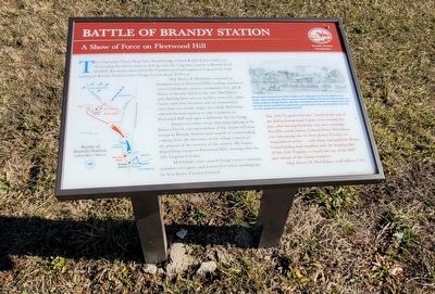
A Show of Force on Fleetwood Hill
Maj. Henry B. McClellan remained at headquarters on Fleetwood Hill, sending couriers to warn Confederate cavalry commander Maj. Gen. J.E.B. Stuart of the new threat to his rear. McClellan's only fighting force was an artillery crew of Lt. John Carter with their howitzer and an ammunition chest that was nearly empty. As a bluff, McClellan ordered the lone cannon to take a position on Fleetwood Hill and open a deliberate fire on Gregg.
Stuart, two miles away, directing fighting at St. James Church, was incredulous of the claims of Union troops in Brandy Station until sounds of cannonading coming from the direction of the village convinced the general of the veracity of the reports. He began dispatching troops to Fleetwood Hill, starting with the 12th Virginia Cavalry.
McClellan's ruse caused Gregg's men to hesitate, unlimber two guns, and return fire before sending the 1st New Jersey Cavalry forward.
Erected by Brandy Station Foundation.
Topics. This historical marker is listed in this topic list: War, US Civil. A significant historical date for this entry is June 9, 1863.
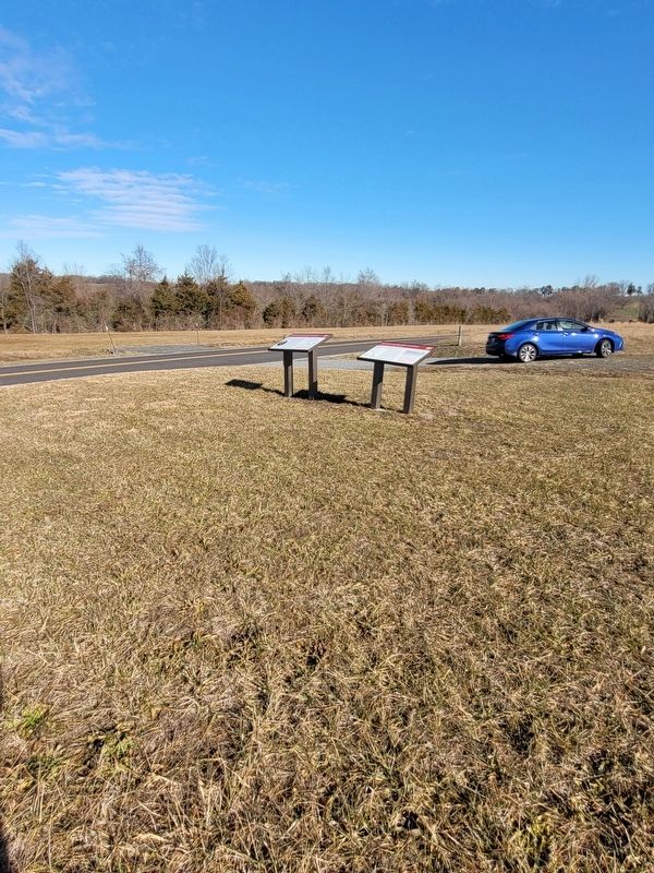
Location. 38° 30.451′ N, 77° 53.008′ W. Marker is in Brandy Station, Virginia, in Culpeper County. Marker is on Fleetwood Heights Road (Virginia Route 685) 0.7 miles east of Alanthus Road (Virginia Route 663), on the right when traveling east. The marker is located on the American Battlefield Trust's Fleetwood Hill overlook area for the Battle of Brandy Station. Touch for map. Marker is in this post office area: Brandy Station VA 22714, United States of America. Touch for directions.
Other nearby markers. At least 8 other markers are within walking distance of this marker. A different marker also named Battle of Brandy Station (here, next to this marker); a different marker also named Battle of Brandy Station (approx. ¼ mile away); a different marker also named Battle of Brandy Station (approx. ¼ mile away); a different marker also named Battle of Brandy Station (approx. ¼ mile away); a different marker also named Battle of Brandy Station (approx. ¼ mile away); a different marker also named Battle of Brandy Station (approx. ¼ mile away); a different marker also named Battle of Brandy Station (approx. ¼ mile away); a different marker also named Battle of Brandy Station (approx. ¼ mile away). Touch for a list and map of all markers in Brandy Station.
Related marker.
Click here for another marker that is related to this marker. Old Marker at this location titled "The Battle of Brandy Station - The Struggle for Fleetwood Hill"
Also see . . .
1. Battle of Brandy Station. Wikipedia (Submitted on January 7, 2024.)
2. Battle of Brandy Station. Brandy Station Foundation (Submitted on January 7, 2024.)
3. Brandy Station - Fleetwood Hill. American Battlefield Trust (Submitted on January 7, 2024.)
Credits. This page was last revised on January 12, 2024. It was originally submitted on January 6, 2024, by Mike McKeown of Baltimore, Maryland. This page has been viewed 60 times since then. Last updated on January 11, 2024, by Carl Gordon Moore Jr. of North East, Maryland. Photos: 1, 2. submitted on January 6, 2024, by Mike McKeown of Baltimore, Maryland. • J. Makali Bruton was the editor who published this page.

