Winslow in Navajo County, Arizona — The American Mountains (Southwest)
A City in Motion: Modern Modes
Journeys to Winslow
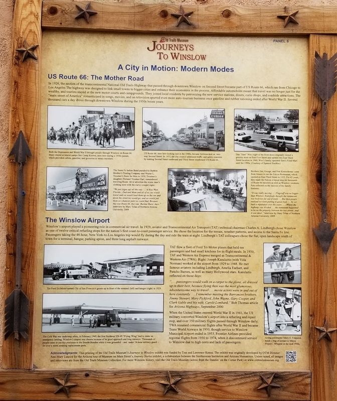
In 1926, the section of the transcontinental National Old Trails Highway that passed through downtown Winslow on Second Street became part of US Route 66, which ran from Chicago to Los Angeles. The highway was designed to link small towns to bigger cities and enhance their economies in the process. Affordable automobiles meant that travel was no longer just for the wealthy, and tourists stayed at the new motor courts and campgrounds. They joined local residents by patronizing the new service stations, diners, curio shops, and roadside attractions. The "main street of America" romanticized in songs, movies, and on television spurred even more auto-tourism business once gasoline and rubber rationing ended after World War II. Several thousand cars a day drove through downtown Winslow during the 1950s boom years.
The Winslow Airport
Winslow's airport played a pioneering role in commercial air travel. In 1929, aviator and Transcontinental Air Transport (TAT) technical chairman Charles A. Lindbergh chose Winslow as one of twelve critical refueling stops for the nation's first coast-to-coast passenger service. He chose the location for the terrain, weather patterns, and access to the Santa Fe line. Passengers taking the 48-hour, New York-to-Los Angeles trip would fly during the day and ride the train at night. Lindbergh's TAT colleagues chose the flat, open landscape south of town for a terminal, hangar, parking apron, and three long asphalt runways.
TAT flew a fleet of Ford Tri-Motor planes that held ten passengers and had small kitchens for in-flight meals. In 1930, TAT and Western Air Express merged as Transcontinental & Western Air (TWA). Right: Joseph Kasulaitis (with Vida Norman) worked at the airport from 1929 to 1948. He met famous aviators including Lindbergh, Amelia Earhart, and Pancho Barnes, as well as many Hollywood stars. Kasulaitis reflected on those days:
"... passengers would walk on a carpet to the plane, all dressed up in their best, because flying then was the most glamorous, adventuresome way to travel... movie actors were in and out of here constantly... I remember meeting the Barrymore brothers, Jimmy Stewart, Mary Pickford, John Wayne, Gary Cooper, and Clark Gable and his wife, Carole Lombard." Bob Thomas article for Arizona Highways, September 2000
When the United States entered World War II in 1941, the US military converted Winslow's airport into a refueling and repair stop, and over 350 military flights passed through Winslow daily. TWA resumed commercial flights after World War II and became Trans World Airways in 1950, though service to Winslow Municipal Airport ended in 1953.
Frontier Airlines provided regional flights from 1950 to 1974, when it discontinued service to Winslow due to high costs and lack of passengers.
Captions
Upper Left: Both the Depression and World War II brought people through Winslow on Route 66. Many stayed at tourist camps like Camp Keyton, seen here during a 1930s parade, which provided cabins, gasoline, and groceries to weary travelers.
Upper Middle: US Route 66, seen here looking east in the 1940s, became bottlenecked on two-way Second Street. In 1953, the city council addressed traffic and safety concerns by making Second Street eastbound and Third Street westbound US Route 66.
Upper Right: Dan "Sam" Woo (right of the front door) originally owned a grocery store on East First Street and opened this East Third Street location in 1960. Woo's family operated Sam's Food Mart until the 1990s. (Courtesy of Spencer SooHoo)
Middle Left: The Santa Fe Indian Band paraded by Babbitt Brother's Trading Company and Wayne L. Troutner's Store for Men in 1959. Troutner's daughter, Floranel Troutner Earl, remembered traveling Route 66 to advertise the iconic men's clothing store with the curvy cowgirl signs:
"We put (signs up) all the way to Key West, Florida...Dad and Mom and all of us, we would travel and we would load them up on the car and down the street we would go, and we would put them on whatever pole we could find. Because this was Route 66, this was 'Burma Shave’ days." Interview by Mary Tolan of Northern Arizona University, 2009
Middle Right: Brothers Jim, George, and Pete Kretsedemas came from Greece to run the Falcon Restaurant, which opened on East Third Street in 1955. For 43 years, they made the Falcon a repeat stop for thousands of Route 66 travelers as well as Winslow residents. Pete reflected on the success of the family business:
"It was really moving... Flagstaff was no bigger than Winslow. Everybody thought the restaurant was built too far out of town... But then people realized we were putting in good food... So we built a reputation over the years... (When) the highway was divided the restaurant happened to be on the property between the two streets. And it was ideal." Interview by Mary Tolan of Northern Arizona University, 2009
Lower Left: The Ford Tri-Motor named City of San Francisco gasses up in front of the terminal (left) and hangar (right) in 1929.
Lower Left: The Cold War was underway when, in February 1949, the first Northrop YB-49 "Flying Wing" had to make an emergency landing. Winslow's airport was chosen because of its good approach and long runways. Thousands of people came to see this precursor to the Stealth Bomber while it was grounded and under 24-hour military guard - for over a week awaiting replacement parts.
Lower Right: Acting postmaster Mary G. Ferguson hands a bag of airmail to Mayor Floyd C. Whipple in the mid-1950s.
Acknowledgments: This printing of the Old Trails Museum's Journeys to Winslow exhibit was funded by Tess and Lawrence Kenna. The exhibit was originally developed by OTM Director Ann-Mary Lutzick for the Arizona tour of Museum on Main Street's Journey Stories exhibit, a collaboration between the Smithsonian Institution and Arizona Humanities. Unless noted, all images and interviews are from the Old Trails Museum Collection. For more Winslow history, visit the Old Trails Museum (across from the Standin' on the Corner Park) or www.oldtrailsmuseum.org.
Erected 2017 by Old Trails Museum - Winslow Historical Society. (Marker Number 6.)
Topics. This historical marker is listed in these topic lists: Air & Space • Industry & Commerce • Roads & Vehicles. A significant historical year for this entry is 1926.
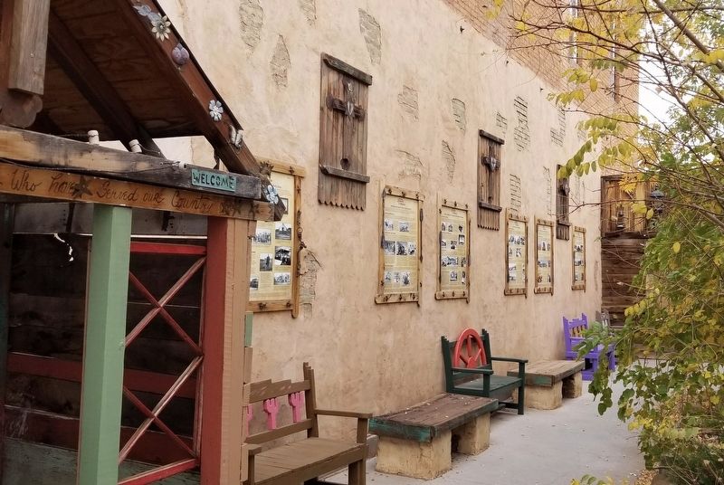
Location. 35° 1.396′ N, 110° 41.841′ W. Marker is in Winslow, Arizona, in Navajo County. Marker is on East 2nd Street, 0.1 miles east of North Kinsley Ave. The marker is located in an alley way between two buildings next to the Worlds Smallest Church. Touch for map. Marker is at or near this postal address: 114 E 2nd St, Winslow AZ 86047, United States of America. Touch for directions.
Other nearby markers. At least 8 other markers are within walking distance of this marker. Winslow Today: Commerce and Employment (here, next to this marker); A City in Motion: The Heyday of the Santa Fe Railway (here, next to this marker); Winslow Today: Downtown Renaissance and Tourism (here, next to this marker); The Railroads Build a Town: Early Industry (here, next to this marker); The Railroads Build a Town: Early Days (here, next to this marker); The First Peoples of the Southwestern Colorado Plateau (a few steps from this marker); Early Trails Across the Little Colorado River Valley (a few steps from this marker); Standin’ on the Corner Park, Winslow, Arizona (within shouting distance of this marker). Touch for a list and map of all markers in Winslow.
Also see . . . Journeys to Winslow. Old Trails Museum - Winslow Historical Society
The Old Trails Museum debuted the Journeys to Winslow exhibit in October 2017 in the Skylark Courtyard, which is a stop along the Journey Through Winslow Pathway. Developed by Tess and Lawrence Kenna, the Pathway is a trail for residents and visitors to explore Winslow’s history and current downtown revitalization, and its other stops include the World’s Smallest Church on Route 66 and historic facades and murals throughout the downtown historic district. The Kennas funded the reprinting of Journeys to Winslow, which was originally developed by the Old Trails Museum for the Winslow stop on the Arizona tour of the Smithsonian’s Journey Stories exhibition (above at the Grand Opening at La Posada Hotel in June 2013).(Submitted on January 15, 2024, by James Hulse of Medina, Texas.)
Credits. This page was last revised on January 15, 2024. It was originally submitted on January 14, 2024, by James Hulse of Medina, Texas. This page has been viewed 54 times since then. Photos: 1, 2. submitted on January 15, 2024, by James Hulse of Medina, Texas.

