Tamassee in Oconee County, South Carolina — The American South (South Atlantic)
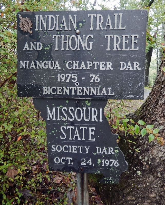
Indian Trail and Thong Tree
1975-76
Bicentennial
Missouri
State
Society DAR
Oct. 24, 1976
Erected 1976 by Missouri State Society DAR.
Topics and series. This historical marker is listed in these topic lists: Fraternal or Sororal Organizations • Native Americans • Patriots & Patriotism. In addition, it is included in the Daughters of the American Revolution, and the The Spirit of ’76, America’s Bicentennial Celebration series lists. A significant historical year for this entry is 1776.
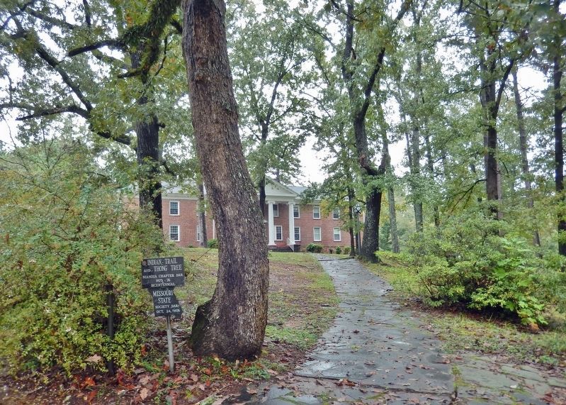
Location. 34° 52.98′ N, 83° 1.147′ W. Marker is in Tamassee, South Carolina, in Oconee County. Marker can be reached from Cain Drive just west of Bumgardner Drive, on the right when traveling west. The marker is located along the subject trail, near the east side of the Tamassee Post Office. Touch for map. Marker is at or near this postal address: 2655B Cain Drive, Tamassee SC 29686, United States of America. Touch for directions.
Other nearby markers. At least 8 other markers are within 2 miles of this marker, measured as the crow flies. Tamassee DAR School (within shouting distance of this marker); May Erwin Talmadge Auditorium/Gymnasium (about 300 feet away, measured in a direct line); In Memory of George R. Ryder (about 400 feet away); Josephine C. Peters — West Virginia Cottage (about 400 feet away); Texas Friendship Cottage (about 500 feet away); a different marker also named Tamassee DAR School (approx. 0.3 miles away); The Cherokee Path (approx. 1.6 miles away); Tamassee Town (approx. 1.7 miles away). Touch for a list and map of all markers in Tamassee.
Also see . . . Thong Tree (Wikipedia). Excerpt:
Large trees that exhibit deformed growth and distinctive forms bent in a vertical plane are sometimes labeled trail trees, marker trees, thong trees, or signal trees by enthusiasts. Historically, these unique trees were commonly known as Indian trail trees. Proponents of trail tree lore claim these unique forms are culturally modified trees used to mark trails or important places. Distinctively bent trees have long been noted throughout the Temperate Deciduous Forest of eastern North America. The extent to which indigenous peoples used such trees as navigational aids, and whether such trees were formed by anthropogenic or natural means is controversial.(Submitted on January 14, 2024, by Cosmos Mariner of Cape Canaveral, Florida.)
Credits. This page was last revised on January 14, 2024. It was originally submitted on January 14, 2024, by Cosmos Mariner of Cape Canaveral, Florida. This page has been viewed 70 times since then. Photos: 1, 2. submitted on January 14, 2024, by Cosmos Mariner of Cape Canaveral, Florida.

