West End in Cincinnati in Hamilton County, Ohio — The American Midwest (Great Lakes)
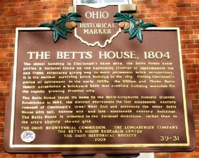
The Betts House, 1804
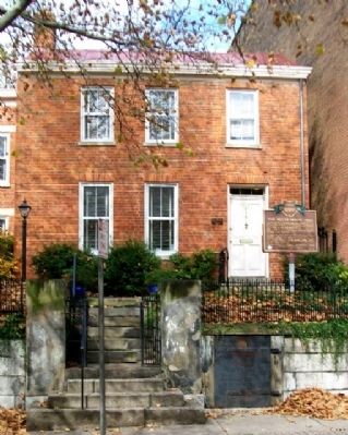
The oldest building in Cincinnati's basin area, the Betts House exemplifies a national trend on the expanding frontier of impermanent log and frame structures giving way to more permanent brick architecture. It is the earliest surviving brick building in the city. During Cincinnati's period of settlement in the early 1800s, the William and Phebe Betts family established a brickyard here that supplied building materials for the rapidly growing frontier city.
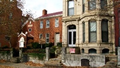
The Betts House lends its name to the Betts-Longworth Historic District. Established in 1983, the district represents the last nineteenth century remnant of Cincinnati's lower West End and surrounds the older Betts House with tall, narrow mid- and late-nineteenth century buildings. The Betts house is oriented to the cardinal directions, rather than to the city's slightly skewed grid.
Erected 2003 by Ohio Bicentennial Commission, The Longaberger Company, The Betts House Research Center, and The Ohio Historical Society. (Marker Number 39-31.)
Topics and series. This historical marker is listed in these topic lists: Industry & Commerce • Notable Buildings • Settlements & Settlers. In addition, it is included in the Ohio Historical Society / The Ohio History Connection series list. A significant historical year for this entry is 1983.
Location. 39° 6.46′ N, 84° 31.326′ W. Marker is in Cincinnati, Ohio, in Hamilton County. It is in West End. Marker is on Clark Street, on the right when traveling west. Marker is about 200 feet west of Central Avenue. Touch for map. Marker is at or near this postal address: 416 Clark Street, Cincinnati OH 45203, United States of America. Touch for directions.
Other nearby markers. At least 8 other markers are within walking distance of this marker. The Gamble House (a few steps from this marker); The Oldest Jewish Cemetery West of the Allegheny Mountains (about 300 feet away, measured in a direct line); Chestnut Street Cemetery / Two Centuries of Jewish Cincinnati (about 300 feet away); Gaines High School / Peter H. Clark (approx. 0.2 miles away); The Miami and Erie Canal (approx. 0.2 miles away); Laurel-Lincoln World War II Memorial (approx. 0.2 miles away); Robert L. McCook Monument / Friedrich Hecker Monument (approx. ¼ mile away); Hecker (approx. ¼ mile away). Touch for a list and map of all markers in Cincinnati.
Also see . . . History of the Betts House. (Submitted on November 1, 2009, by William Fischer, Jr. of Scranton, Pennsylvania.)
Credits. This page was last revised on February 4, 2023. It was originally submitted on November 1, 2009, by William Fischer, Jr. of Scranton, Pennsylvania. This page has been viewed 1,310 times since then and 22 times this year. Photos: 1, 2, 3. submitted on November 1, 2009, by William Fischer, Jr. of Scranton, Pennsylvania.


