Brownsville in Brooklyn in Kings County, New York — The American Northeast (Mid-Atlantic)
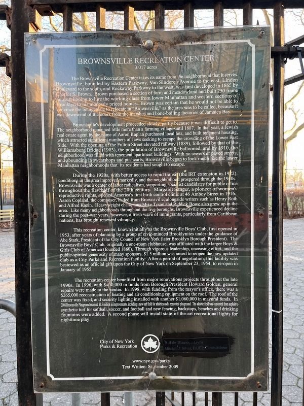
Brownsville Recreation Center
3.017 acres
The Brownsville Recreation Center takes its name from the neighborhood that it serves. Brownsville, bounded by Eastern Parkway, Van Sinderen Avenue to the east, Linden Boulevard to the south, and Rockaway Parkway to the west, was first developed in 1865 by Charles S. Brown. Brown purchased a section of farm and meadowland and built 250 frame houses, hoping to lure the working class from lower Manhattan and western sections of Brooklyn to his modestly priced homes. Brown was certain that he would not be able to convince the bourgeoisie to relocate in "Brownsville," as the area was to be called because it was downwind of the odors from the marshes and bone-boiling factories of Jamaica Bay.
Brownsville's development proceeded slowly, partly because it was difficult to get to. The neighborhood remained little more than a farming village until 1887. In that year, a Jewish real estate agent by the name of Aaron Kaplan purchased local lots, and built tenement housing, which attracted significant numbers of Jews seeking to escape the crowding of the Lower East Side. With the opening of the Fulton Street elevated railway (1889), followed by that of the neighborhood was filled with tenement apartment buildings. With no sewers or paved streets, and abounding in sweatshops and pushcarts, Brownsville began to look much like the lower Manhattan neighborhoods that its residents had sought to escape.
During the 1920s, with better access to rapid transit (the IRT extension in 1922), conditions in the area improved markedly, and the neighborhood prospered through the 1940s. Brownsville was a center of labor radicalism, supporting socialist candidates for public office throughout the first half of the century. Margaret Sanger, a pioneer of women's reproductive rights, opened America's first birth control clinic at 46 Amboy Street in 1916. Aaron Copland, the composer hailed from Brownsville, alongside writers such as Henry Roth and Alfred Kazin. Heavyweight champions Mike Tyson and Riddick Bowe also grew up in the area. Like many neighborhoods throughout the five boroughs, Brownsville experienced decline the post-war years, however, a fresh wave of immigrants, particularly from Caribbean nations, has brought renewed vibrancy.
This recreation center, known initially as the Brownsville Boys' Club, first opened in 1953, after years of planning by a group of civic minded Brooklynites under the guidance of Abe Stark, President of the City Council of New York (later Brooklyn Borough President). The Brownsville Boys' Club, originally a one-room clubhouse, was affiliated with the larger Boys & Girls Club of America (founded 1860). Through vigorous leadership, unceasing effort, and the public-spirited
The recreation center benefited from major renovations throughout the late 1990s. In 1996, with $400,000 in funds from Borough President Howard Golden, general repairs were made to the center. In 1998, with funding from the mayor's office, there was a $265,000 reconstruction of the heating and air conditioning equipment on the roof. The roof of the center was fixed, and security lighting installed with another $1,060,000 in mayoral funds. In 2008 Brownsville Playground received $1.5 million in improvements, including a new turf field for athletics and a renovated playground. The athletic field was converted from asphalt to synthetic turf for softball, soccer, and football and new fencing, backstops, benches and drinking fountains were added. A second phase will install state-of-the-art recreational lights for nighttime play
Erected 2009 by City of New York Parks & Recreation (NYC Parks).
Topics and series. This historical marker is listed in these topic lists: Government & Politics • Parks & Recreational Areas • Railroads & Streetcars • Settlements & Settlers. In addition, it is included in the NYC Parks series list. A significant historical month for this entry is January 1955.
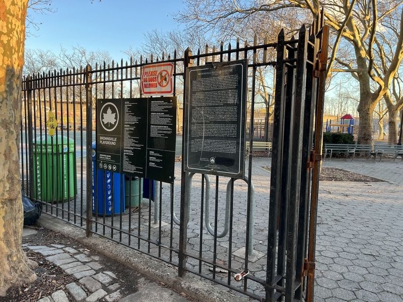
Location. 40° 39.422′ N, 73° 54.106′ W. Marker is in Brooklyn, New York, in Kings County. It is in Brownsville. Marker is at the intersection of Hegeman Avenue and Sackman Street, on the left when traveling west on Hegeman Avenue. Touch for map. Marker is at or near this postal address: 814 Sackman Street, Brooklyn NY 11212, United States of America. Touch for directions.
Other nearby markers. At least 8 other markers are within 2 miles of this marker, measured as the crow flies. Van Dyke Playground (approx. 0.6 miles away); Canarsie Veterans Memorial (approx. 0.8 miles away); Howard Playground (approx. one mile away); a different marker also named Howard Playground (approx. 1.1 miles away); Pieter Claesen Wyckoff House (approx. 1.3 miles away); Hilltop Playground (approx. 1.4 miles away); Jack "Jackie" Roosevelt Robinson (approx. 1˝ miles away); Callahan-Kelly Playground (approx. 1˝ miles away). Touch for a list and map of all markers in Brooklyn.
Credits. This page was last revised on January 15, 2024. It was originally submitted on January 15, 2024, by Devry Becker Jones of Washington, District of Columbia. This page has been viewed 57 times since then. Photos: 1, 2. submitted on January 15, 2024, by Devry Becker Jones of Washington, District of Columbia.

