Hebron in Jefferson County, Wisconsin — The American Midwest (Great Lakes)
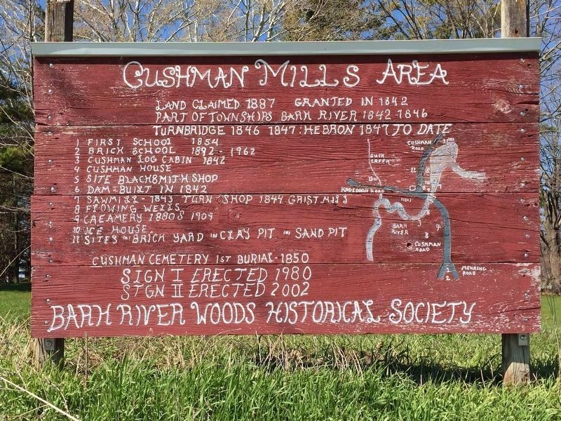
Cushman Mills Area
Land claimed 1887 Granted in 1842
Part of Townships Bark River 1842-1846
Turnbridge 1846 : Hebron 1847 to date
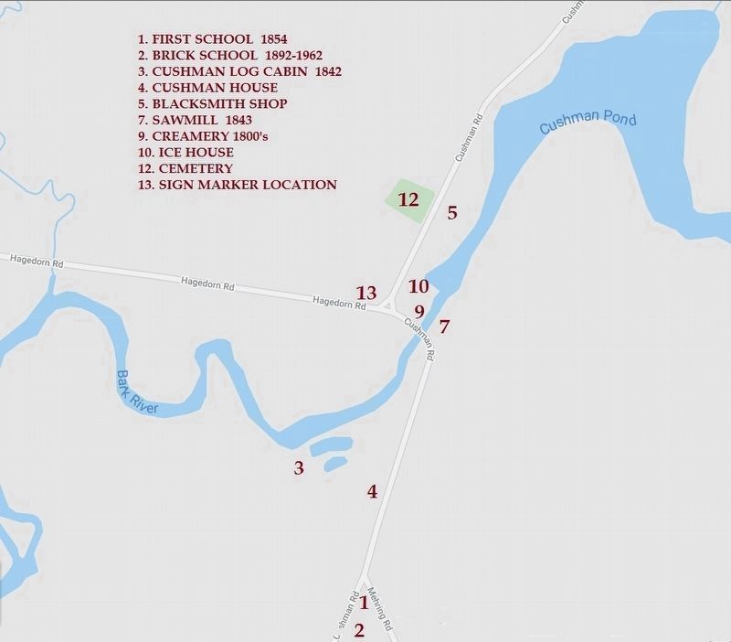
1 First school 1854
2 Brick school 1892 - 1962
3 Cushman log cabin 1842
4 Cushman house
5 Site Blacksmith Shop
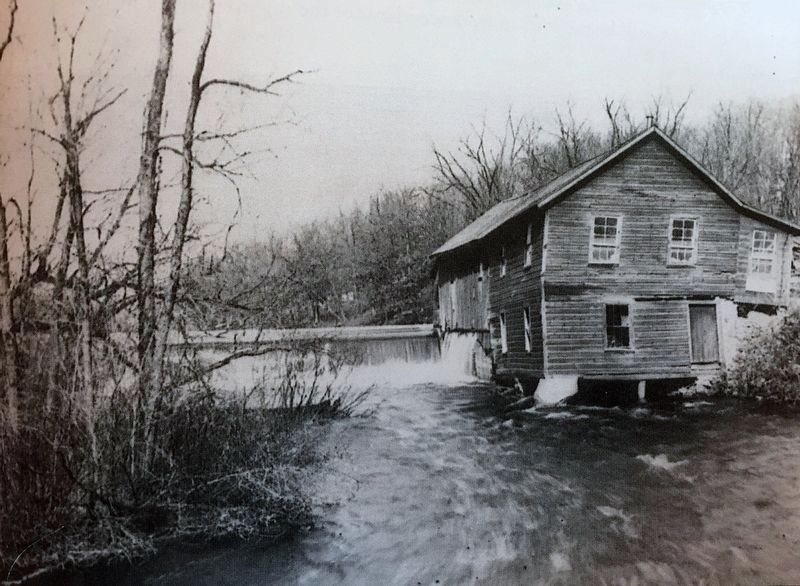
6 Dam built in 1842
7 Sawmill - 1843 Turn Shop 1844 Grist Mill
8 Flowing wells
9 Creamery 1880s 1909
10 Ice House
11 Sites (?) Brick Yard (?) Clay Pit (?) Sand Pit
Cushman Cemetery 1st Burial - 1850
Erected 2002 by Bark River Woods Historical Society.
Topics. This historical marker is listed in these topic lists: Cemeteries & Burial Sites • Settlements & Settlers.
Location. 42° 57.641′ N, 88° 40.33′ W. Marker is in Hebron, Wisconsin, in Jefferson County. Marker is at the intersection of Hagedorn Road and Cushman Rd, on the left when traveling east on Hagedorn Road. Touch for map. Marker is at or near this postal address: W2728 Hagedorn Rd, Jefferson WI 53549, United States of America. Touch for directions.
Other nearby markers. At least 8 other markers are within 10 miles of this marker, measured as the crow flies. Zion Church (approx. 4.7 miles away); Black Hawk War Encampment (approx. 6.4 miles away); Lincoln Hill (approx. 7 miles away); Fort Koshkonong (approx. 8.4 miles away); Wm. R. Look Log Cabin (approx. 8.4 miles away); Revolutionary War Veterans (approx. 9.2 miles away); Whitewater Historical Society Depot Museum (approx. 9.4 miles away); Whitewater Passenger Depot (approx. 9.4 miles away).
Credits. This page was last revised on January 24, 2024. It was originally submitted on January 17, 2024, by James Bonewald of Dousman, Wisconsin. This page has been viewed 73 times since then. Photos: 1, 2, 3. submitted on January 17, 2024, by James Bonewald of Dousman, Wisconsin. • J. Makali Bruton was the editor who published this page.
Editor’s want-list for this marker. A wide view photo of the marker and the surrounding area together in context. • Can you help?


