Vinton in Benton County, Iowa — The American Midwest (Upper Plains)
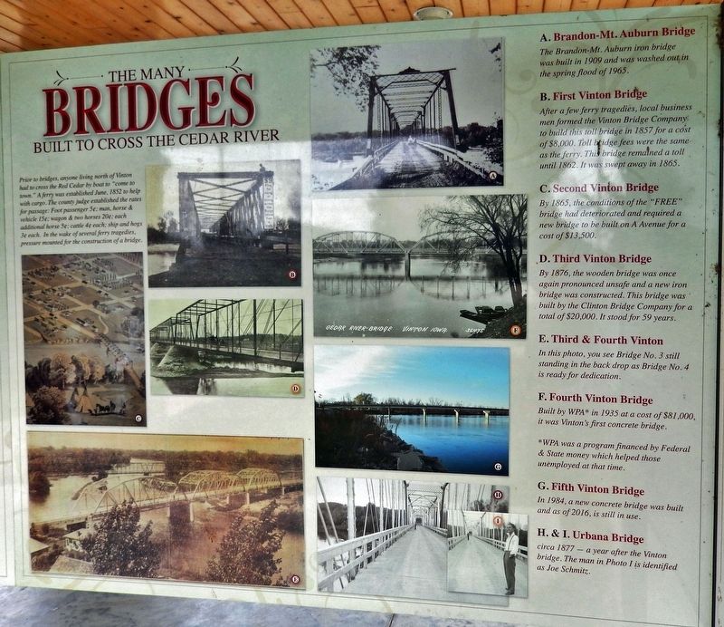
The Many Bridges Built to Cross the Cedar River
Photographed by Cosmos Mariner, June 28, 2021
1. The Many Bridges Built to Cross the Cedar River Marker
Prior to bridges, anyone living north of Vinton had to cross the Red Cedar by boat to “come to town.” A ferry was established June, 1852 to help with cargo. The county judge established the rates for passage: Foot passenger 5¢; man, horse & vehicle 15¢; wagon & two horses 20¢; each additional horse 5¢; cattle 4¢ each; ship and hogs 3¢ each. In the wake of several ferry tragedies, pressure mounted for the construction of a bridge.
A. Brandon-Mt. Auburn Bridge
The Brandon-Mt. Auburn iron bridge was built in 1909 and was washed out in the spring flood of 1965.
B. First Vinton Bridge
After a few ferry tragedies, local businessmen formed the Vinton Bridge Company to build this toll bridge in 1857 for a cost of $8,000. Toll bridge fees were the same as the ferry. This bridge remained a toll until 1862. It was swept away in 1865.
C. Second Vinton Bridge
By 1865, the conditions of the "FREE" bridge had deteriorated and required a new bridge to be built on A Avenue for a cost of $13,500.
D. Third Vinton Bridge
By 1876, the wooden bridge was once again pronounced unsafe, and a new iron bridge was constructed. This bridge was built by
this page online
E. Third & Fourth Vinton
In this photo, you see Bridge No. 3 still standing in the backdrop as Bridge No. 4 is ready for dedication.
F. Fourth Vinton Bridge
Built by WPA* in 1935 at a cost of $81,000, it was Vinton's first concrete bridge.
*WPA was a program financed by Federal & State money which helped those unemployed at that time.
G. Fifth Vinton Bridge
In 1984, a new concrete bridge was built and as of 2016, is still in use.
H. & I. Urbana Bridge
circa 1877 — a year after the Vinton bridge. The man in Photo I is identified as Joe Schmitz.
Topics and series. This historical marker is listed in these topic lists: Bridges & Viaducts • Charity & Public Work • Industry & Commerce • Waterways & Vessels. In addition, it is included in the Works Progress Administration (WPA) projects series list. A significant historical month for this entry is June 1852.
Location. 42° 10.211′ N, 92° 1.503′ W. Marker is in Vinton, Iowa, in Benton County. It can be reached from the intersection of A Avenue and West 1st Street, on the right when traveling north. The marker is located

Photographed by Cosmos Mariner, June 28, 2021
2. The Many Bridges Built to Cross the Cedar River Marker
Looking north through the Harrison Pavilion. The marker is in the middle of the right side of the kiosk.

Regionally, this marker is in Eastern Iowa. It is also in the American Midwest and in the Corn Belt. Globally, it is in North America, the Western Hemisphere, the Western World, and the Anglosphere. Historically, it finds itself in what was once the territory of the Mississippian Culture and also the Louisiana Purchase.
Other nearby markers. At least 8 other markers are within walking distance of this marker: Red Cedar River (here, next to this marker); Minne Estema Park (here, next to this marker); Moments in Time on the Cedar (here, next to this marker); Flooding of the Cedar River (here, next to this marker); Iowa Canning Co. Seed House (about 300 feet away, measured in a direct line); Watson's Opera House (about 700 feet away); Sweet Corn Day Festival (approx. 0.2 miles away); Benton County Courthouse (approx. 0.2 miles away). Touch for a list and map of all markers in Vinton.
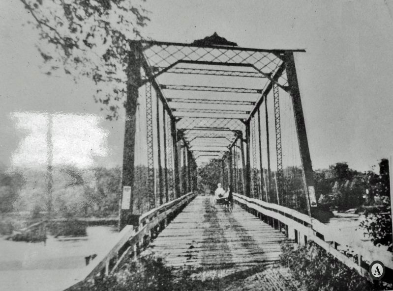
3. Marker detail: Bridge A — Brandon-Mt. Auburn Bridge
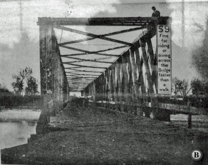
4. Marker detail: Bridge B — First Vinton Bridge
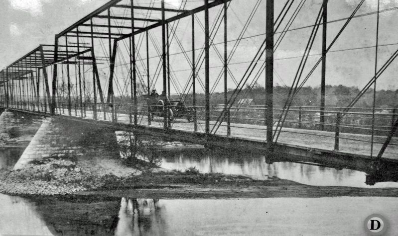
5. Marker detail: Bridge D — Third Vinton Bridge
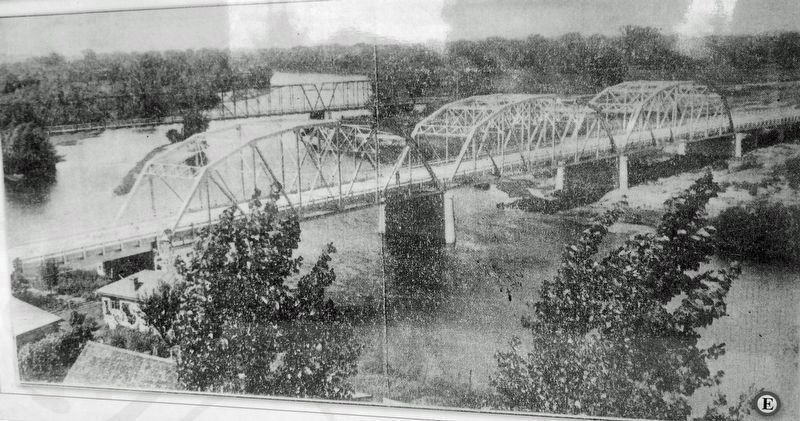
6. Marker detail: Bridge E — Third & Fourth Vinton Bridges
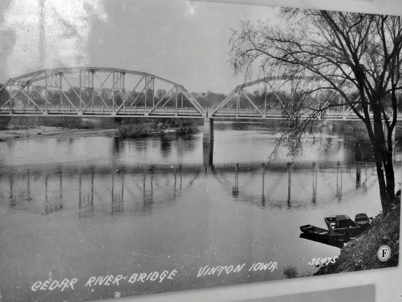
7. Marker detail: Bridge F — Fourth Vinton Bridge
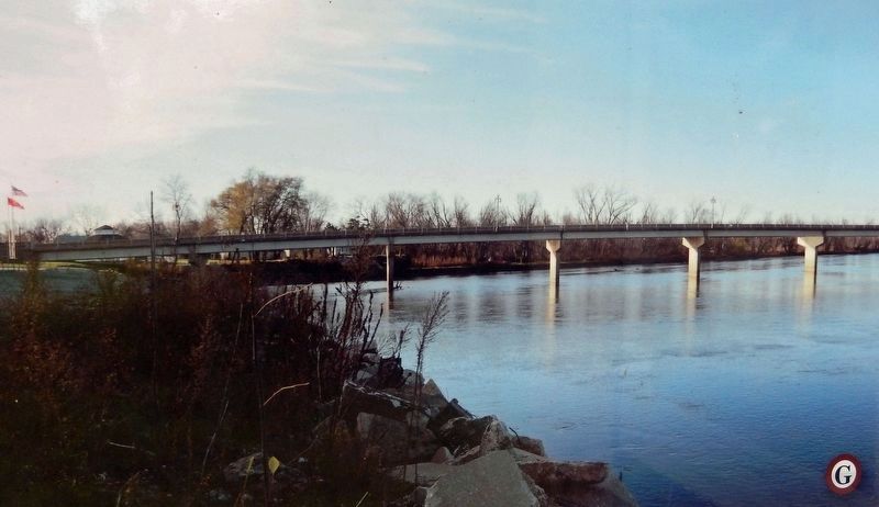
8. Marker detail: Bridge G — Fifth Vinton Bridge
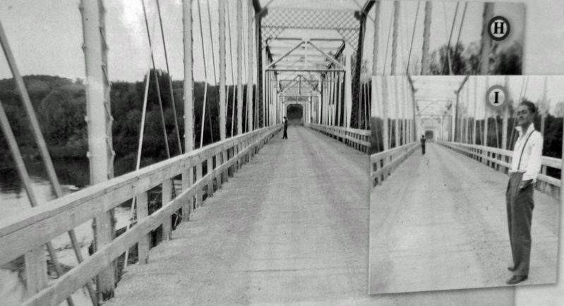
9. Marker detail: Bridge H & I — Urbana Bridge
Credits. This page was last revised on December 4, 2024. It was originally submitted on January 18, 2024, by Cosmos Mariner of Cape Canaveral, Florida. This page has been viewed 562 times since then and 104 times this year. Photos: 1, 2, 3, 4, 5, 6, 7, 8, 9. submitted on January 19, 2024, by Cosmos Mariner of Cape Canaveral, Florida.
