Dansaert in Bruxelles, Brussels, Belgium — Northwestern Europe
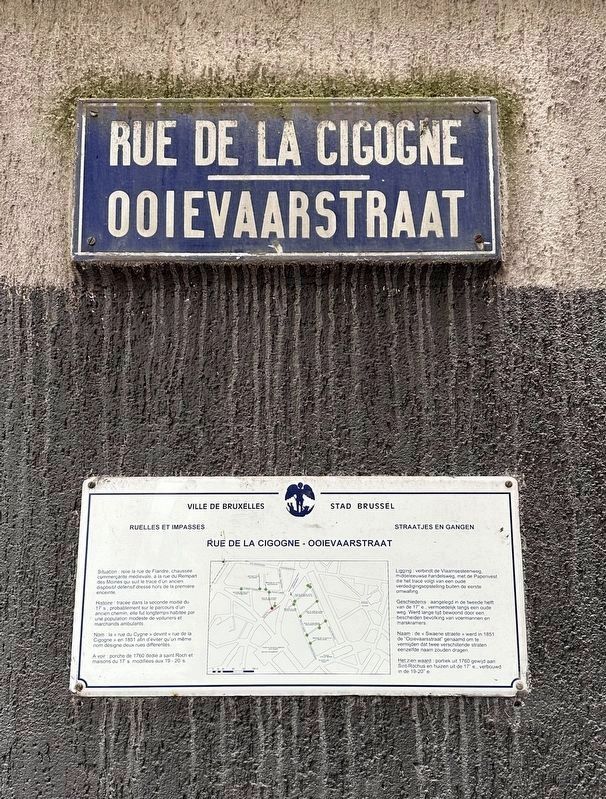
Rue de la Cigogne / Ooievarstraat / “Stork” Street
— Ruelles et Impasses - Straatjes en Gangen —
Inscription.
Situation: relie la rue de Flandre, chaussée commerçante médiévale, à la rue du Rempart des Moines qui suit le tracé d'un ancien dispositif défensif dressé hors de la première enceinte.
Histoire: tracée dans la seconde moitié du 17's, probablement sur le parcours d'un ancien chemin, elle fut longtemps habitée par une population modeste de voituriers et marchands ambulants.
Nom: la «rue du Cygne» devint «rue de la Cigogne» en 1851 afin d'éviter qu'un même nom désigne deux rues différentes.
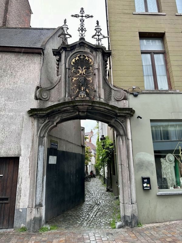
A voir: porche de 1760 dédié à saint Roch et maisons du 17' s. modifiées aux 19-20's.
Ligging: verbindt de Vlaamsesteenweg, middeleeuwse handelsweg, met de Papenvest die het tracé volgt van een oude verdedigingsopstelling buiten de eerste omwalling.
Geschiedenis: aangelegd in de tweede helft van de 17 e., vermoedelijk langs een oude weg. Werd lange tijd bewoond door een bescheiden bevolking van voermannen en marskramers.
Naam: de «Swaene straete» werd in 1851 de "Ooievaarsstraat" genaamd om te vermijden dat twee verschillende straten eenzelfde naam zouden dragen.
Het zien waard: portiek uit 1760 gewijd aan Sint-Rochus en huizen uit de 17” e., verbouwd in de 19-20" e.
Location: Connects Rue de Flandre, a medieval commercial road, to Rue du Rempart des Moins, which follows the outside of the first city wall.
History: Constucted in the second half of the 17th century, probably along an old road. Was inhabited for a long time by a modest population of carters and peddlers.
Name: “Rue du Cygne” (“Swan Street”) became “Rue de la Cigogne” (“Stork Street”) in 1851 in order to avoid the same name designating two different streets.
Worth seeing: Entance from 1760 dedicated to Saint Roch and houses from the 17th century, rebuilt in the 19th and 20th centuries.
Erected by Ville de Bruxelles.
Topics. This historical marker is listed in this topic list: Roads & Vehicles. A significant historical year for this entry is 1851.
Location. 50° 51.142′ N, 4° 20.678′ E. Marker is in Bruxelles, Brussels. It is in Dansaert. Marker is at the intersection of Rue de Cigogne and Rue du Rem des Moines, on the left when traveling north on Rue de Cigogne. Touch for map. Marker is in this post office area: Bruxelles, Brussels 1000, Belgium. Touch for directions.
Other nearby markers. At least 8 other markers are within walking distance of this marker. Monument: au Pigeon Soldat / aan de Oorlogs Duif / to the War Pigeons (1914-1918) (about 210 meters away, measured
in a direct line); Rue du Chien Marin / Zeehondstraat / “Sea Dog” Street (about 210 meters away); Revolving Bridge / Drehbrücke “des Barques” (approx. 0.3 kilometers away); Église Saint-Jean-Baptiste au Béguinage / Church of Saint John the Baptist at the Béguinage (approx. 0.4 kilometers away); Tour Noire / Zwarte Toren / Black Tower (approx. 0.4 kilometers away); Emile Jacqmain (approx. 0.6 kilometers away); Adolphe Max (approx. 0.6 kilometers away); The Royal Flemish Theatre / Das Königliche Flämische Theater (approx. 0.6 kilometers away). Touch for a list and map of all markers in Bruxelles.
Also see . . . Hidden Belgium: Rue de la Cigogne (Brussels Times, May 19, 2023).
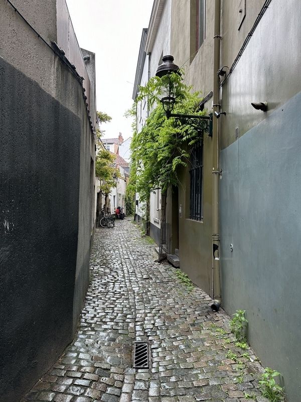
Excerpt: This medieval alley paved with bumpy cobblestones is one of the last relics of old Brussels. Reached through an 18th-century gate with a tiny chapel on top dedicated to St Roch, the narrow passage runs between workers’ houses that have somehow survived untouched.(Submitted on January 19, 2024.)
Credits. This page was last revised on January 19, 2024. It was originally submitted on January 19, 2024, by Andrew Ruppenstein of Lamorinda, California. This page has been viewed 51 times since then. Photos: 1, 2, 3. submitted on January 19, 2024, by Andrew Ruppenstein of Lamorinda, California.


