Ste Catherine in Bruxelles, Brussels, Belgium — Northwestern Europe
Revolving Bridge / Drehbrücke “des Barques”
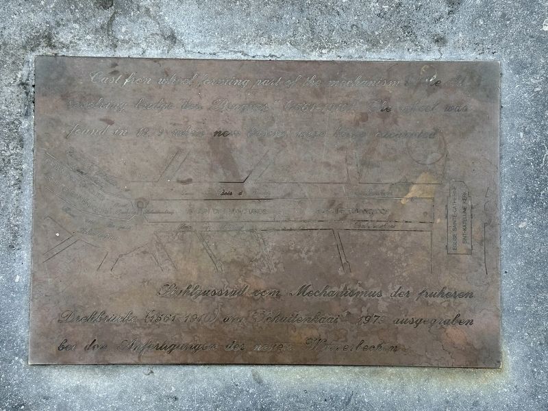
Inscription.
Cast wheel forming part of the mechanism of the old revolving bridge “des Barques” (1561-1910). The wheel was found in 1979 when new basins were being excavated.
Stahlgussrad vom Mechanismus der früheren Drehbrücke (1561-1910) am “Schuitenkaai”, 1979 ausgegraben bei den Anfertigungen der neuen Wasserbecken.
Topics. This historical marker is listed in these topic lists: Bridges & Viaducts • Waterways & Vessels. A significant historical year for this entry is 1979.
Location. 50° 51.092′ N, 4° 20.9′ E. Marker is in Bruxelles, Brussels. It is in Ste Catherine. Marker is on Quai au Bois à Brûler, on the right when traveling south. Touch for map. Marker is in this post office area: Bruxelles, Brussels 1000, Belgium. Touch for directions.
Other nearby markers. At least 8 other markers are within walking distance of this marker. Rue du Chien Marin / Zeehondstraat / “Sea Dog” Street (within shouting distance of this marker); Tour Noire / Zwarte Toren / Black Tower (about 120 meters away, measured in a direct line); Église Saint-Jean-Baptiste au Béguinage / Church of Saint John the Baptist at the Béguinage (about 180 meters away); Rue de la Cigogne / Ooievarstraat / “Stork” Street (approx. 0.3 kilometers away); Monument: au Pigeon Soldat / aan de Oorlogs Duif / to the War Pigeons (1914-1918) (approx. 0.3 kilometers away); Emile Jacqmain (approx. 0.4 kilometers away); Adolphe Max (approx. 0.4 kilometers away); Le Passage du Nord / De Noord-Passage / The Northern Gallery / Die Nord-Passage (approx. 0.4 kilometers away). Touch for a list and map of all markers in Bruxelles.
Also see . . . Old Port, fish market (Visit Brussels).
Excerpt: The port of Brussels used to extend right into the heart of the city. A swing bridge separated the Bassin des Barques from the Bassin des Marchands. It was on these long quays that business was conducted. The site, traditionally associated with the sale of fish, is located near Saint Catherine’s Church. A market called "Vismet" was active there from 1884 to 1955.(Submitted on January 21, 2024.)
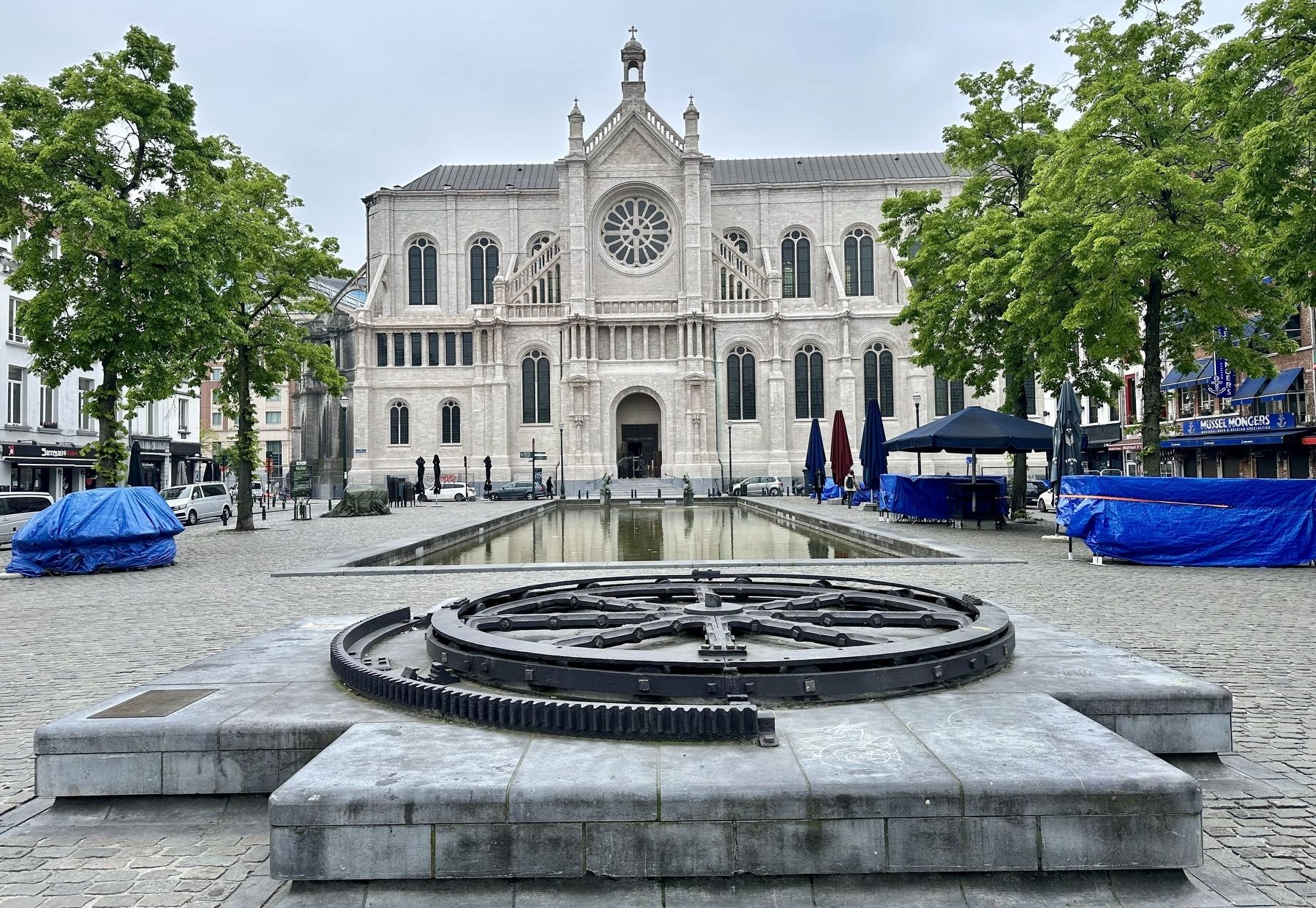
Even today, the Quai au Bois à Brûler and the Quai aux Briques, which surround the Marché aux Poissons, bear witness to abundant economic, food and gastronomic activity. Port activities continued at this location until the beginning of the 20th century, when the basins were filled in. Saint Catherine’s Church wasbuilt on the site of the Sainte-Catherine basin between 1854 and 1874. There is no fish market there now, but for decades the site has been a mecca for fish and shellfish restaurants in the capital.Photographed By Andrew Ruppenstein, May 15, 20232. Revolving Bridge / Drehbrücke “des Barques” Marker and wheelThe marker is visible here on the left. There probably at one time would have been an additional plaque in French and Dutch, as those are the local languages, but if there was, it is no longer extant. The Èglise Sainte-Catherine (“Saint Catherine Church”) is in the background.

Photographed By ND photo, circa 1902
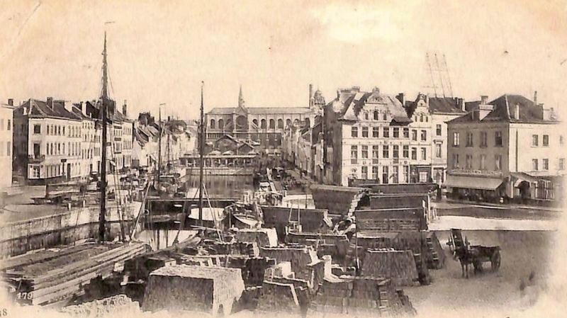
3. Le Canal de Villebrouck postcard photo
This photo, cropped from a postcard, shares the same perspective as the preceding photo, but was taken from perhaps 15-25 meters further north. Both quays are visible, and the small structure visible spanning the channel is probably the revolving bridge described on the marker (and thus, likely the marker site, at least roughly).
Credits. This page was last revised on January 21, 2024. It was originally submitted on January 21, 2024, by Andrew Ruppenstein of Lamorinda, California. This page has been viewed 43 times since then. Photos: 1, 2, 3. submitted on January 21, 2024, by Andrew Ruppenstein of Lamorinda, California.

