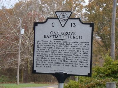
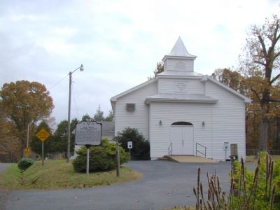
Near Madison in Madison County, Virginia — The American South (Mid-Atlantic)
Oak Grove Baptist Church
Erected 1995 by Department of Historic Resources. (Marker Number G-13.)
Topics and series. This historical marker is listed in this topic list: Churches & Religion. In addition, it is included in the Virginia Department of Historic Resources (DHR) series list. A significant historical year for this entry is 1869.
Location. 38° 22.107′ N, 78° 10.806′ W. Marker is near Madison, Virginia, in Madison County. Marker is on Oak Park Rd (County Route 634) west of Lillards Ford Road (County Route 607), on the left when traveling east. Touch for map. Marker is in this post office area: Culpeper VA 22701, United States of America. Touch for directions.
Other nearby markers. At least 8 other markers are within 5 miles of this marker, measured as the crow flies. Jackson’s Crossing (approx. 3.7 miles away); Madison County / Culpeper County (approx. 3.8 miles away); Crooked Run Baptist Church (approx. 4 miles away); Oliver Dinwiddie Tucker (approx. 4.1 miles away); Jackson’s March to Fredericksburg (approx. 4.1 miles away); James L. Kemper Residence (approx. 4.1 miles away); Madison County Confederate Dead (approx. 4.3 miles away); The Fallen Warriors Monument (approx. 4.3 miles away). Touch for a list and map of all markers in Madison.
Credits. This page was last revised on June 16, 2016. It was originally submitted on November 1, 2009, by J. J. Prats of Powell, Ohio. This page has been viewed 1,706 times since then and 43 times this year. Photos: 1, 2. submitted on November 1, 2009, by J. J. Prats of Powell, Ohio.

