Saint Anthony Main in Minneapolis in Hennepin County, Minnesota — The American Midwest (Upper Plains)
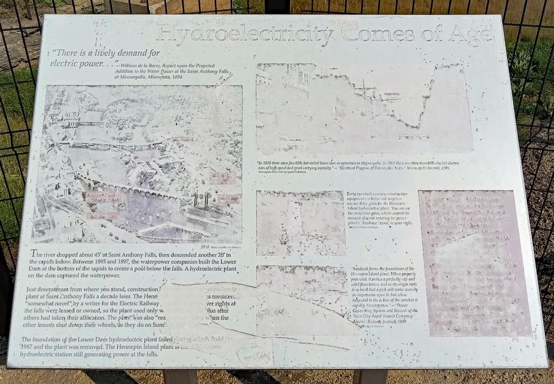
Hydroelectricity Comes of Age
"There is a lively demand for electric power..."–William de la Barre, Report upon the Projected Addition to the Water Power at the Saint Anthony Falls at Minneapolis, Minnesota, 1894
The river dropped about 45' at Saint Anthony Falls, then descended another 20' in the rapids below. Between 1895 and 1897, the waterpower companies built the Lower Dam at the bottom of the rapids to create a pool below the falls. A hydroelectric plant on the dam captured the waterpower.
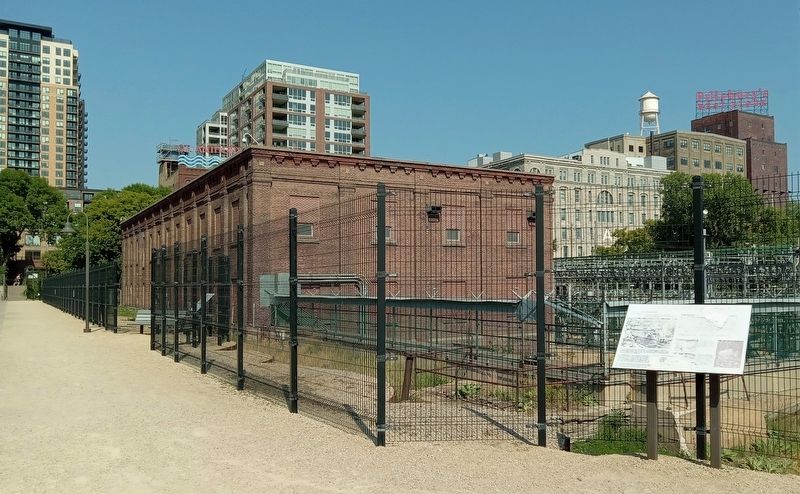
Just downstream from where you stand, construction began on another hydroelectric plant at Saint Anthony Falls a decade later. The Hennepin Island plant was considered "somewhat novel" by a writer for the Electric Railway Journal. Waterpower rights at the falls were leased or owned, so the plant used only water that was surplus after others had taken their allocation. The plant was also "ready to use water when the other lessees shut down their wheels, as they do on Sunday and holidays."
The foundation of the Lower Dam hydroelectric plant failed during a flash flood in 1987 and the plant was removed. The Hennepin Island plant is the only historic hydroelectric station still generating power at the falls.
"In 1878 there were five little bob-tailed horse cars in operation in Minneapolis. In 1903 there are more than 600 wheeled electric cars of high speed and great carrying capacity." – "Electrical Progress of Twenty-five Years," Minneapolis Journal, 1903
Early twentieth-century construction equipment–a horse and wagon–crosses three gates for the Hennepin Island hydroelectric plant. You can see the completed gates, which control the amount of water entering the power plant's "headrace" canal, to your right.
"Sandrock forms the foundation of the Hennepin Island plant. When properly protected, it makes a perfectly safe and solid foundation, and in its virgin state is so hard that a pick will make scarcely an impression upon it, but when subjected to the action of the weather it rapidly disintegrates." – "Power Generating System and Records of the Twin City Rapid Transit Company," Electric Railway Journal, 1909
All the electricity from the Lower Dam and Hennepin Island power plants was purchased by the Twin City Rapid Transit Company, which also built a steam-powered generating plant near the Lower Dam to supply the heavy demand. Horses pulled the city's streetcars until [???] after a su[???] cars the transit company converted the entire fleet within three years, installing miles of [??] tracks and overhead powerlines. At the same time it connected the Minneapolis and Saint Paul lines. By 1916, the system
had over 400 miles of tracks extending from Lake Minnetonka to Stillwater. By 1954, though, buses completely replaced streetcars.
Topics. This historical marker is listed in these topic lists: Industry & Commerce • Railroads & Streetcars • Waterways & Vessels. A significant historical year for this entry is 1895.
Location. 44° 58.993′ N, 93° 15.319′ W. Marker is in Minneapolis, Minnesota, in Hennepin County. It is in Saint Anthony Main. Marker can be reached from SE Main Street. The marker is in Water Power Park, just southwest of the Hennepin Island Hydroelectric Plant. Touch for map. Marker is at or near this postal address: 204 SE Main Street, Minneapolis MN 55414, United States of America. Touch for directions.
Other nearby markers. At least 8 other markers are within walking distance of this marker. Hydroelectricity: The Early Years (a few steps from this marker); A Complex Family Tree (within shouting distance of this marker); The Spin on Turbines and Generators (within shouting distance of this marker); From Power Plant to Light Switch (within shouting distance of this marker); A Tale of Two Waterpower Companies (within shouting distance of this marker); Beneath Your Feet (about 300 feet away, measured in a direct line); Harnessing Waterpower (about 300 feet away); Reshaping the Island (about 300 feet away). Touch for a list and map of all markers in Minneapolis.
More about this marker. The marker is damaged and extremely sun-faded.
Credits. This page was last revised on March 25, 2024. It was originally submitted on January 21, 2024, by McGhiever of Minneapolis, Minnesota. This page has been viewed 49 times since then. Photos: 1, 2. submitted on January 21, 2024, by McGhiever of Minneapolis, Minnesota. • J. Makali Bruton was the editor who published this page.

