Near Lawn in Taylor County, Texas — The American South (West South Central)
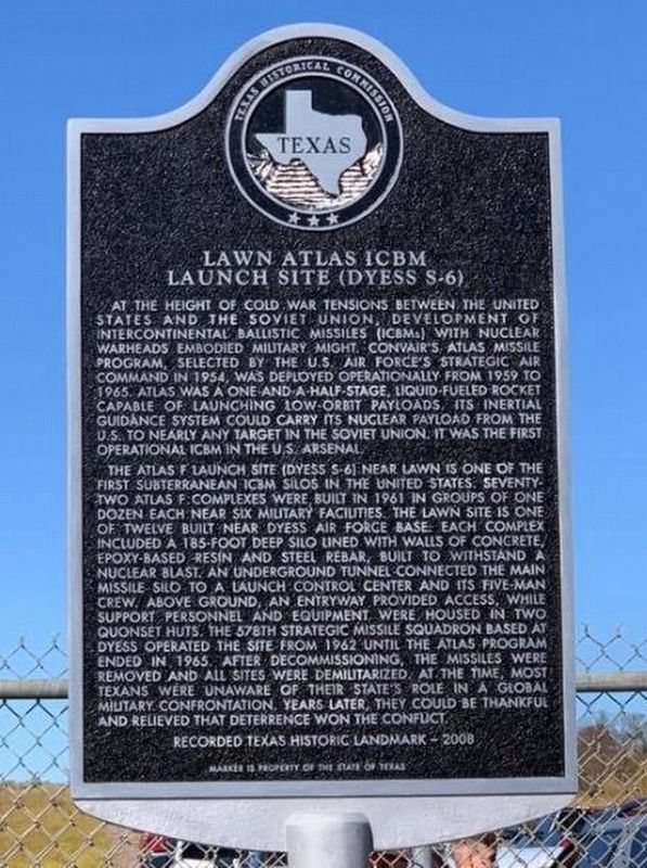
Lawn Atlas ICBM Launch Site (Dyess S-6)
The Atlas F Launch site (Dyess S-6) near Lawn is one of the first subterranean ICBM silos in the United States. Seventy-two Atlas F complexes were built in 1961 in groups of one dozen each near six military facilities. The Lawn site is one of twelve built near Dyess Air Force Base. Each complex included a 185-foot deep silo lined with walls of concrete, epoxy-based resin and steel rebar, built to withstand a nuclear blast. An underground tunnel connected the main missile silo to a launch control center and its five-man crew. Above ground, an entryway provided access, while support personnel and equipment were housed in two quonset huts. The 578th Strategic Missile Squadron based at Dyess operated the site from 1962 until the Atlas program ended in 1965. After decommissioning, the missiles were removed and all sites were demilitarized. At the time, most Texans were unaware of their state's role in a global military confrontation. Years later, they could be thankful and relieved that deterrence won the conflict.
Erected 2008 by Texas Historical Commission. (Marker Number 16131.)
Topics. This historical marker is listed in this topic list: War, Cold. A significant historical year for this entry is 1962.
Location. 32° 8.24′ N, 99° 42.204′ W. Marker is near Lawn, Texas, in Taylor County. Marker is on Farm to Market Road 604, 2.4 miles east of U.S. 84, on the left when traveling east. The marker is located 20 miles south of Abilene, take 83/84 to US-84 until you reach Lawn, Texas. In Lawn, turn east at the blinking light onto FM 604 and drive 2.4 miles. You'll see the historical marker on the left, but beyond that the site is gated. Touch for map. Marker is at or near this postal address: 1990 FM 604, Lawn TX 79530, United States of America. Touch for directions.
Other nearby markers. At least 8 other markers are within 9 miles of this marker, measured as the crow flies. Pioneer Physician J.D. Windham (approx. 6.7 miles away); Jim Ned Creek (approx. 7.1 miles away); Cotton Production in Runnels County (approx. 7.3 miles away); Ranger Peak (approx. 7.3 miles away); Ranger Campsite (approx. 7.3 miles away); Old Townsite of Content (approx. 7.4 miles away); Counts Cemetery (approx. 8.1 miles away); Cedar Gap Community (approx. 8.8 miles away).
Regarding Lawn Atlas ICBM Launch Site (Dyess S-6). The 578th Strategic Missile Squadron was based at Dyess Air Force Base in Abilene, Texas from 1962 thru 1965. There were 12 sites built in a ring around Abilene. In 2001, Farm-to-Market Road 604 from State Highway 351 in Shackelford County to U.S. Highway 83 in Taylor County was designated as the Atlas ICBM Highway, an act signed by the Governor of Texas.
These sites were manned 24 hours a day, 7 days a week, 365 days a year during the time the Squadron was active. During the Cuban Missile Crisis, all operational 578th sites were at a high level of alert and were ready to launch the Atlas missile should it have become necessary. The squadron was armed with the SM-65F weapon system, more commonly know as the Atlas F. The 578th was an Atlas F unit which meant the missile was housed in a "silo launcher" style complex.
The missile was kept in a vertical position at all times. In order to launch, two 75-ton overhead doors were opened and the "bird" was lifted out of the silo. The Atlas ICBM required RP1 and Liquid Oxygen for powering the rocket engines. The RP1 fuel was kept on board the missile at all times during alert. Before the missile was lifted to the launch position, it was filled with the Liquid Oxygen fuel. Internal pressure was maintained by a "head" of gaseous Nitrogen.
The Atlas had a range of about 6,000 miles. The Atlas rocket was also used by NASA during the early days of manned space travel and was the booster used to put John Glenn into Earth orbit.
Missile Acceptance Date: 5/31/1962
Missile Delivery Date: 6/11/1962
Decommissioned: 3/25/1965
Credits. This page was last revised on January 23, 2024. It was originally submitted on January 23, 2024, by Kelly Sherley of Lawn, Texas. This page has been viewed 55 times since then. Photo 1. submitted on January 23, 2024, by Kelly Sherley of Lawn, Texas. • James Hulse was the editor who published this page.
Editor’s want-list for this marker. A photo of the marker and the surrounding area in context. • Can you help?
