Hanover Township near Perrysville in Ashland County, Ohio — The American Midwest (Great Lakes)
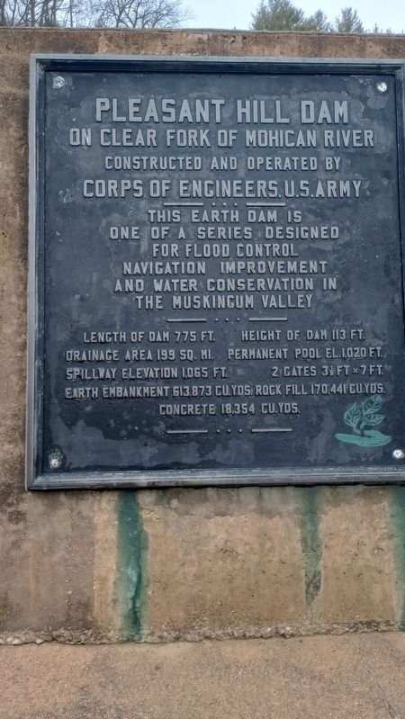
Pleasant Hill Dam
On Clear Fork of Mohican River
— Constructed and operated by Corps of Engineers, U.S. Army —
This earth dam is one of a series designed for flood control navigation improvement and water conservation in the Muskingum Valley
Length of dam 775 ft.
Height of dam 113 ft.
Drainage area 199 sq. mi.
Permanent pool el. 1,020 ft.
Spillway elevation 1,065 ft.
2 gates 3 1/2 ft. x 7 ft.
Earth embankment 613,873 cu. yds.
Rock fill 170,441 cu. yds.
Concrete 18,354 cu.yds.
Topics. This historical marker is listed in these topic lists: Bridges & Viaducts • Charity & Public Work • Waterways & Vessels.
Location. 40° 37.402′ N, 82° 19.554′ W. Marker is near Perrysville, Ohio, in Ashland County. It is in Hanover Township. Marker is on County Road 3006 north of Pleasant Hill Lake Trail, on the right when traveling north. Touch for map. Marker is at or near this postal address: 1041 Co Rd 3006, Perrysville OH 44864, United States of America. Touch for directions.
Other nearby markers. At least 8 other markers are within 4 miles of this marker, measured as the crow flies. Ohio Memorial Shrine (approx. 1.9 miles away); Clear Fork Gorge (approx. 2.2 miles away); Perrysville Union Cemetery (Veterans Memorial) (approx. 2.4 miles away); Hemlock Falls / The Groveport River (approx. 2.9 miles away); Johnny “Appleseed” Land Lease and Nursery (approx. 3.6 miles away); The Corn Crib (approx. 3.7 miles away); The Plow (approx. 3.7 miles away); The Outhouse (approx. 3.7 miles away). Touch for a list and map of all markers in Perrysville.
Credits. This page was last revised on February 6, 2024. It was originally submitted on January 28, 2024, by Craig Doda of Napoleon, Ohio. This page has been viewed 55 times since then. Photos: 1, 2, 3. submitted on January 28, 2024, by Craig Doda of Napoleon, Ohio. • Devry Becker Jones was the editor who published this page.


