Webster Groves in St. Louis County, Missouri — The American Midwest (Upper Plains)
Webster Groves War Memorial
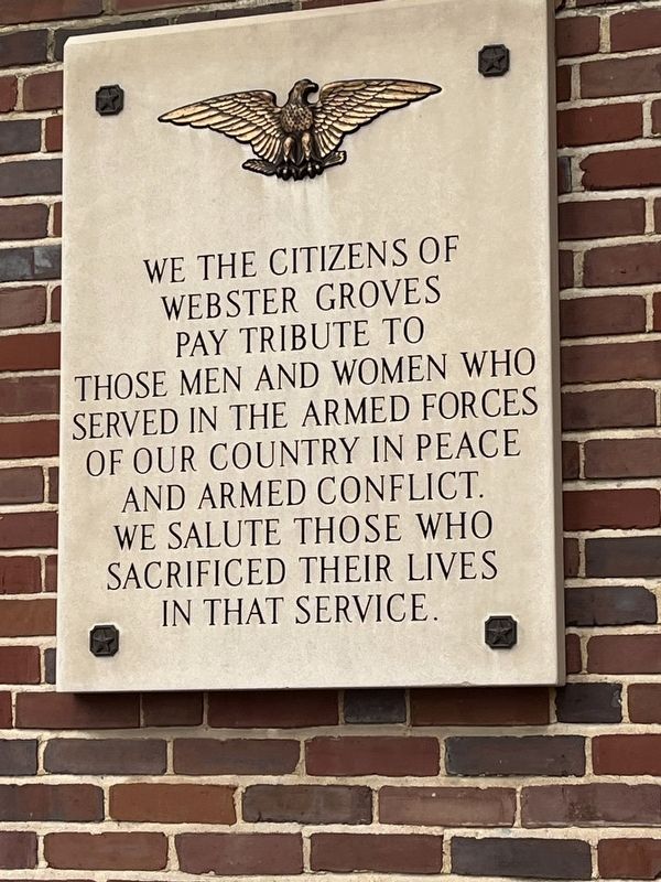
Photographed by Thomas Smith, January 27, 2024
1. We The Citizens Marker
Topics. This memorial is listed in this topic list: Military.
Location. 38° 35.545′ N, 90° 21.386′ W. Memorial is in Webster Groves, Missouri, in St. Louis County. It is at the intersection of E. Lockwood Avenue and S. Elm Ave., on the right when traveling east on E. Lockwood Avenue. Webster Grove City Hall. Touch for map. Memorial is at or near this postal address: 4 E Lockwood Avenue, Saint Louis MO 63119, United States of America. Touch for directions.

Regionally, this memorial is in Greater St. Louis. It is also in the American Midwest, in the Lewis & Clark Corridor, in the Corn Belt, and in the Great River Road Region. Globally, it is in North America, the Western Hemisphere, the Western World, and the Anglosphere. Historically, it finds itself in what was once the Viceroyalty of New France, the territory of the Mississippian Culture, the Louisiana Purchase,
this page online
Other nearby markers. At least 8 other markers are within 2 miles of this marker, measured as the crow flies: Historic Black Churches in Webster Groves (approx. 0.4 miles away); Clarence Barbre (approx. half a mile away); Douglass School (approx. half a mile away); The Rock House/Edgewood Children's Center (approx. 0.6 miles away); Spanish Land Grant (approx. 0.9 miles away); Stories That Shape Our Culture (approx. one mile away); Original site of Rock Hill Presbyterian Church (approx. 1.3 miles away); Fairfax House (approx. 1.3 miles away). Touch for a list and map of all markers in Webster Groves.
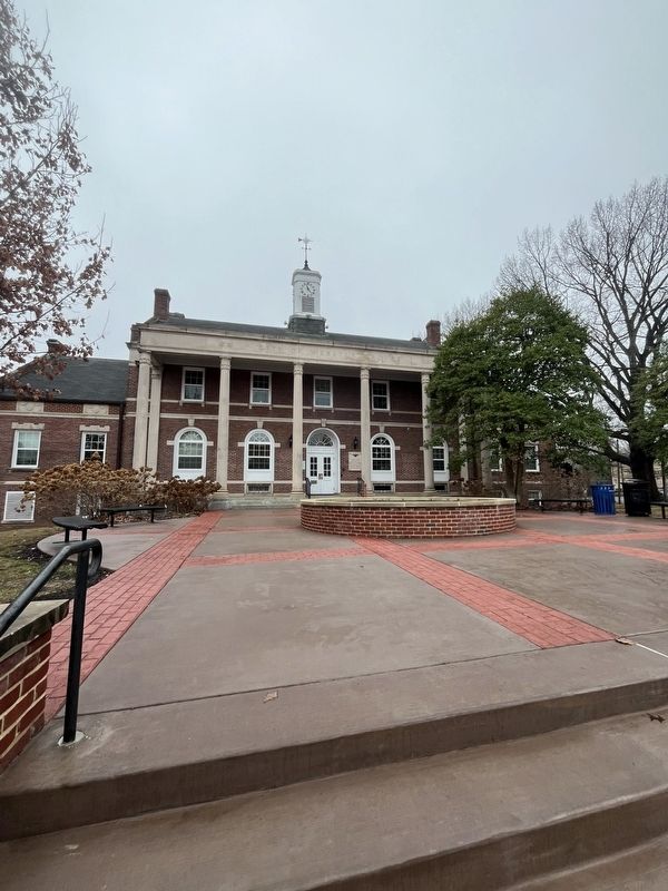
Photographed by Thomas Smith, January 27, 2024
2. We The Citizens Marker
Credits. This page was last revised on January 30, 2024. It was originally submitted on January 28, 2024, by Thomas Smith of Waterloo, Ill. This page has been viewed 282 times since then and 29 times this year. Photos: 1, 2. submitted on January 28, 2024, by Thomas Smith of Waterloo, Ill. • Andrew Ruppenstein was the editor who published this page.
