Near Evansville in Washington County, Arkansas — The American South (West South Central)
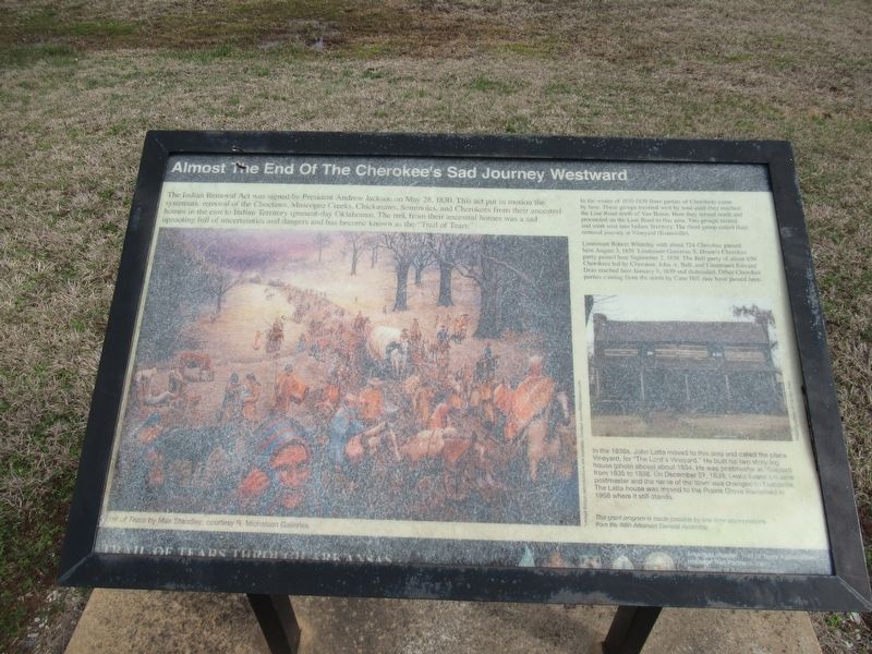
Almost The End Of The Cherokee's Sad Journey Westward
Inscription.
The Indian Removal Act was signed by President Andrew Jackson on May 28, 1830. This act put in motion the systematic removal of the Choctaws, Muscogee Creeks, Chickasaws, Seminoles, and Cherokees from their ancestral homes in the east to Indian Territory (present-day Oklahoma). The trek from their ancestral homes was a sad uprooting full of uncertainties and dangers and has become known as the "Trail of Tears."
In the winter of 1838-1839 three parties of Cherokees came by here. These groups traveled west by land until they reached the Line Road north of Van Buren. Here they turned north and proceeded on the line Road to this area. Two groups turned and went west into Indian Territory. The third group ended their removal journey at Vineyard (Evansville).
Lieutenant Robert Whiteley with about 724 Cherokee passed here August 3, 1838. Lieutenant Gustavus S. Drane's Cherokee party passed here September 2, 1838. The Bell party of about 650 Cherokees led by Cherokee, John A. Bell, and Lieutenant Edward Deas reached here January 8, 1939 and disbanded. Other Cherokee parties coming from the north by Cane Hill may have passed here.
In the 1830s, John Latta moved to this area and called the place Vineyard, for "The Lord's Vineyard." He built his two story log house (photo above) about 1834. He was postmaster at Vineyard from 1835 to 1838. On December 27, 1838, Lewis Evans became postmaster and the name of the town was changed to Evansville. The Latta house was moved to the Prairie Grove Battlefield in 1958 where it still stands.
This grant program is made possible by one-time appropriations from the 86th Arkansas General Assembly.
Erected by Arkansas Chapter, Trail of Tears Association.
Topics and series. This historical marker is listed in this topic list: Native Americans. In addition, it is included in the Trail of Tears series list. A significant historical date for this entry is May 28, 1830.
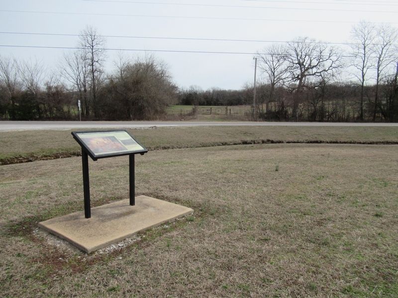
Location. 35° 48.107′ N, 94° 29.744′ W. Marker is near Evansville, Arkansas, in Washington County. Marker is at the intersection of State Highway 59 and State Highway 156, on the left when traveling north on State Highway 59. Touch for map. Marker is in this post office area: Evansville AR 72729, United States of America. Touch for directions.
Other nearby markers. At least 8 other markers are within 10 miles of this marker, measured as the crow flies. Bethlehem Methodist-Episcopal Church South (approx. 5 miles away); Bethlehem Cemetery (approx. 5 miles away); Fruit Cellar (approx. 9.2 miles away); Dr. William and Laura Welch House - 1855 (approx. 9.2 miles away); Zebulon and Eunice Edmiston House – 1872 (approx.
9.2 miles away); The Battle of Cane Hill (approx. 9.3 miles away); Washington County Cane Hill College (approx. 9.3 miles away); Confederates Fall Back Before Union Assault (approx. 9.4 miles away).
Credits. This page was last revised on January 30, 2024. It was originally submitted on January 29, 2024, by Jason Armstrong of Talihina, Oklahoma. This page has been viewed 50 times since then. Photos: 1, 2. submitted on January 29, 2024, by Jason Armstrong of Talihina, Oklahoma. • Andrew Ruppenstein was the editor who published this page.

