
Key West in Monroe County, Florida — The American South (South Atlantic)
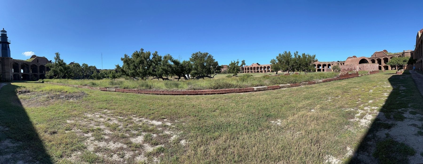
Soldiers' Barracks
| — | Dry Tortugas National Park | — |

Photographed by Pete Skillman, November 20, 2023
1. Soldiers' Barracks Marker
Quite a number of prisoners are quartered in the building that is erected for barracks. There is no roof on it but it rains so seldom they seldom are discomoded [sic] by rain.
William S. Stebbins, 110th New York Volunteers, May 21, 1864
(captions)
Soldiers' barracks in the 1860s (below), seen behind the original Garden Key Lighthouse
One-story kitchens were located between the barracks and the interior fort wall.
Erected by National Park Service, U.S. Department of the Interior.
Topics and series. This historical marker is listed in this topic list: Forts and Castles. In addition, it is included in the Lighthouses series
this page online
Location. 24° 37.721′ N, 82° 52.341′ W. Marker is in Key West, Florida, in Monroe County. It can be reached from no nearby street. Touch for map. Marker is at or near this postal address: Fort Jefferson - Key West, Key West FL 33040, United States of America. Touch for directions.

Regionally, this marker is on the Florida Keys. It is also in the American South and on the Gulf Coast. Globally, it is in the North Atlantic Region, North America, a Gulf of Mexico state, the Western Hemisphere, the Western World, and the Anglosphere. Historically, it finds itself in what was once New Spain, the territory of the Mississippian Culture, one of the Confederate States of America, and the Antebellum South.
Other nearby markers. At least 8 other markers are within walking distance of this marker: Traverse Magazine (a few steps from this marker); Rifled Cannon (a few steps from this marker); Catching Rain (within shouting distance of this marker); In Memory of Brevet Major, Jos. Sim Smith (within shouting distance of this marker); Intricate Gun Rooms (within shouting distance of
Photographed by Pete Skillman, November 20, 2023
2. Panorama of the Soldiers' Barracks ruins

Photographed by James Hulse, January 12, 2026
3. Soldiers' Barracks Marker
The view of the marker with the ruins of the Soldiers' Barracks in the background.
Credits. This page was last revised on February 8, 2026. It was originally submitted on January 29, 2024, by Pete Skillman of Wilmington, Delaware. This page has been viewed 150 times since then and 39 times this year. Photos: 1, 2. submitted on January 29, 2024, by Pete Skillman of Wilmington, Delaware. 3. submitted on February 8, 2026, by James Hulse of Medina, Texas. • Bernard Fisher was the editor who published this page.
