Key West in Monroe County, Florida — The American South (South Atlantic)
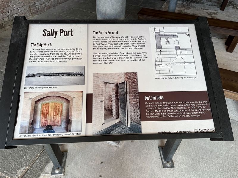
Sally Port
The Sally Port served as the only entrance to the Fort. It was accessed by crossing a 1,100 foot wooden causeway from the island. All personnel and goods entered and exited the Fort through the Sally Port. A moat and drawbridge protected the Fort from unauthorized access.
The Fort Is Secured
On the morning of January 14, 1861, Captain John M. Brannan led troops of Battery B, 1st U.S. Artillery, quietly across the island from the U.S. Army Barrack to Fort Taylor. They took with them four 6-pounder field guns, ammunition and muskets. They crossed the causeway and entered the Fort unchallenged.
The Union flag which had flown above the U.S. Army. Barrack was raised above the Fort. This showed the islanders the Fort was in Union hands. It would then remain under Union control for the duration of the American Civil War.
Fort Jail Cells
On each side of the Sally Port were prison cells. Soldiers, sailors and blockade runners were often held there until they could be tried for their charges. In July 1865, Dr. Samuel Mudd and other conspirators of President Abraham Lincoln were held there for a short time before being. transferred to Fort Jefferson in the Dry Tortugas.
(captions)
View of the causeway from Key West
View of Sally Port from inside the Fort looking towards Key West
Drawing of the Sally Port showing the drawbridge
Erected by Florida State Parks.
Topics. This historical marker is listed in these topic lists: Forts and Castles • War, US Civil.
Location. 24° 32.872′ N, 81° 48.595′ W. Marker is in Key West, Florida, in Monroe County. Marker can be reached from the intersection of Angela Street and Quay Road. Touch for map. Marker is in this post office area: Key West FL 33040, United States of America. Touch for directions.
Other nearby markers. At least 8 other markers are within walking distance of this marker. Life in the Barrack (a few steps from this marker); Battery Osceola (within shouting distance of this marker); Battery Adair (within shouting distance of this marker); The Sherlock Holmes of Fort Zachary Taylor (within shouting distance of this marker); Fort Taylor (within shouting distance of this marker); Big Guns (within shouting distance of this marker); Hidden Treasure (within shouting distance of this marker); To Guard the Harbor (within shouting distance of this marker). Touch for a list and map of all markers in Key West.
Also see . . .
1. Fort Zachary Taylor Historic State Park. Florida State Parks (Submitted on January 30, 2024.)
2. Fort Zachary Taylor Historic State Park. Wikipedia (Submitted on January 30, 2024.)
Credits. This page was last revised on January 30, 2024. It was originally submitted on January 30, 2024, by Pete Skillman of Townsend, Delaware. This page has been viewed 55 times since then. Photo 1. submitted on January 30, 2024, by Pete Skillman of Townsend, Delaware. • Bernard Fisher was the editor who published this page.
Editor’s want-list for this marker. Wide shot of marker and its surroundings. • Can you help?
