Cedar City in Iron County, Utah — The American Mountains (Southwest)
Cedar City's Iron Heritage
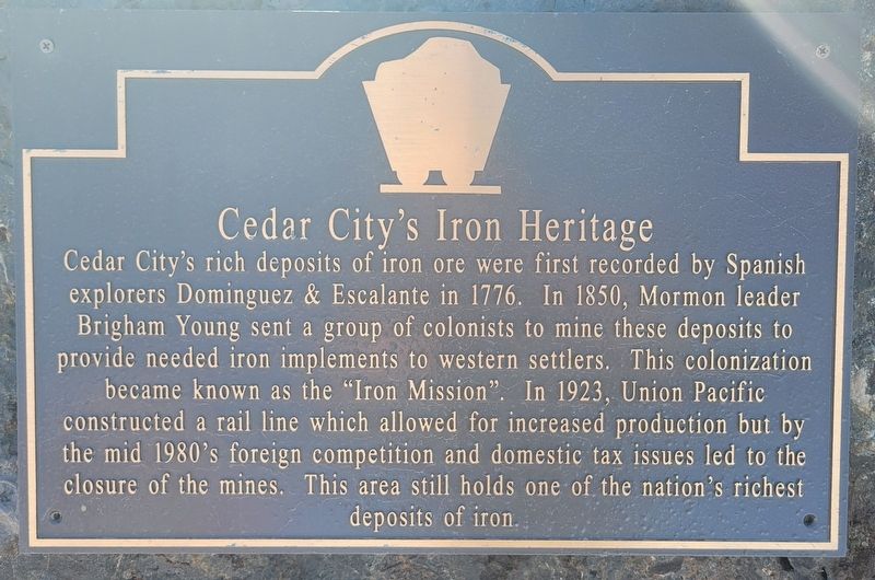
Photographed by Jeremy Snow, January 31, 2024
1. Cedar City's Iron Heritage Marker
Topics. This historical marker is listed in these topic lists: Industry & Commerce • Settlements & Settlers. A significant historical year for this entry is 1850.
Location. 37° 41.247′ N, 113° 3.73′ W. Marker is in Cedar City, Utah, in Iron County. It is on Main Street, on the right when traveling south. Touch for map. Marker is at or near this postal address: 581 N Main Street, Cedar City UT 84721, United States of America. Touch for directions.

Regionally, this marker is in Color Country. It is also in the American Mountain West and on
this page online
Other nearby markers. At least 8 other markers are within walking distance of this marker: The Hay Derrick (about 400 feet away, measured in a direct line); Legacies of Iron County (about 400 feet away); Pioneer Cabin (about 400 feet away); The Ore Shovel (about 500 feet away); The Caboose (about 500 feet away); Utah Parks Company Bus Garage (about 700 feet away); Cedar City Historic Pioneer Cemetery Wall (approx. ¼ mile away); Deseret Iron Works (approx. ¼ mile away). Touch for a list and map of all markers in Cedar City.
More about this marker. The marker sits outside the entrance of the Cedar City Visitor Center.
Credits. This page was last revised on February 6, 2024. It was originally submitted on February 1, 2024, by Jeremy Snow of Cedar City, Utah. This page has been viewed 406 times since then and 47 times this year. Photo 1. submitted on February 1, 2024, by Jeremy Snow of Cedar City, Utah. • Andrew Ruppenstein was the editor who published this page.
Editor’s want-list for this marker. Photo of the marker and surroundings • Can you help?
