Lomé in Lomé Commune, Maritime, Togo — West Africa
Former Central Railroad Station of Lomé
Photographed by J. Makali Bruton, July 21, 2023
1. Former Central Railroad Station of Lomé Marker

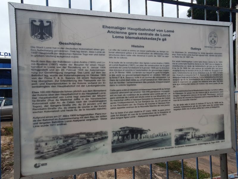
Ehemaliger Hauptbahnhof von Lomé
Geschicht
Die Stadt Lomé hat in der deutschen Kolonialzeit einen groBen Aufschwung genommen. Dies lag daran, dass Lomé ab 1897 Hauptstadt der deutschen Kolonie Togo war und daher in großem Umfang ausgebaut wurde.
Nach dem Bau der Bahnlinien Lomé-Aného (1905) und Lomé-Kpalimé (1907) wurde der Bauplan für einen Hauptbahnhof in Lomé von der Bauleitung am 6. Januar 1908 fertiggestellt und am 24. Februar 1908 der Kolonialregierung zur Genehmigung vorgelegt. Das Land, auf dem der Bahnhof lag, wurde der Kolonialregierung im Oktober 1905 von der Firma F. & A. Swanzy mit einem Nutzungsvertrag übergeben. Zur Erleichterung des Transports von Import- und Exportprodukten in der Kolonie verband ein Eisenbahngleis den Hauptbahnhof mit der Landungsbrücke.
Etwa 100.000 Reisende fuhren jährlich aus dem Binnenland der Kolonie über den Hauptbahnhof in die Hauptstadt Lomé. Der Hauptbahnhof von Lomé liegt zwischen der Misahōhe-Straße (Rue du Maréchal Joffre in der französischen Kolonialzeit oder Av. de Calais nach der Unabhängigkeit Togos), der Sangera-Straße (Av. du 24 janvier) und
this page online
Aufgrund eines am 27. März 1908 fertiggestellten Plans wurde der Bahnhof im Zusammenhang mit dem Bau der dritten und längsten Bahnlinie Lomé-Atakpamé vergrößert. Diese Linie wurde 1911 eröffnet.
Ancienne gare centrale de Lomé
Histoire
La ville de Lomé a connu un essor particulier au temps colonial allemand grâce à la construction de différentes infrastructures dans cette ville devenue à partir de 1897 la capitale de la colonie.
À la suite de la construction des lignes Lomé-Aného (1905) et Lomé-Kpalimé (1907), un plan de construction de la gare centrale de Lomé fut élaboré le 6 janvier 1908 par la direction des travaux et soumis à l'autorisation du gouverneur impérial le 24 février 1908. Le terrain sur lequel la gare fut érigée, a été cédé au gouvernement impérial en octobre 1905 par la firme F & A. Swanzy suite à un contrat de concession. La Gare de Lomé était reliée au wharf construit en 1904 dans le but de faciliter l'acheminement des produits d'import-export dans la colonie togolaise.
Cette gare
Photographed by J. Makali Bruton, July 21, 2023
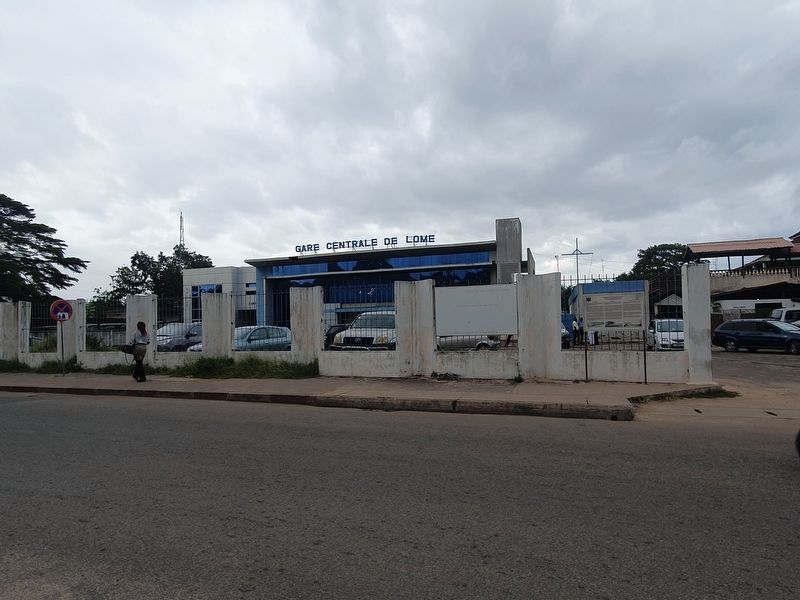
2. Former Central Railroad Station of Lomé and Marker
Sur la base d'un plan établi le 27 mars 1908, la gare principale fut élargie en vue de la construction de la troisième et plus longue ligne Lomé - Atakpamé inaugurée en 1911.
Lome blemaketekedzeƒe gå
Dutinya
Le dzamawo fe amedziɖuyi la, woɖo ngoyiyido vovovowo anyi. Esia na be Lome dua kpo ngoyiyi toxe, vevieto esi wotro zu fiadu tso fè 1897 me.
Esi wode ketekegakpo Lome kple Anexo dome le fé 1905 me le Lome kple Kpalime dome le fè 1907 me vo megbe la. dodzikpofea wo doɖo de ketekedze fe gå tutu nu le dzove 6 lia fe fè 1908 me, eye wotsce do momefia ŋku me hena modeɖe le enu le dzodze 24 lia fe fè 1908 me. Anyigba si dzi wotu ketekedze fea ɖo
Photographed by J. Makali Bruton, July 21, 2023
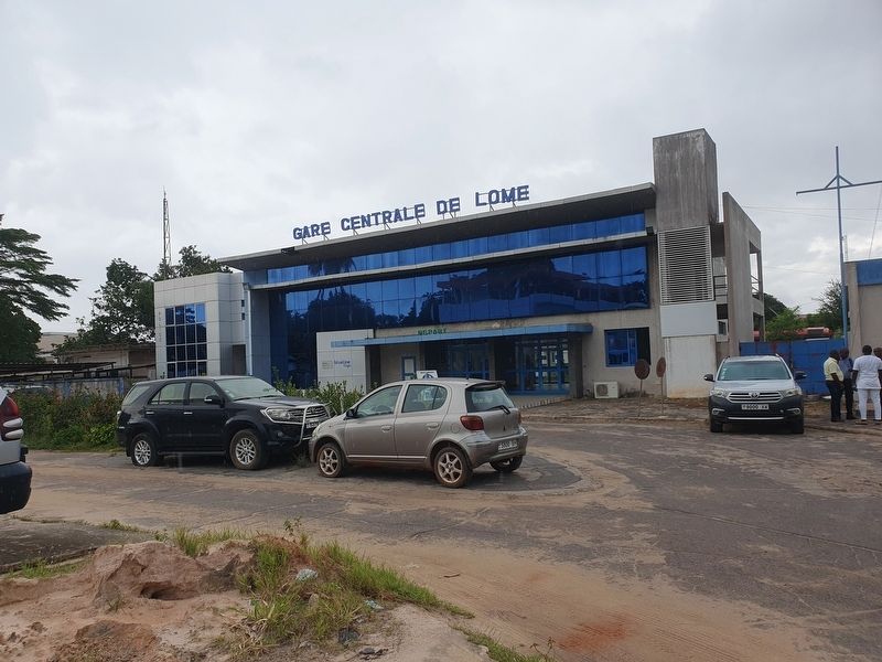
3. Former Central Railroad Station of Lomé
Lome ketekedze fea le Misahonemo (rue du maréchal Joffre) le fräseawo fe yeyiyi me alo Kalemo ga le ɖokuisinɔno xoxo megbe. Sangeramo (dzove 24 lia) kple "Rennbahn" (avenue du champ de course) le fräseawo noli si woyona fifia be "avenue de la nouvelle marche".
Ku de dodo aɖe si wowo le tedoxe 27 lia le fè 1908 me la, wokeke ketekedzeƒe gå de enu kple susu be woaɖo ketekegakpo didito wu si anye etɔ̃lia tso Lome yi Atakpame.
Former Central Railroad Station of Lomé
History
The city of Lomé experienced a particular boom during the German colonial era thanks to the construction of various infrastructures in this city, which became the capital of the colony from 1897 onwards.
Following the construction of the Lomé-Aného (1905) and Lomé-Kpalimé (1907) lines, a plan for the construction of the Lomé Central Station was drawn up on 6 January 1908 by the management and submitted to the Imperial Governor for authorization on February 24, 1908. The land on which the station was erected was ceded to the Imperial Government in October 1905 by F. & A. Swanzy following a concession contract. The Lomé railway station was connected to the wharf built in 1904 to facilitate the transport of import-export products in the Togolese colony.
This station was a constantly frequented space during German colonial times as about 100,000 people travelled by train from the interior of the colony to Lomé per year. The Lomé Central Station is located between Rue Misahöhe (Rue du Maréchal Joffre in French times or Avenue de Calais after independence), Rue Sangera (Av. du 24 Janvier) and the Rue Rennbahn (Av. du Champ de Course in the French era, called Avenue de la Nouvelle Marche today).
On the basis of a plan drawn up on 27 March 1908, the main station was enlarged in preparation for the construction of the third and longest line from Lomé to Atakpamé, which was inaugurated in 1911.
Erected 2008 by Alexander Beckmann, German Ambassador to Togo 2008-2011.
Topics. This historical marker is listed in these topic lists: Industry & Commerce • Railroads & Streetcars. A significant historical date for this entry is January 6, 1908.
Location. 6° 7.811′ N, 1° 13.172′ E. Marker is in Lomé, Maritime, in Lomé Commune. It is on Avenue de Calais north of Avenue de 24 Janvier, on the right when traveling north. Touch for map. Touch for directions.

Regionally, it is in Africa, Sub-Saharan Africa, and specifically West Africa. Historically, it finds itself in what was once a French colony and also a British Mandate.
Other nearby markers. At least 5 other markers are within walking distance of this marker: The Lomé Advanced Training School (approx. 0.4 kilometers away); Independence of Togo (approx. 0.4 kilometers away); The Wharf of Lomé (approx. 0.9 kilometers away); The Sacred Heart of Jesus of Lomé Cathedral (approx. 0.9 kilometers away); Paul Ahyi, Forces Vives, 1989 (approx. 1.2 kilometers away).
Credits. This page was last revised on February 1, 2024. It was originally submitted on February 1, 2024, by J. Makali Bruton of Washington, District of Columbia. This page has been viewed 291 times since then and 47 times this year. Photos: 1, 2, 3. submitted on February 1, 2024, by J. Makali Bruton of Washington, District of Columbia.
