Jekerkwartier in Maastricht, Limburg, Netherlands — Northwestern Europe
Stadsommuring, Poorten en Torens / City Walls, Gates and Towers I
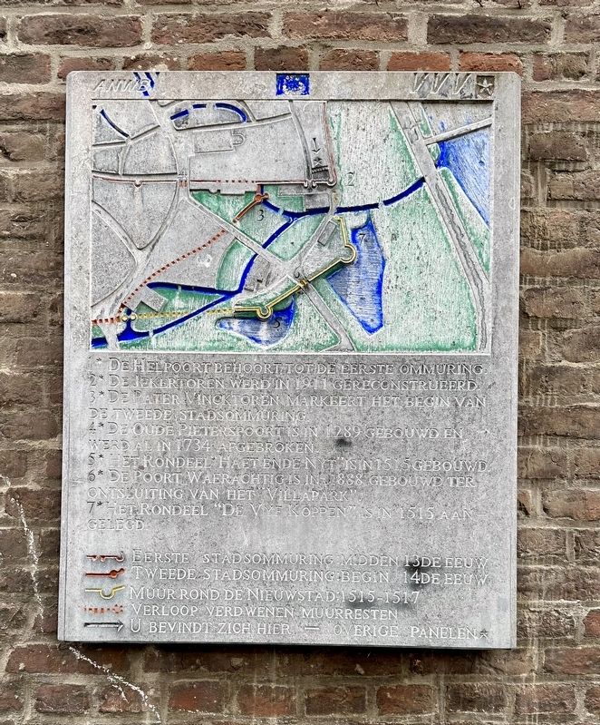
Inscription.
2 De Jekertoren werd in 1911 gereconstrueerd.
3 De Pater Vincktoren markeert het begin van de tweede stadsommuring.
4 De Oude Pieterspoort is in 1289 gebouwd en werd al in 1734 afgebroken.
5 Het rondeel “Haet Ende Nyt” is in 1515 gebouwd.
6 De poort Waerachtig is in 1888 gebouwd ter ontsluiting van het “Villapark”.
7 Het rondeel "De Vyf Koppen” is in 1515 gelegd.
(kaart:)
Eerste stadsommuring midden 13de eeuw
Tweede stadsommuring begin 14de eeuw
Muur rond de nieuwstad: 1515-1517
Verloop verdwenen muurresten
U bevindt zich hier · Overige panelen
1 The Helpoort (“Hell Gate”) is part of the first wall.
2 The Jekertoren (“Jeker Tower”) was reconstructed in 1911.
3 The Pater Vinck Tower marks the beginning of the second city wall.
4 The Oude Pieterspoort was built in 1289 and was demolished in 1734.
5 The roundel “Haet Ende Nyt” (Hate and Envy) was built in 1515.
6 The Waerachtig gate was built in 1888 to provide access to the “Villapark”.
7 The roundel "De Vyf Koppen" was constructed in 1515.
(map key:)
First city wall mid-13th century
Second city wall early 14th century
Wall around the new town: 1515-1517
Route/Course of disappeared wall remains
You are here · Other panels
Erected 2000 by The ANWB, VVV.
Topics. This historical marker is listed in this topic list: Forts and Castles.
Location. 50° 50.739′ N, 5° 41.669′ E. Marker is in Maastricht, Limburg. It is in Jekerkwartier. Marker is on Sint Bernardusstraat, on the right when traveling north. Touch for map. Marker is at or near this postal address: Sint Bernardusstraat 37C, Maastricht, Limburg 6211 HH, Netherlands. Touch for directions.
Other nearby markers. At least 8 other markers are within walking distance of this marker. Helpoort / Hell Gate (a few steps from this marker); Jekertoren / Jeker Tower (within shouting distance of this marker); Papiermolen ‘De Ancker’ / “The Anchor” Paper Mill (within shouting distance of this marker); Waterpoort Achter de Minderbroeders / “Behind the Franciscans” Water Gate (within shouting distance of this marker); Faliezustersklooster / Sisters of the Veil Convent (about 90 meters away, measured in a direct line); Poort Waerachtig / “Waerachtig” Gate (about 120

Photographed By Andrew Ruppenstein, October 26, 2023
2. Stadsommuring, Poorten en Torens / City Walls, Gates and Towers I Marker - wide view
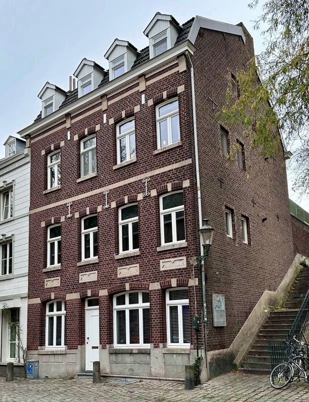
The marker is visible here just to the left of the foot of the stairs. The stairs lead up to a street that runs along the top of the wall. The bit of tree visible here is the same tree seen in the next picture.
Also see . . . Vestingwerken van Maastricht (Wikipedia, in Dutch).
Overview (in translation): The Maastricht defenses are the fortifications or defensive works of the Dutch-Limburg city of Maastricht, built over a period of 1,500 years to protect the city and its inhabitants against enemy attacks.(Submitted on February 4, 2024.)
The city was walled and fortified from Roman times until after 1867 (when its fortress status was lifted). Over the centuries, ramparts, walls, gates, towers, bastions and other fortifications have been continuously built. Roughly speaking, one can speak of four construction periods: the Gallo-Roman fortifications, the early medieval fortifications, the medieval city walls and the outbuildings from the 16th to 19th centuries. For centuries, the fortified city of Maastricht was known as the "stronghold of the Netherlands", an advanced post of the Republic of the Netherlands.
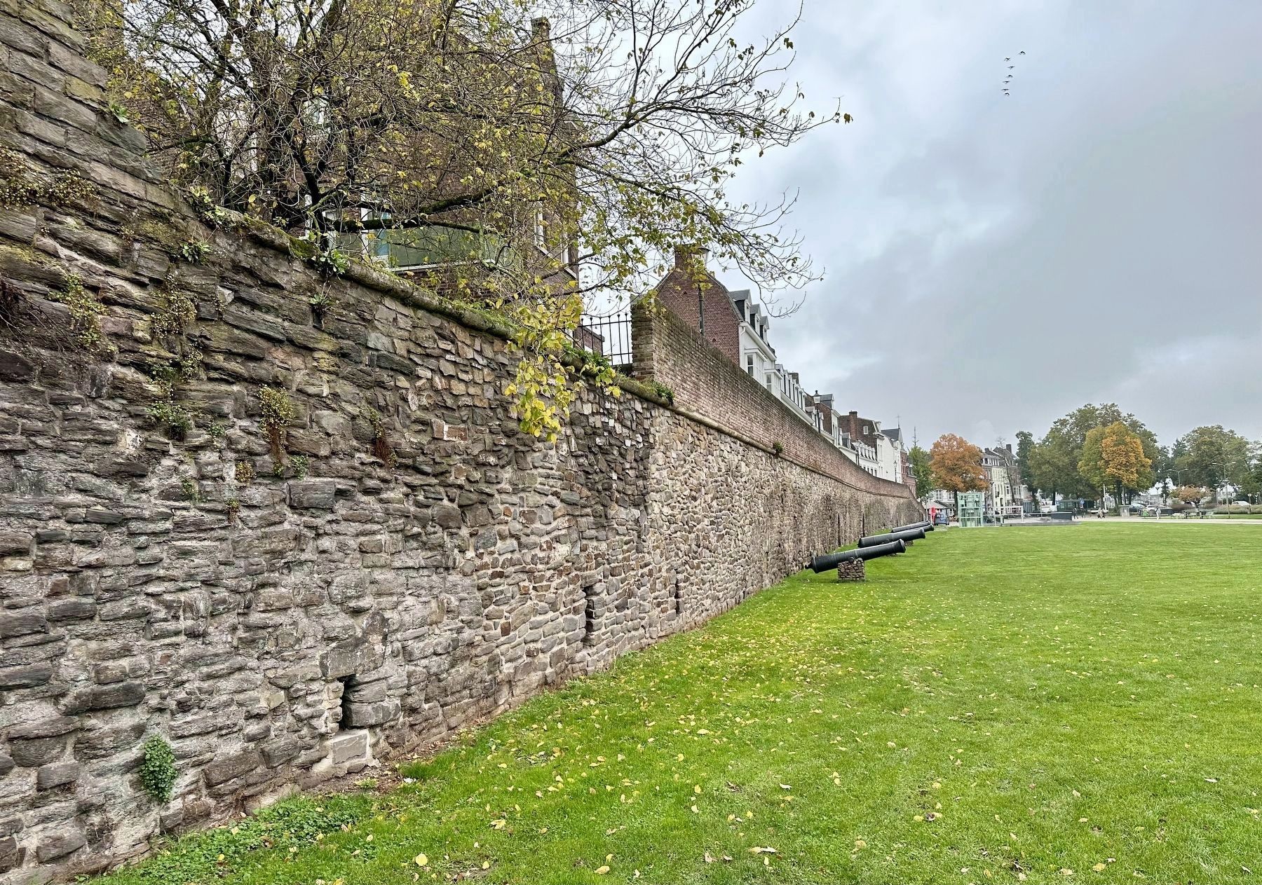
Although large parts of the city walls (including all but one of the city gates) and outer works were demolished in the 19th century, the remaining fortifications(a total of approximately 150 objects with 30,000 m2 of walls and 11 km of corridor systems) form a unique sample of a fortified city through the ages.Photographed By Andrew Ruppenstein, October 26, 20233. City Wall - exterior, looking northThis picture was taken less than 5 meters from the marker site (as the crow flies, if a crow could fly through walls). But for those creatures that can’t pass through walls, it would be a walk through the Helpoort (“Hell Gate”), around the Jeker Tower, and then less than 10 meters along the wall, northwards.
Credits. This page was last revised on February 4, 2024. It was originally submitted on February 4, 2024, by Andrew Ruppenstein of Lamorinda, California. This page has been viewed 47 times since then. Photos: 1, 2, 3. submitted on February 4, 2024, by Andrew Ruppenstein of Lamorinda, California.

