Womack Hill near Gilbertown in Choctaw County, Alabama — The American South (East South Central)
Little Place Cemetery / Mt. Pleasant Baptist Church Womack Hill Community
Choctaw County
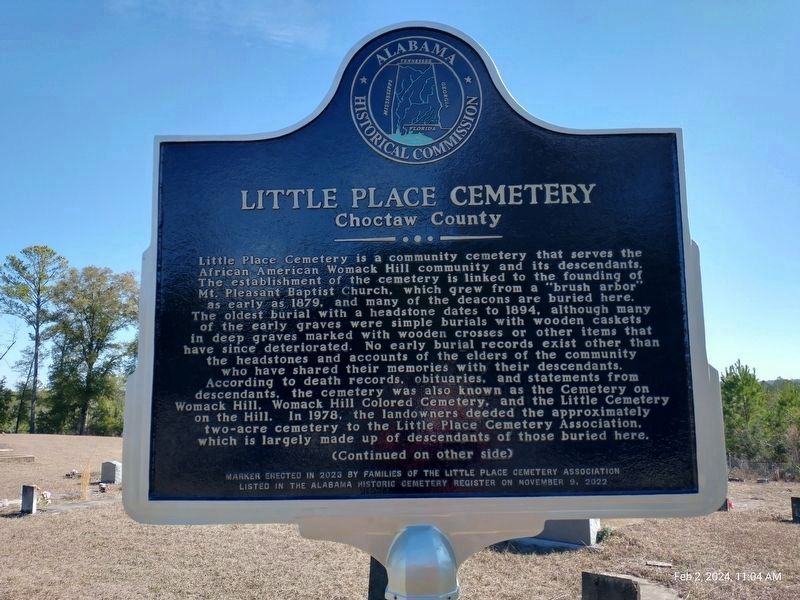
Little Place Cemetery is a community cemetery that serves the African American Womack Hill community and its descendants. The establishment of the cemetery is linked to the founding of Mt. Pleasant Baptist Church, which grew from a “brush arbor” as early as 1879, and many of the deacons are buried here. The oldest burial with a headstone dates to 1894, although many of the early graves were simple burials with wooden caskets in deep graves marked with wooden crosses or other items that have since deteriorated. No early burial records exist other than the headstones and accounts of the elders of the community who have shared their memories with their descendants. According to death records, obituaries, and statements from descendants, the cemetery was also known as the Cemetery on Womack Hill, Womack Hill Colored Cemetery, and the Little Cemetery on the Hill. In 1978, the landowners deeded the approximately two-acre cemetery to the Little Place Cemetery Association, which is largely made up of descendants of those buried here. (Continued on Other Side)
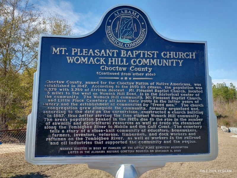
(Continued From Other Side) Choctaw County, named for the Choctaw Nation of Native Americans, was established in 1847. According to the 1850 US census, the population was 8,379 with 3,769 of African descent. Mt. Pleasant Baptist Church, located 3 miles to the west of here on Womack Hill Road, is in the historical center of the community. The Womack Hill community, Mt. Pleasant Baptist Church and Little Place Cemetery all have their roots in the latter years of slavery and the establishment of communities by “freed men.” The church congregation grew alongside the community, formally organized and, according to the date on the cornerstone, constructed a church building in 1887, thus better serving the then vibrant Womack Hill community. The area’s population peaked in the 1920s due to the rise in the number of sawmills and agricultural resources as well as trade via steamboat along the Tombigbee River to Mobile and the Gulf Coast. The cemetery tell a story of a close-knit community of educators, homemakers, farmers, inventors, veterans, timber-men, and dock workers and raftsmen on the Tombigbee River, as well as workers in the railroad and oil industries that supported the community and the region.
Erected 2023 by Families of the Little Place Cemetery Association and Alabama Historical Commission.
Topics and series. This historical marker is listed in these topic
lists: African Americans • Cemeteries & Burial Sites • Churches & Religion. In addition, it is included in the Alabama Historical Commission series list. A significant historical year for this entry is 1887.
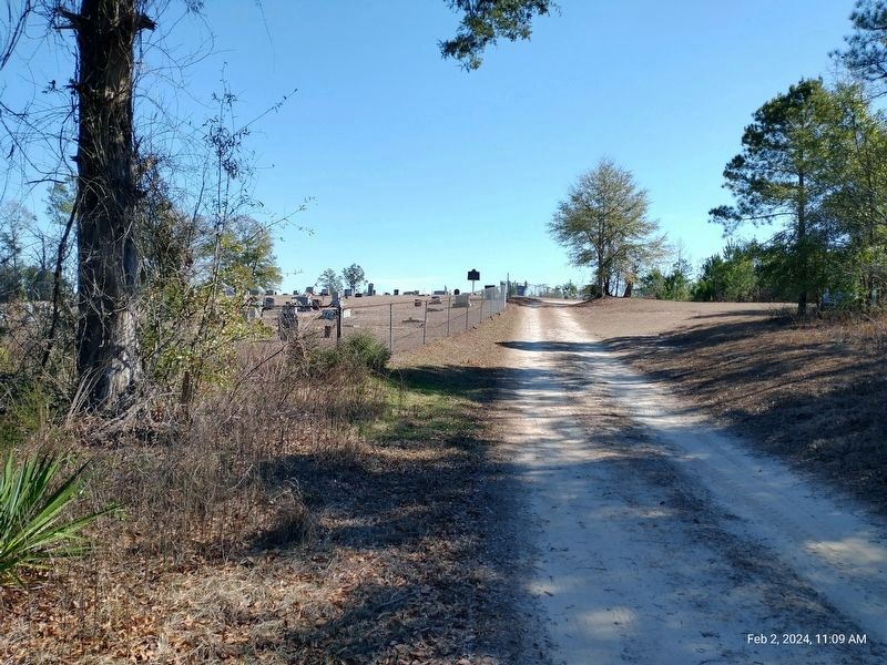
Location. 31° 52.533′ N, 88° 10.68′ W. Marker is near Gilbertown, Alabama, in Choctaw County. It is in Womack Hill. Marker is on Little Drive (Little Place Cemetery Drive), 0.2 miles east of Ararat Road (County Route 23), on the left when traveling east. The road way to the cemetery is a sandy soil unimproved roadway that is subject to erosion as well as standing water. Many efforts have been made to place signs at the Ararat Road turn onto Little Drive, including temporary yard signs which may or may not be present. The road is currently named Little Drive however it has been historically known as Little Place Cemetery Drive and as of 11/2023 the county began the needed official changes required to change the road name to return it to its historical and original name Little Place Cemetery Drive. That said many maps may continue to carry the name as Little Drive as well until all system updates are made. This roadway also serves
as an entry to private agricultural lands nearby. The rural location is isolated and distant from from services other than the very few and occasional homes located along Ararat Road. Touch for map. Marker is in this post office area: Gilbertown AL 36908, United States of America. Touch for directions.
Other nearby markers. At least 8 other markers are within 12 miles of this marker, measured as the crow flies. West Bend (approx. 4˝ miles away); Springhill Missionary Baptist Church Cemetery (approx. 5.1 miles away); Sims Cemetery (approx. 7˝ miles away); Ulcanush Baptist Church (approx. 8.6 miles away); Clarke-Washington Electric Membership Corporation (approx. 9.9 miles away); First Oil Well In Alabama (approx. 10.2 miles away); Creek Indian War (approx. 10.9 miles away); Silas Elementary School (approx. 11.6 miles away). Touch for a list and map of all markers in Gilbertown.
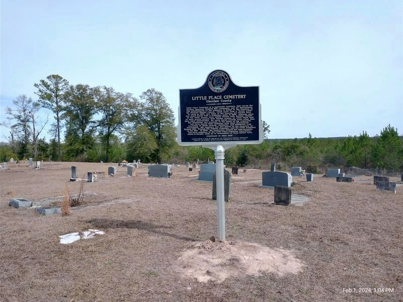
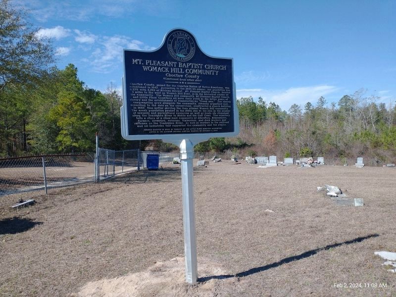
More about this marker. The marker is locate near the highest point on the cemetery property inside the entrance gate as one faces the southern horizon. Many of the earliest graves are located nearby the marker.
Although ordered in the Spring of 2023, production backlogs associated with the COVID years delayed final production/delivery until January 2024 and installation on February 1, 2024 - the first day of African American History month.
Credits. This page was last revised on February 4, 2024. It was originally submitted on February 4, 2024, by Jim Ellis of Theodore, Alabama. This page has been viewed 118 times since then. Photos: 1, 2, 3, 4, 5. submitted on February 4, 2024, by Jim Ellis of Theodore, Alabama. • James Hulse was the editor who published this page.
