Brigham City in Box Elder County, Utah — The American Mountains (Southwest)
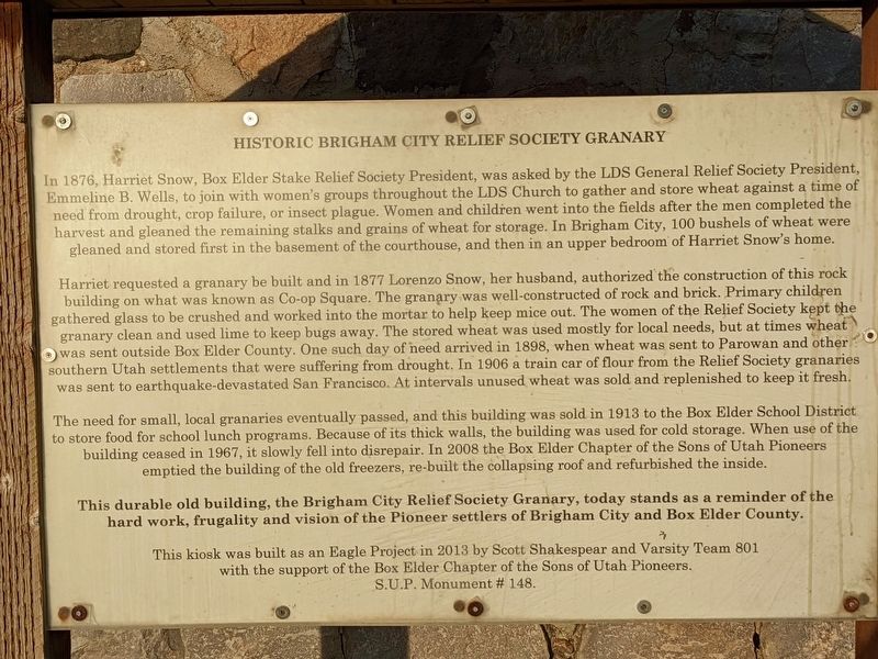
Historic Brigham City Relief Society Granary
In 1876, Harriet Snow, Box Elder Stake Relief Society President, was asked by the LDS General Relief Society President, Emmeline B. Wells, to join with women's groups throughout the LDS Church to gather and store wheat against a time of need from drought, crop failure, or insect plague. Women and children went into the fields after the men completed the harvest and gleaned the remaining stalks and grains of wheat for storage. In Brigham City, 100 bushels of wheat were gleaned and stored first in the basement of the courthouse, and then in an upper bedroom of Harriet Snow's home.
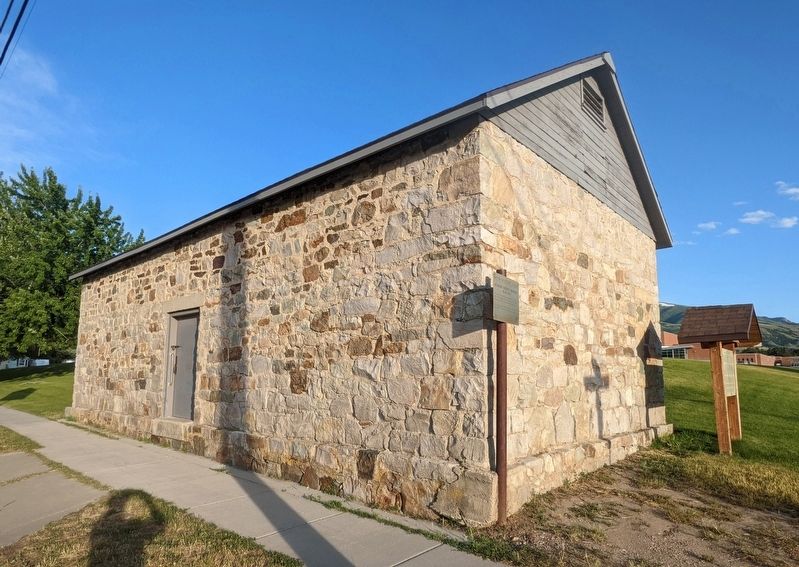
Harriet requested a granary be built and in 1877 Lorenzo Snow, her husband, authorized the construction of this rock building on what was known as Co-op Square. The granary was well-constructed of rock and brick. Primary children gathered glass to be crushed and worked into the mortar to help keep mice out. The women of the Relief Society kept the granary clean and used lime to keep bugs away. The stored wheat was used mostly for local needs, but at times wheat was sent outside Box Elder County. One such day of need arrived in 1898, when wheat was sent to Parowan and other southern Utah settlements that were suffering from drought. In 1906 a train car of flour from the Relief Society granaries was sent to earthquake-devastated San Francisco. At intervals unused wheat was sold and replenished to keep it fresh.
The need for small, local granaries eventually passed, and this building was sold in 1913 to the Box Elder School District to store food for school lunch programs. Because of its thick walls, the building was used for cold storage. When use of the building ceased in 1967, it slowly fell into disrepair. In 2008 the Box Elder Chapter of the Sons of Utah Pioneers emptied the building of the old freezers, re-built the collapsing roof and refurbished the inside.
This durable old building, the Brigham City Relief Society Granary, today stands as a reminder of the hard work, frugality and vision of the Pioneer settlers of Brigham City and Box Elder County.
This kiosk was built as an Eagle Project in 2013 by Scott Shakespear and Varsity Team 801 with the support of the Box Elder Chapter of the Sons of Utah Pioneers.
S.U.P. Monument # 148.
Erected 2013 by Sons of Utah Pioneers. (Marker Number 148.)
Topics and series. This historical marker is listed in these topic lists: Charity & Public Work • Churches & Religion • Settlements & Settlers • Women. In addition, it is included in the Sons of Utah Pioneers series list. A significant historical year for this entry is 1876.
Location. 41° 30.761′ N, 112° 0.555′ W. Marker is in Brigham City, Utah, in Box Elder County. Marker is at the intersection of East 100 North and North 400 East, on the right when traveling east on East 100 North. Touch for map. Marker is at or near this postal address: 408 E 100 N, Brigham City UT 84302, United States of America. Touch for directions.
Other nearby markers. At least 8 other markers are within one mile of this marker, measured as the crow flies. Brigham City Fire Station/City Hall (approx. 0.4 miles away); Brigham City Co-op Store (approx. 0.4 miles away); Brigham City Co-Op (approx. half a mile away); A Pioneer Home (approx. half a mile away); Erected in Honor of Brigham Young (approx. half a mile away); Box Elder Fort (approx. 0.6 miles away); Lorenzo Snow Burial Site (approx. 0.7 miles away); Historical Rail (approx. one mile away). Touch for a list and map of all markers in Brigham City.
Credits. This page was last revised on February 7, 2024. It was originally submitted on February 6, 2024, by Jeremy Snow of Cedar City, Utah. This page has been viewed 55 times since then. Photos: 1, 2. submitted on February 6, 2024, by Jeremy Snow of Cedar City, Utah. • Andrew Ruppenstein was the editor who published this page.

