Brigham City in Box Elder County, Utah — The American Mountains (Southwest)
Brigham City Co-Op
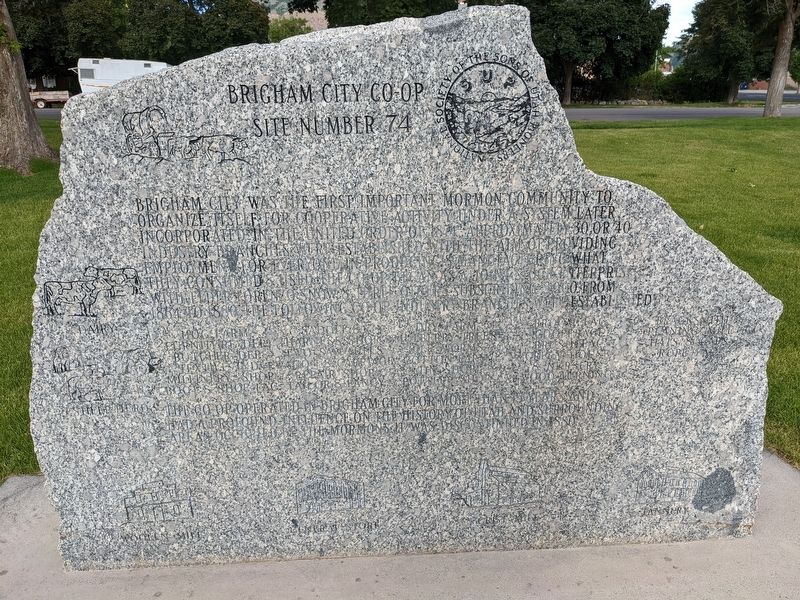
Photographed by Jeremy Snow, June 24, 2023
1. Brigham City Co-Op Marker
Brigham City was the first important Mormon community to organize fistle for cooperative activity under a system later incorporated in the United Order of 1874. Approximately 30 or 40 industry branches were established with the aim of providing employment for everyone in producing & manufacturing what they consumed & used. The Co-Op began as a join stock enterprise with Elder Lorenzo Snow & three others subscribing 3000 from 1864 to 1880. The following Co-Op industry branches were established:
Hog Farm
Furniture Dep
Butcher Dep
Textile Ind
Millinery Shop
Boot & Shoe Fac
Saddle & Harness Shop
Two Saw Mills
Wagon & Carriage Repair Shop
Tailor & Fancy
Dry Farm
Mulberry Trees & Silk Worms
Cotton Farm
Tin Shop
Pottery Shop
Broom Fac
Cooperage
Brush Fac
Green House & Nursery
Wood Turning
Furniture Dep,
Blacksmith
Planting Mill
Hats & Caps
Rope Fac
The Co-Op operated in Brigham City for more than 15 years and had a profound influence on the history of Utah and surrounding areas occupied by the Mormons. It was discontinued in 1880.
Erected by Sons of Utah Pioneers. (Marker
this page online
Topics. This historical marker is listed in these topic lists: Industry & Commerce • Settlements & Settlers. A significant historical year for this entry is 1874.
Location. 41° 30.655′ N, 112° 1.158′ W. Marker is in Brigham City, Utah, in Box Elder County. It is on West Forest Street. Touch for map. Marker is at or near this postal address: 200 W Forest St, Brigham City UT 84302, United States of America. Touch for directions.

Regionally, this marker is in Utah’s Cache Valley and in the West Desert. It is also in the American Mountain West and on the Colorado Plateau. Globally, it is in North America, the Rocky Mountains, the Western Hemisphere, the Western World, and the Anglosphere. Historically, it finds itself in what was once New Spain and also Mexico’s Alta California.
Other nearby markers. At least 8 other markers are within walking distance of this marker: A Pioneer Home (a few steps from this marker); Erected in Honor of Brigham Young (a few steps from this marker); Brigham City Co-op Store (approx. 0.2 miles away); Brigham City Fire Station/City Hall (approx. 0.2 miles away); Box Elder Fort (approx. 0.4 miles away); Brigham City Tabernacle (approx. 0.4 miles away); Historical Rail (approx. half a mile away); Union Pacific Depot-Built 1907 (approx. half a mile away). Touch for a list and map of all markers in Brigham City.
Also see . . . Cooperative Community in the North Brigham City Utah. (Submitted on July 14, 2025, by Brandon D Cross of Flagler Beach, Florida.)
Credits. This page was last revised on August 5, 2025. It was originally submitted on February 6, 2024, by Jeremy Snow of Cedar City, Utah. This page has been viewed 310 times since then and 26 times this year. Photo 1. submitted on February 6, 2024, by Jeremy Snow of Cedar City, Utah. • Bill Pfingsten was the editor who published this page.
