Huntington in Emery County, Utah — The American Mountains (Southwest)
Huntington
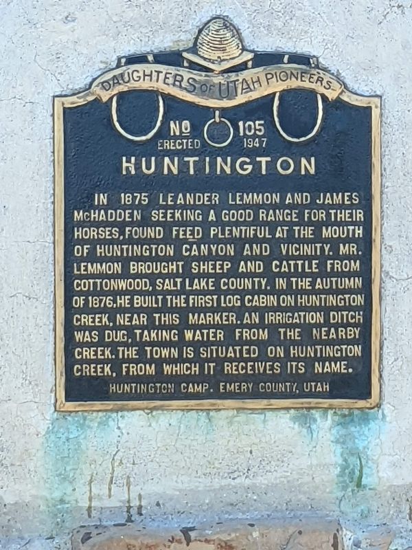
In 1875 Leander Lemmon and James McHadden seeking a good range for their horses, found feed plentiful at the mouth of Huntington Canyon and vicinity. Mr. Lemmon brought sheep and cattle from Cottonwood, Salt Lake County. In the autumn of 1876,he built the first log cabin on Huntington Creek, near this marker. An irrigation ditch was dug, taking water from the nearby creek. The town is situated on Huntington Creek, from which it receives its name.
Huntington Camp, Emery County, Utah
Erected 1947 by Daughters of Utah Pioneers. (Marker Number 105.)
Topics and series. This historical marker is listed in these topic lists: Agriculture • Settlements & Settlers. In addition, it is included in the Daughters of Utah Pioneers series list. A significant historical year for this entry is 1875.
Location. 39° 21.177′ N, 111° 0.764′ W. Marker is in Huntington, Utah, in Emery County. Marker is on State Highway 31, on the left when traveling south. The marker is mounted to a low brick cairn on the south side of the road. The is a pull-out for parking. Touch for map. Marker is at or near this postal address: 2030 UT-31, Huntington UT 84528, United States of America. Touch for directions.
Other nearby markers. At least 8 other markers are within 4 miles of this marker, measured as the crow flies. Old Ranger Station (approx. 3 miles away); Old Bell (approx. 3 miles away); North Emery High School (approx. 3.1 miles away); Huntington's First Meeting House (approx. 3.1 miles away); Hiawatha (approx. 3.8 miles away); Robber's Roost (approx. 3.8 miles away); Mohrland (approx. 3.8 miles away); Desert Lake-Victor (approx. 3.8 miles away). Touch for a list and map of all markers in Huntington.
Credits. This page was last revised on February 8, 2024. It was originally submitted on February 6, 2024, by Jeremy Snow of Cedar City, Utah. This page has been viewed 41 times since then. Photo 1. submitted on February 6, 2024, by Jeremy Snow of Cedar City, Utah. • Andrew Ruppenstein was the editor who published this page.
Editor’s want-list for this marker. photo of the marker and its surroundings • Can you help?
