Near Conneaut in Ashtabula County, Ohio — The American Midwest (Great Lakes)
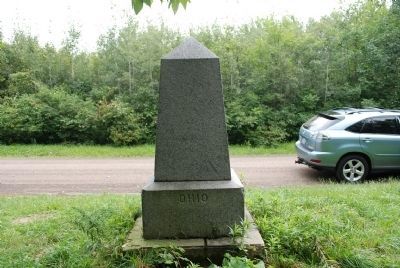
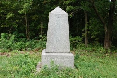
PA-OH Border Monument
Inscription.
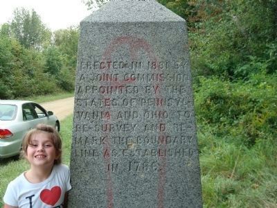
Erected in 1881 by a joint commission appointed by the states of Pennsylvania and Ohio to re-survey and re-mark the boundary line as established in 1786.
Erected 1881.
Topics. This historical marker and monument is listed in this topic list: Landmarks. A significant historical year for this entry is 1881.
Location. 41° 58.25′ N, 80° 31.16′ W. Marker is near Conneaut, Ohio, in Ashtabula County. Marker is on State Line Road, ¼ mile south of Lake Road. Touch for map. Marker is in this post office area: Conneaut OH 44030, United States of America. Touch for directions.
Other nearby markers. At least 8 other markers are within 3 miles of this marker, measured as the crow flies. The Western Reserve (approx. 1.7 miles away); a different marker also named The Western Reserve (approx. 1.9 miles away); Nickel Plate Road Berkshire Locomotive No. 755 (approx. 2½ miles away); Old Time Ball Signal (approx. 2½ miles away); Hopper Car and Caboose (approx. 2½ miles away); Conneaut Historical Railroad Museum (approx. 2½ miles away); Remembering Our Fallen Heroes (approx. 2.6 miles away); Conneaut Viaduct (approx. 2.6 miles away). Touch for a list and map of all markers in Conneaut.
More about this monument. There is some unfortunate graffiti on the marker itself.
Also see . . .
1. Mapping Pennsylvania’s Western Boundary . In 1878, a joint commission appointed by Ohio and Pennsylvania conducted a resurvey of the boundary between the two states. When the work was completed in 1882, two terminal monuments were erected on the line, one 2,400 feet south of Lake Erie and one 690 feet north of the Ohio River. Each monument consisted of an obelisk that measures 4.5 feet high and 28 inches square at the bottom and sits on a base that is 4 feet square and 21 inches high. (Submitted on November 4, 2009.)
2. Point of Beginning. A good background of the 1785 United States Survey of Public Lands and the dangers faced by Geographer of the United States Thomas Hutchins and his men. (Submitted on November 4, 2009.)
Credits. This page was last revised on June 16, 2016. It was originally submitted on November 4, 2009, by Mike Baker of Cambridge Springs, Pennsylvania. This page has been viewed 3,040 times since then and 79 times this year. Photos: 1. submitted on November 4, 2009, by Mike Baker of Cambridge Springs, Pennsylvania. 2, 3. submitted on September 6, 2011, by David Toetz of Parma, Ohio. • Kevin W. was the editor who published this page.


