Brandywine Park in Wilmington in New Castle County, Delaware — The American Northeast (Mid-Atlantic)
Lower Dam and North Short Millrace

Photographed By Devry Becker Jones (CC0), February 9, 2024
1. Lower Dam and North Short Millrace Marker
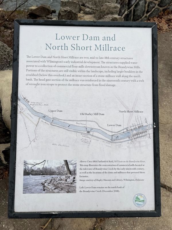
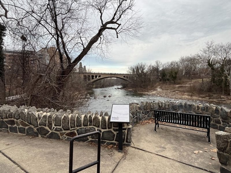
the Lower Dam and North Short Millrace are two, mid-to-late 18th century structures associated with Wilmington's early industrial development. The structures supplied water power to a collection of commercial flour mills downstream known as the Brandywine Mills. Portions of the structures are still visible within the landscape, including larger boulders in the creekbed (below this overlook) and an intact section of a stone millrace wall along the north bank. The head gate section of the millrace was reinforced in the nineteenth century with a web of wrought iron straps to protect the stone structure from the flood damage.
[Captions:]
Above: Circa 1816 Fairlamb & Reid, Mill Seats on the Brandywine River. This map illustrates the concentration of commercial mills located at the tidewater of Brandywine Creek by the early nineteenth century, as well as the locations of the dams and millraces that powered these factories.
Image courtesy of Hagley Museum and Library, Wilmington, Delaware
Left: Lower Dam remains on the north bank of the Brandywine Creek (December 2018).
Erected by Delaware Department of Natural Resources and Environmental Control.
Topics. This historical marker is listed in these topic lists: Industry & Commerce • Waterways & Vessels. A significant historical year for this entry is 1816.
Location. 39° 45.064′ N, 75° 32.838′ W. Marker is in Wilmington, Delaware, in New Castle County. It is in Brandywine Park. Marker is on South Park Drive east of North West Street, on the right when traveling west. Touch for map. Marker is at or near this postal address: 1420 N West St, Wilmington DE 19801, United States of America. Touch for directions.
Other nearby markers. At least 8 other markers are within walking distance of this marker. Looking Back… (here, next to this marker); Presbyterian Meeting House (within shouting distance of this marker); First Presbyterian Church (within shouting distance of this marker); McKinley (within shouting distance of this marker); Washington Street Bridge (about 400 feet away, measured in a direct line); Washington Memorial Bridge Centennial (about 500 feet away); Black Walnut (about 600 feet away); Jonathan P. Whitcomb Memorial Music Circle (about 600 feet away). Touch for a list and map of all markers in Wilmington.

Photographed By Devry Becker Jones (CC0), February 9, 2024
2. Lower Dam and North Short Millrace Marker
Credits. This page was last revised on February 9, 2024. It was originally submitted on February 9, 2024, by Devry Becker Jones of Washington, District of Columbia. This page has been viewed 49 times since then. Photos: 1, 2. submitted on February 9, 2024, by Devry Becker Jones of Washington, District of Columbia.