West Springfield in Hampden County, Massachusetts — The American Northeast (New England)
Hessian Encampment
Photographed by Bill Coughlin, November 2, 2009
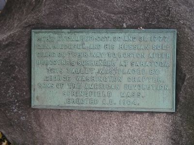
1. Hessian Encampment Marker
Erected 1904 by Sons of the American Revolition, George Washington Chapter.
Topics. This historical marker is listed in these topic lists: Notable Places • War, US Revolutionary. A significant historical year for this entry is 1777.
Location. 42° 6.419′ N, 72° 37.039′ W. Marker is in West Springfield, Massachusetts, in Hampden County. It is at the intersection of Park Avenue (Massachusetts Route 20) and Main Street, on the left when traveling east on Park Avenue. Touch for map. Marker is in this post office area: West Springfield MA 01089, United States of America. Touch for directions.

Regionally, this marker is in Massachusetts’ Knowledge Corridor, in Pioneer Valley, and in Greater Springfield. It is also in the American Northeast and in New England. Globally, it is in North America, the Western Hemisphere, the Western World, and the Anglosphere. Historically, it finds itself in what was once one of the original Thirteen Colonies.
Other nearby markers. At
this page online
Photographed by Bill Coughlin, November 2, 2009
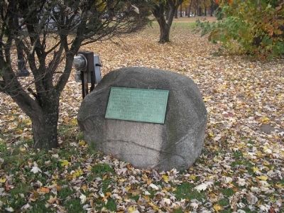
2. Marker in West Springfield
Photographed by Bill Coughlin, November 2, 2009
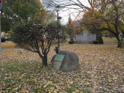
3. Hessian Encampment Marker
Credits. This page was last revised on July 23, 2020. It was originally submitted on November 4, 2009, by Bill Coughlin of Woodland Park, New Jersey. This page has been viewed 1,774 times since then and 48 times this year. Photos: 1, 2, 3. submitted on November 4, 2009, by Bill Coughlin of Woodland Park, New Jersey.
