Near Rutherfordton in Rutherford County, North Carolina — The American South (South Atlantic)
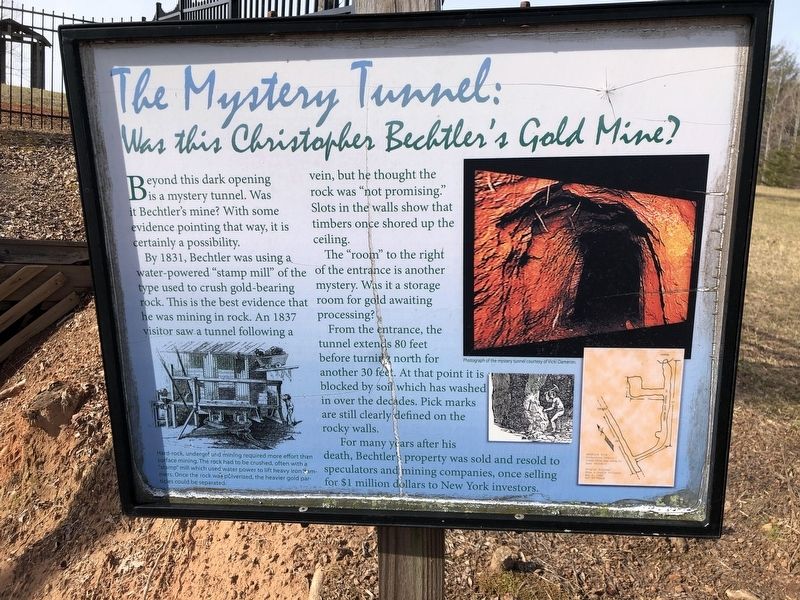
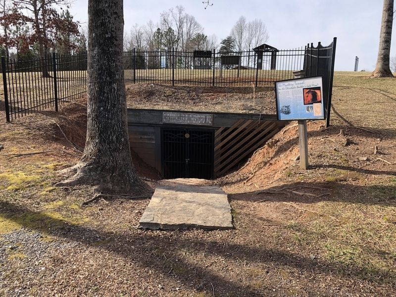
The Mystery Tunnel: Was This Christopher Bechtler's Gold Mine?
Photographed by Duane and Tracy Marsteller, February 4, 2024
1. The Mystery Tunnel: Was This Christopher Bechtler's Gold Mine? Marker
By 1831, Bechtler was using a water-powered “stamp mill” of the type used to crush gold-bearing rock. This is the best evidence that he was mining in rock. An 1837 visitor saw a tunnel following a vein, but he thought the rock was “not promising.” Slots in the walls show that timbers once shored up the ceiling.
The “room” to the right of the entrance is another mystery. Was it a storage room for gold awaiting processing?
From the entrance, the tunnel extends 80 feet before turning north for another 30 feet. At that point it is blocked by soil which has washed in over the decades. Pick marks are still clearly defined on the rocky walls.
For many years after his death, Bechtler's property was sold and resold to speculators and mining companies, once selling for $1 million dollars to New York investors.
[Caption] Hard-rock, underground mining required more effort than surface mining. The rock had to be crushed, often with a “stamp” mill which used water power to lift heavy iron hammers. Once the rock was pulverized, the heavier gold particles could be separated.
Topics.
this page online
Location. 35° 24.842′ N, 81° 58.204′ W. Marker is near Rutherfordton, North Carolina, in Rutherford County. It can be reached from Gilboa Church Road ¼ mile north of Gilmer Edwards Road (North Carolina Road 1526), on the right when traveling north. Marker is in Bechtler Mint Site Historic Park. Touch for map. Marker is at or near this postal address: 342 Gilboa Church Rd, Rutherfordton NC 28139, United States of America. Touch for directions.

Regionally, this marker is in North Carolina’s Mountains. It is also in the American South, specifically in the Upper South, in Appalachia, and specifically in Southern Appalachia. Globally, it is in North America, the Western Hemisphere, the Western World, and the Anglosphere. Historically, it finds itself in what was once the territory of the Mississippian Culture, one of the original Thirteen Colonies, one of the Confederate States of America, and the Antebellum South.
Other nearby markers. At least 8 other markers are within 3
Photographed by Duane and Tracy Marsteller, February 4, 2024
2. The Mystery Tunnel: Was This Christopher Bechtler's Gold Mine? Marker
Credits. This page was last revised on February 11, 2024. It was originally submitted on February 10, 2024, by Duane and Tracy Marsteller of Murfreesboro, Tennessee. This page has been viewed 569 times since then and 63 times this year. Photos: 1, 2. submitted on February 10, 2024, by Duane and Tracy Marsteller of Murfreesboro, Tennessee.
