Smithfield/Four Courts in Dublin in County Dublin, Leinster, Ireland — Mid-East (and Dublin)
Hammond Lane & Church Street
A synopsis of the archaeology
By Colm Moriarty
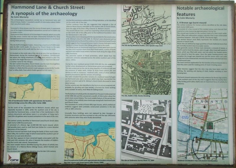
The archaeological excavations carried out at Hammond Lane and Church Street, Dublin 7 revealed a wealth of information about Dublin city's very first north-siders.
Excavated in three phases over the course of seven years, it represents one of the largest archaeological excavations carried out in Dublin city in modern times.
It uncovered deep deposits of archaeological material, which unusually in a city centre context had not been extensively truncated by deep Georgian and Victorian basements (the area had not been re-developed during the periods).
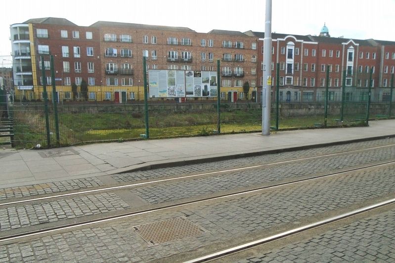
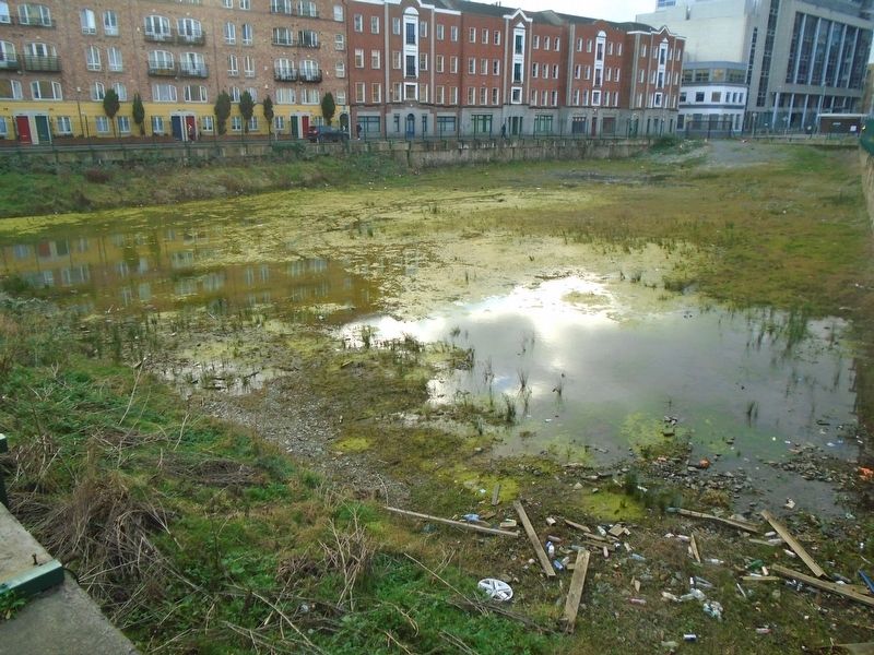
The site itself is triangular in plan, measuring a maximum of 120m east-west by 60m north-south. It is bound by Church Street to the east, Hammond Lane to the south and the Red Luas Line to the north.
It is located on the north side of the city in an area that was known as Oxmanstown during the medieval period. In tradition, Oxmanstown was where the Viking inhabitants of Dublin were evicted to after the city fell to the Anglo-Normans in 1170 (Oxmen or 'men from the east' is another name for the Vikings).
The site's eastern boundary, Church Street, was the main thoroughfare from the north of the country into the medieval city. Indeed, it is likely that this ancient route way gave access to the 'hurdle ford' or átha cliath, from which Dublin gained its Irish name.
[First column map caption reads]
Site of Scandinavian Dublin with approximate site location, ford and bridge across the Liffey (after Clarke 1988)
To the north of the excavation lies St Michan's church, which was reputedly founded in 1095, while the southern end of the site is bounded by Hammond lane, a street that is first mentioned in 15th century documents and whose name is a corruption of Hang man's Lane (the city gallows were located somewhere to the west of the site).
The earliest activity identified at Hammond Lane/Church Street dates back nearly 4,000 thousand years. It consisted of a Bronze Age (2,500-500 BC) burnt mound, which had possibly been used to cook food (see below for a more detailed discussion of this feature). The burnt mound had been built along the banks of then much wider River Liffey, the northern edge of which traversed the southern part of the site in an east-west direction.
The site then appears to have remained largely unoccupied until the 11th and 12th centuries AD, when it became the location of Dublin's very first north-side suburb, Oxmanstown. The most notable feature identified during this phase of activity was the remains of a Hiberno-Norse (Viking) house, which fronted onto Church Street. This structure was radiocarbon dated to circa the late 11th century. It is the first conclusive evidence for a Viking habitation so far identified on the north side of the river.
Further evidence from the site suggested that originally a line of Hiberno-Norse houses extended up the eastern side of Church Street, from the edge of the River Liffey towards St. Michan's Church. This would indicate that a small but expanding suburb already existed on the north side of the Liffey prior to the traditional foundation date for Oxmanstown in AD 1170. This would be more in keeping with the reputed date for the construction of St. Michan's church in AD 1095. St. Michan's was obviously built to serve a local community and the evidence from Hammond Lane/Church Street suggests that these parishioners lived in houses that were nearly identical to those found in the Viking walled city to the south.
The Viking houses at Hammond Lane/Church Street were built close to the river and to protect them from flash flood events, a series of banks and post-and-wattle break waters had been built along the edge of the Liffey foreshore. This extensive system of flood protection, which dated from the 11th/12th centuries extended across the entire southern part of the site (c. 120m).
During the later medieval period (1169-1550 AD) the site underwent further urban development as Oxmanstown grew and prospered.
This was evidenced on the site by deep deposits of medieval soils and the presence of water wells, timber & stone lined rubbish pits and latines as well as numerous medieval walls, some of which defined
property boundaries and the remains of buildings. The walls included the possible remains of a medieval tower/toll gate on Hammond Lane and a structure which may have represented the southern precinct wall of St. Michan's church (both discussed in more detail below).
Further activity was also identified in the form [of] an animal powered mill, probably for grinding corn (see below), a furnace for metal working and a number of ovens, most likely for baking bread.
The final phase of activity at the site dated from the post medieval period (1550-1900 AD) and this uncovered a wealth of information about the area's more recent history. The most notable feature of this period was the creation of an entirely new streetscape along both Hammond Lane and Church Street. This consisted of a series of Dutch Billy type houses, which artefactual evidence suggests were probably constructed sometime in the late 17th or 18th centuries.
Unusually these buildings were not replaced by later Georgian or Victorian structures and they survived on-site until the late 19th/20th centuries when they were finally demolished.
[Second column bottom map caption reads]
Site
of Scandinavian Dublin with approximate site location and present day river course and street layout (after Simms 1988)
[Third column top map caption reads]
The site during Medieval Dublin, John Speed's map 1610
[Third column middle map caption reads]
The site, Dublin 1728, Charles Brooking
[Third column bottom map caption reads]
The site on Ordinance Survey Sheet 13, 1864
Notable archaeological features
By Colm Moriarty
1. A Bronze age burnt mound
The evidence for human activity identified at the site dates back nearly 4,000 years. It consists of a low mound of fire-cracked stones and charcoal that covered an area measuring approximately 4.5m by 5m. This mound was located on the northern bank of a then much wider River Liffey and radiocarbon analysis indicates that it was constructed sometime between 1920 and 1730 BC (The Bronze Age). This ancient feature most likely representes the remains of a burnt mound or fulacht fiadh.
These sites are defined by large quantities of heat shattered stone that are normally located close to a water source. They generally consist of three main elements: a mound of stones, a hearth used to heat the stones, and a trough, often lined with wood or stone, which was filled with water and into which the heated stones were placed to heat the water Once the water heating process was complete the trough was cleaned out and the stones were cast aside giving rise to the characteristic mound of burnt stones and charcoal seen at Hammond Lane. The most common explanation for the function of burnt mound sites is that they were used for cooking joints of meat in boiling water.
Other theories suggest that the sites may also have been used for bathing, the washing and dyeing of cloth, leather working or even brewing beer. This burnt mount represents the only evidence for Bronze Age activity in the northern part of the city and it suggests that the nearby River Liffey fording point (átha cliath) was an important focus of activity for millenia.
[Map caption reads]
Medieval and Modern map and ancient riveshoreline
[Second Panel]
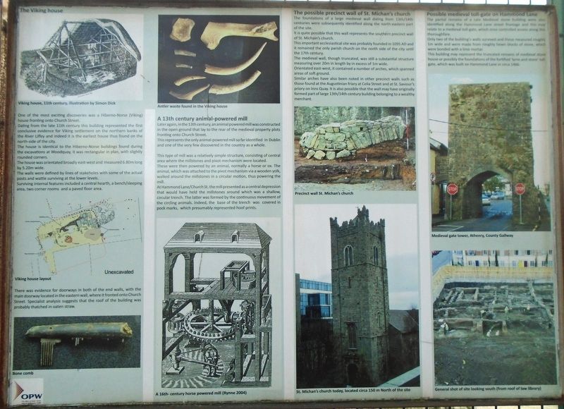
The Viking house
[Image caption reads]
Viking house, 11th century illustration by Simon Dick
One of the most exciting discoveries was a Hiberno-Norse (Viking) house fronting onto Church Street. Dating from the late 11th century this building represented the first conclusive evidence for Viking settement on the northern banks of the River Liffey and indeed it is the earliest house thus found on the north-side of the city. The house is identical to the Hiberno-Norse buildings found during the excavations at Woodguay, it was rectangular in plan, with slightly rounded corners. The house was orientated broadly east-west and measured 6.80m long by 5.20m wide. The walls were defined by lines of stakeholes with some of the actual posts and wattle surviving at the lower levels. Surviving internal features included a central hearth, a bench/sleeping area, two corner rooms and a paved floor area.
[Illustration caption reads] Viking house layout
There was evidence for doorways in both of the end walls, with the main doorway located in the eastern wall, where it fronted onto Church Street. Specialist analysis suggests that the roof of the building was probably thatched in oaten straw.
[Photo caption reads] Bone comb
[Second column top photo caption reads]
Antler waste found in the Viking house
A 13th century animal-powered mill
Later again, in the 13th century, an animal powered mill was constructed in the open ground that lay to the rear of the medieval property plots fronting onto Church Street. This represents the only animal-powered mill so far identified in Dublin and one of the very few discovered in the country as a whole.
This type of mill was a relatively simple structure, consisting of central area where the millstones and pivot mechanism were located. These were then powered by an animal, normally a horse or ox. The animal, which was attached to the pivot mechanim via a wooden yolk, walked around the millstones in a circular motion, thus powering the mill.
At Hammond Lane/Church St. the mill presented as a central depression that would have held the millstones around which was a shallow, circular trench. The latter was formed by the continuous movement of the circling animals. Indeed, the base of the trench was covered in pock marks, which presumably represented hoof prints.
[Illustration caption reads]
A 16th century horse powered mill (Rynne 2004)
The possible precinct wall of St. Michan's church
The foundations of a large medieval wall dating from 13th/14th centuries were subsequently identified along the north-eastern part of the site. It is quite possible that this wall represents the southern precinct wall of St. Michan's church. This important ecclesiastical site was probably founded in 1095 AD and it remained the only parish church on the north side of the city until the 17th century.
The medieval wall, though truncated, was a substantial structure measuring over 20m in length by in excess of 1m wide. Orientated east-west, it contained a number of anches, which spanned areas of soft ground. Similar arches have also been noted in other precinct walls such as those found at the Augustinian friary at Celia Street and at St. Saviour's priory on Inns Quay. It is also possible that the wall may have originally formed part of [a] large 13th/14th century building belonging to a wealthy merchant.
[Photo captions read]
Precinct wall St. Michan's church
St. Michan's church today, located circa 150m North of the site
Possible medieval toll-gate on Hammond Lane
The partial remains of a Late Medieval stone building were also identified along the Hammond Lane street frontage and this may relate to a medieval toll-gate, which once controlled access along this thoroughfare. Only two of the building's walls survived and these measured roughly 1m wide and were made from roughly hewn blocks of stone, which were bonded with a lime mortar. This building may represent the truncated remains of [a] medieval stone house or possibly the foundations of the fortified 'lyme and stone' toll-gate, which was built on Hammond Lane in circa 1466.
[Photo captions read]
Medieval gate tower, Athenry, County Gallway
General shot of site looking south (from roof of law library)
Erected by Office of Public Works/Oifig na n-Oibreacha Poiblí.
Topics. This historical marker is listed in these topic lists: Anthropology & Archaeology • Settlements & Settlers.
Location. 53° 20.822′ N, 6° 16.516′ W. Marker is in Dublin, Leinster, in County Dublin. It is in Smithfield/Four Courts. Marker is at the intersection of Church Street (National Route 1) and the Luas tram line, on the right when traveling south on Church Street. Touch for map. Marker is at or near this postal address: 158-159 Church Street, Dublin, Leinster D07 F3P6, Ireland. Touch for directions.
Other nearby markers. At least 8 other markers are within walking distance of this marker. Smithfield History / Stair Smithfield (about 210 meters away, measured in a direct line); Smithfield Utah (about 210 meters away); Padre Pio (about 210 meters away); Four Courts Garrison / Garastún na gCiethre Cúirteanna (approx. 0.2 kilometers away); Mendicity Institution Garrison / Garastún Institiúid Deirciochta (approx. 0.4 kilometers away); Site of St Olave's Church / Láthair Eaglais Amhlaoibh (approx. half a kilometer away); First Performance of Handel's Messiah (approx. half a kilometer away); James Clarence Mangan (approx. half a kilometer away). Touch for a list and map of all markers in Dublin.
Credits. This page was last revised on February 13, 2024. It was originally submitted on February 13, 2024, by William Fischer, Jr. of Scranton, Pennsylvania. This page has been viewed 132 times since then. Photos: 1, 2, 3, 4. submitted on February 13, 2024, by William Fischer, Jr. of Scranton, Pennsylvania.


