Patagonia in Santa Cruz County, Arizona — The American Mountains (Southwest)
Patagonia Depot
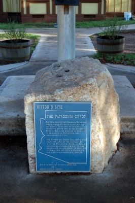
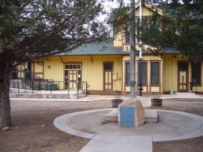
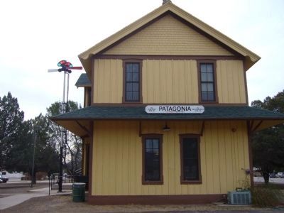
The Patagonia depot building dates from the turn of the century. In 1965 the Patagonia-Sonoita Rotary Club saved it from demolition and began a continuing effort to save it. Since 1974 the City of Patagonia has been using it for municipal offices.
Erected by City of Patagonia and Patagonia Rotary Club, and Arizona Historical Society.
Topics and series. This historical marker is listed in these topic lists: Notable Buildings • Railroads & Streetcars. In addition, it is included in the Rotary International, and the Southern Pacific Railroad series lists. A significant historical year for this entry is 1897.
Location. 31° 32.432′ N, 110° 45.19′ W. Marker is in Patagonia, Arizona, in Santa Cruz County. Marker is on McKeown Avenue near 3rd Avenue. Marker is located just a few feet south of old railroad depot mounted on a locally-quarried granite stone. Touch for map. Marker is in this post office area: Patagonia AZ 85624, United States of America. Touch for directions.
Other nearby markers. At least 8 other markers are within 14 miles of this marker, measured as the crow flies. Mowry Mine (within shouting distance of this marker); Cady Hall (about 700 feet away, measured in a direct line); John Ward's Ranch (approx. 3.3 miles away); Camp Crittenden (approx. 8.8 miles away); Sonoita Quarter Horse Show and Races (approx. 11 miles away); Little Outfit School (approx. 11 miles away); Mission Guevavi (approx. 12.6 miles away); Boy Scout Memorial (approx. 13.9 miles away). Touch for a list and map of all markers in Patagonia.
Also see . . . Patagonia Heritage Tile Mural Project 2009. A blog publishing local working group "digging into" the People, Places & Progress to commemorate Arizona State Centennial 1912-2012 (Submitted on November 5, 2009, by Tim Mello of Patagonia, Arizona.)
Additional keywords. Southern Pacific Railroad
Credits. This page was last revised on June 16, 2016. It was originally submitted on November 5, 2009, by Tim Mello of Patagonia, Arizona. This page has been viewed 2,061 times since then and 50 times this year. Photos: 1. submitted on November 5, 2009, by Tim Mello of Patagonia, Arizona. 2. submitted on November 7, 2009, by Tim Mello of Patagonia, Arizona. 3, 4, 5. submitted on January 31, 2010, by Bill Kirchner of Tucson, Arizona. • Kevin W. was the editor who published this page.


