The Loop District in Chicago in Cook County, Illinois — The American Midwest (Great Lakes)
Old Colony Building
Holabird and Roche, architect; 1893-94
| — | Chicago Landmark | — |
Photographed by Sean Flynn, February 14, 2024
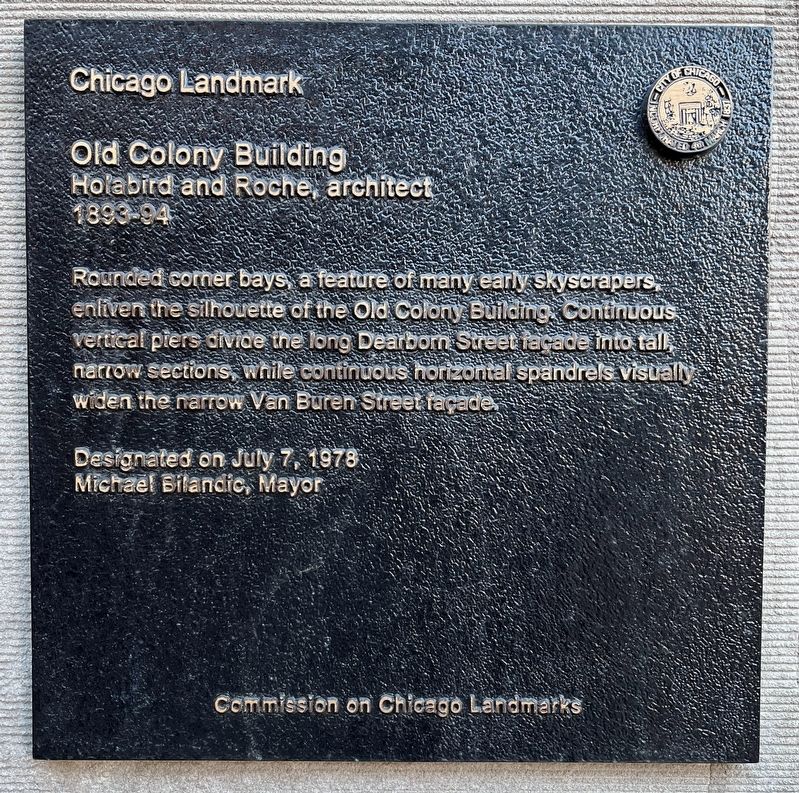
1. Old Colony Building Marker
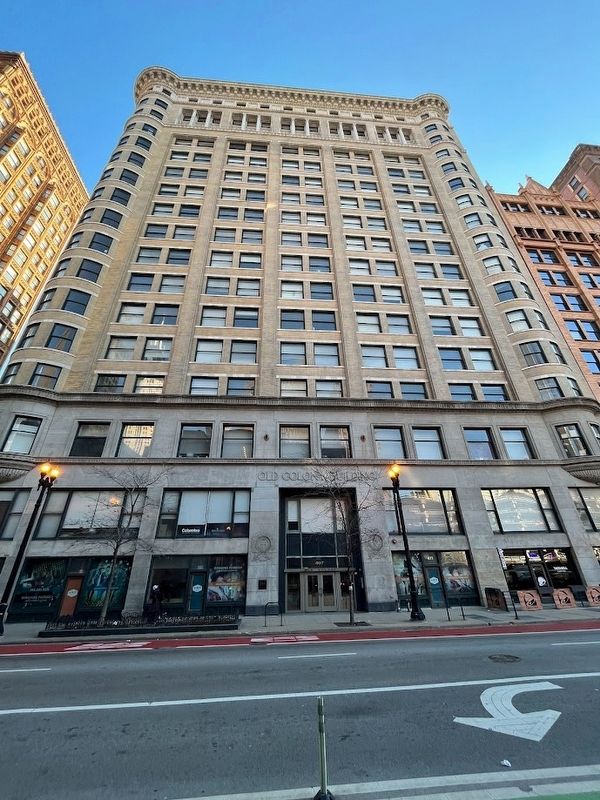
Rounded corner bays, a feature of many early skyscrapers, enliven the silhouette of the Old Colony Building. Continuous vertical piers divide the long Dearborn Street façade into tall, narrow sections, while continuous horizontal spandrels visually widen the narrow Van Buren Street façade.
Designated on July 7, 1978
Michael Bilandic, Mayor
Erected 1978 by Commission on Chicago Landmarks; City of Chicago.
Topics and series. This historical marker is listed in this topic list: Architecture. In addition, it is included in the Illinois, Chicago Landmarks Commission series list. A significant historical year for this entry is 1893.
Location. 41° 52.599′ N, 87° 37.745′ W. Marker is in Chicago, Illinois, in Cook County. It is in The Loop District. It is on South Dearborn Street south of Van Buren Street. The marker is to the left of the Old Colony Building's Dearborn Street entrance. Touch for map. Marker is at or near this postal address: 407 South Dearborn Street, Chicago IL 60605, United States of America. Touch for directions.

Regionally, this marker is in the American Midwest. Globally, it is in North America,
this page online
Other nearby markers. At least 8 other markers are within walking distance of this marker: A different marker also named Dearborn Street (within shouting distance of this marker); Fisher Building (within shouting distance of this marker); Robert Williams (about 300 feet away, measured in a direct line); Harold Washington (about 400 feet away); Leiter II Building (about 400 feet away); State Street (about 500 feet away); The Morton Building / Hotel Blake (about 600 feet away); The DePaul Center (about 700 feet away). Touch for a list and map of all markers in Chicago.
Another marker is no longer nearby. Dearborn Street (was within shouting distance of this marker but has been confirmed missing).
More about this marker. Based on Google Maps Street View, the marker was posted in its current location sometime after 2021. However, the marker displays some signs of wear related
Photographed by Sean Flynn, February 14, 2024
2. Old Colony Building
Also see . . .
1. Old Colony Building. Chicagology website entry (Submitted on February 14, 2024, by Sean P. Flynn of Oak Park, Illinois.)
2. The Arc at Old Colony. Wikipedia entry (Submitted on April 7, 2024, by Larry Gertner of New York, New York.)
Historic American Buildings Survey (Library of Congress), circa 1964
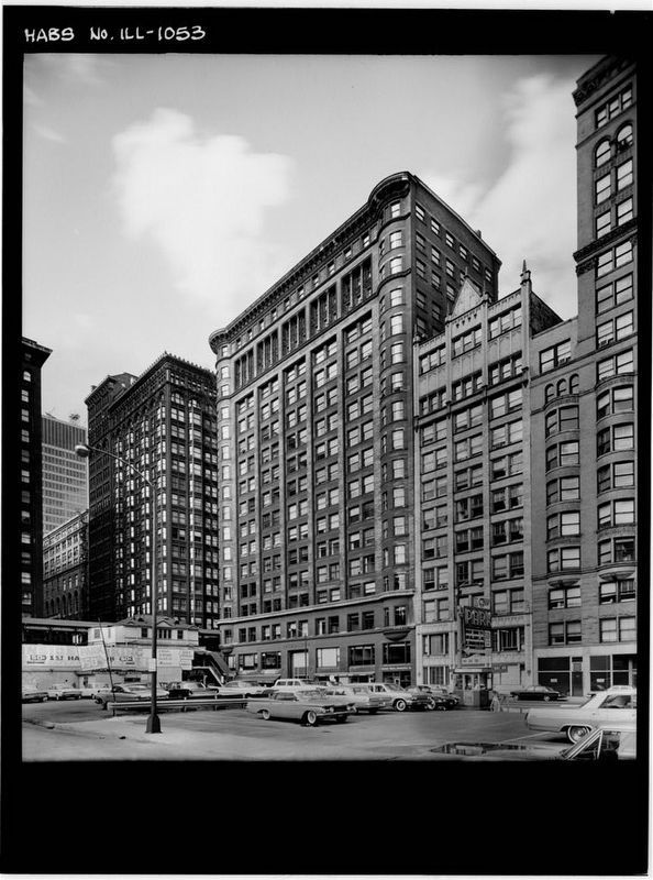
3. Old Colony Building
According to the Library of Congress, this photo was taken by photographer Harold Allen on May 24, 1964. The foreground remains a parking lot today, and the Plymouth Building to its immediate right and the Manhattan Building next to that are both still in existence.
Credits. This page was last revised on April 7, 2024. It was originally submitted on February 14, 2024, by Sean P. Flynn of Oak Park, Illinois. This page has been viewed 485 times since then and 44 times this year. Photos: 1, 2, 3. submitted on February 14, 2024, by Sean P. Flynn of Oak Park, Illinois.
