Minot in Ward County, North Dakota — The American Midwest (Upper Plains)
June 22, 2011
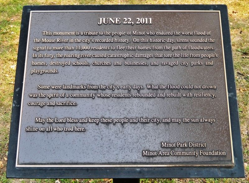
This monument is a tribute to the people of Minot who endured the worst flood of the Mouse River in the city's recorded history. On this historic day, sirens sounded the signal to more than 11,000 residents to flee their homes from the path of floodwaters. In its fury, the roaring river caused catastrophic damages that tore the life from people's homes destroyed schools, churches and businesses, and ravaged city parks and playgrounds.
Some were landmarks from the city's early days. What the flood could not drown was the spirit of a community whose residents rebounded and rebuilt with resiliency, courage and sacrifice.
May the Lord bless and keep these people and their city, and may the sun always shine on all who trod here.
Erected by Minot Park District, Minot Area Community Foundation.
Topics. This historical marker is listed in these topic lists: Disasters • Waterways & Vessels. A significant historical date for this entry is June 22, 2011.
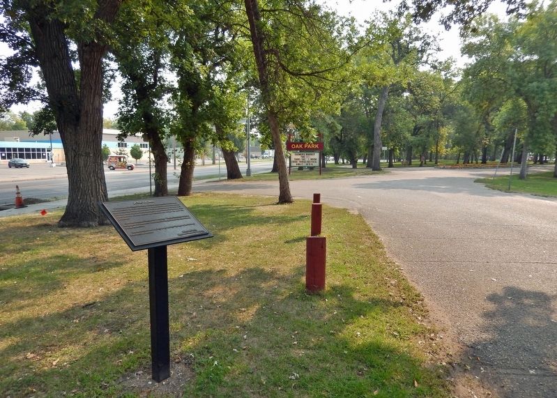
Location. 48° 14.393′ N, 101° 18.862′ W. Marker is in Minot, North Dakota, in Ward County. Marker can be reached from 4th Avenue Northwest, 0.2 miles east of 16th Street Northwest, on the right when traveling east. The marker is located beside the park road on the north side of Oak Park, just north of the main parking lot. Touch for map. Marker is at or near this postal address: 1300 4th Avenue Northwest, Minot ND 58703, United States of America. Touch for directions.
Other nearby markers. At least 8 other markers are within 2 miles of this marker, measured as the crow flies. Eastwood Park (approx. 1.7 miles away); First Lieutenant Orville Emil Bloch (approx. 1.8 miles away); ☆ Private First Class Henry Gurke (approx. 1.8 miles away); ☆ Private Nels Wold (approx. 1.8 miles away); Staff Sergeant Jack J. Pendleton (approx. 1.8 miles away); ☆ Lieutenant Colonel Fred E. Smith (approx. 1.8 miles away); Master Sergeant Woodrow Wilson Keeble (approx. 1.8 miles away); Commander Willis Winter Bradley, Jr. (approx. 1.8 miles away). Touch for a list and map of all markers in Minot.
Also see . . .
1. 2011 Souris River Flood (Wikipedia). Excerpt:
The 2011 Souris/Mouse River flood in Canada and the United States occurred in June and was greater than a hundred-year flooding event for the river. The US Army Corps of Engineers estimated the flood to have a recurrence interval of two to five centuries. The flooding affected Saskatchewan and North Dakota; notably in Minot, where it overtopped levees and caused the evacuation of about 11,000 residents. The flooding in Minot was worse than the 1969 and 1881 floods; many other towns along the river were affected and many acres of farmland were inundated. On June 24, the Souris River exceeded record flood levels at Minot. By June 26, all hydrographs on the Souris from the North Dakota side had recorded record-breaking flood levels, with the exception of Lake Darling, which was less than 0.2 ft from record stage.(Submitted on February 14, 2024, by Cosmos Mariner of Cape Canaveral, Florida.)
2. Historic Flooding along the Souris River (Earth Observatory). Excerpt:
Overnight on June 25–26, 2011, the Souris River reached the highest level on record at Minot, North Dakota. The river crested at 1,561.72 feet above sea level, according to the Advanced Hydrological Prediction Service (AHPS). This was well over the record level of 1,558 feet set in 1881. By June 24, 2011, a quarter of the city’s residents had been displaced, the Grand Forks Herald reported.(Submitted on February 14, 2024, by Cosmos Mariner of Cape Canaveral, Florida.)
Credits. This page was last revised on February 14, 2024. It was originally submitted on February 14, 2024, by Cosmos Mariner of Cape Canaveral, Florida. This page has been viewed 49 times since then. Photos: 1, 2. submitted on February 14, 2024, by Cosmos Mariner of Cape Canaveral, Florida.

