North City in Dublin in County Dublin, Leinster, Ireland — Mid-East (and Dublin)
Nelson and the Spire / Nelson agus an Túr Solais
The General Post Office and Nelson's Pillar in 1820
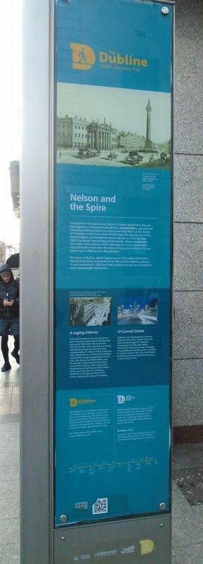
Nelson and the Spire
Long before the spectacular Spire of Dublin stood here this site belonged to a famous British admiral. Nelson's Pillar was erected following Admiral Nelson's victory over Napoleon at the Battle of Trafalgar in the days when Dublin was the second city of the British Empire. Its foundation stone was laid on 21st October 1809, the fourth anniversary of the battle. When completed, the public were able to climb 168 steps to enjoy a panoramic view of Dublin from near the top of the granite column. It was blown up in 1966 by Irish Republicans.
The Spire of Dublin, which reaches up to 120 metres (394 feet) above street level, is believed to be the world's tallest sculpture. It was completed in 2003 and has quickly become one of Dublin's most recognisable landmarks.
[Photo caption reads]
The ruins of the Imperial Hotel and Clery's following the 1916 Easter Rising.
A raging inferno
O'Connell Street and the various streets that intersect it sustained terrible damage during the 1916 Easter Rising and the 1922-3 Civil War, when pro and anti-Treaty Republicans found themselves on the opposite sides of a bitter conflict following Irish independence. In 1916 British shelling caused fires to rage through much of the area. Like the General Post Office, only the façade of Clery's department store survived the inferno, while Liberty Hall, headquarters of James Connolly's Citizen Army, was destroyed. An interactive exhibition in the General Post Office further explores the story of the Rising.
O'Connell Street
Dublin's main thoroughfare is named after the 'Liberator', Daniel O'Connell, who led the struggle for Catholic emancipation in the early 1800s. One of the widest streets in Europe, it is considered to be the centre of Dublin. It contains some of the city's most historic buildings and monuments and serves as a vital transport hub.
The Dubline Dublin Discovery Trail
The Dubline is an orientation route and the easiest way to explore many of the city's most visited sites. Along the route, discover the stories that shaped Dublin and trace the timeline of our city from its origins to the present day. Explore at your leisure the hidden gems along the way.
For more information please visit:
www.VisitDublin.com
Dublin Discovery Trails
Explore Dublin's hidden
treasures with a self-guided walk. Download the app at www.dublindiscoverytrails.com or from the nearby Visit Dublin Centre. Please follow the QR codes below for more information.
Rebellion Trail
To explore the extraordinary story of the 1916 Easter Rising follow the Rebellion walking trail through Dublin city centre.
[Timeline not transcribed]
Radharc ar Ard-Oifig an Phoist agus Colún Nelson, Sráid Sackville, Baile Átha Cliath
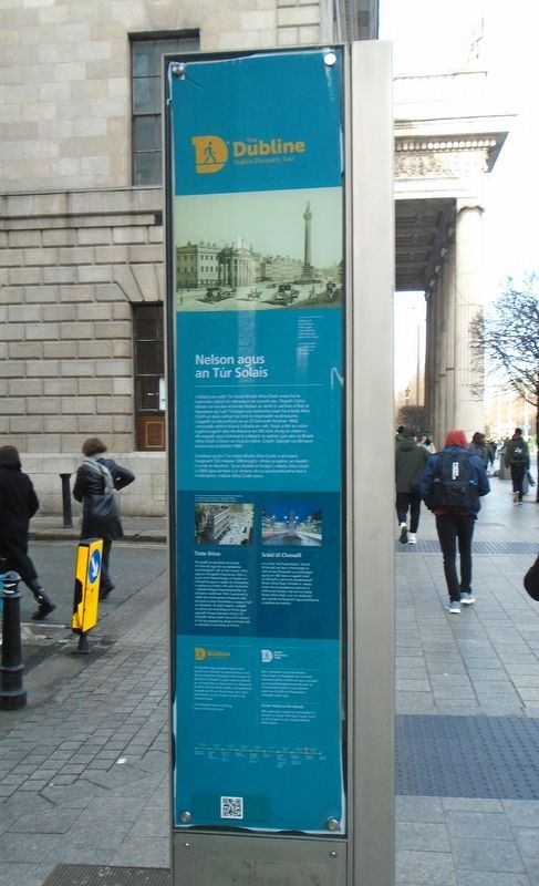
Nelson agus an Túr Solais
I bhfad sula raibh Túr Solais Bhaile Átha Cliath anseo ba le haimiréal cáiliúil ón mBreatain an suíomh seo. Tógadh Colún Nelson tar éis don Aimiréal Nelson an lámh in uachtar a fháil ar Napoleon ag Cath Trafalgar sna laethanta nuair ba é Baile Átha Cliath an dara cathair ba mhó in Impireacht na Breataine. Leagadh an bhunchloch ar an 21 Deireadh Fómhair 1809, comóradh ceithre bliana ó tharla an cath. Nuair a bhí an colún tógtha tugadh deis do dhaoine an 168 céim chuig an mbarr a dhreapadh agus taitneamh a bhaint as radharc gan sárú ar Bhaile Átha Cliath ó bharr an cholúin eibhir. Chaith Óglaigh na hÉireann buama leis sa bhliain 1966.
Creidtear gurb é Túr Solais Bhaile Átha Cliath, a shíneann beagnach 120 méadar (394 troigh) i dtreo na spéire,
an dealbh
is airde ar domhan. Tá an dealbh le feiceáil i mBaile Átha Cliath
ó 2003 agus áirítear é ar cheann de na sainchomharthaí tíre is
inaitheanta i mBaile Átha Cliath anois.
[Léann fotheideal an ghrianghraif]
Rinneadh an-damáiste do Shráid Ui Chonaill agus do na sráideanna mórthimpeall i rith an Éirí Amach 1916 agus an Chogaidh Chathartha 1922-3, nuair a bhí Poblachtaigh ar thaobh an Chonartha agus in éadan an Chonartha in adharca a chéile i rith cath fíochmhar i ndiaidh fhógairt Neamhspleáchas na hÉireann. Sa bhliain 1916, tuairgneáil a raibh arm na Breataine freagrach aisti ba chúis le tinte fiochmhara a scaip ar fud an cheantair. Ní raibh fágtha i ndiaidh na dtinte ach Ard-Oifig an Phoist agus aghaidh shiopa ilrannach Clery's. Tá tuilleadh eolais maidir leis an Éirí Amach le fáil ag taispeántas idirghníomhach atá á reáchtáil in Ard-Oifig an Phoist.
Sráid Uí Chonaill
Is in onóir 'An Fuascailteoir', Daniel O'Connell, an fear a threoraigh an cath ar son Fhuascailt na gCaitliceach ag tús an 18ú haois a tugadh Sráid Uí Chonaill ar phríomh-chosbhealach Bhaile Átha Cliath. Áirítear é i measc ceann de na sráideanna cathrach is leithne san Eoraip, mar aon le croilár Bhaile Átha Cliath. Is ar an tsráid seo atá cuid de na foirgnimh agus leachtanna is stairiúla sa chathair.
Is treochlár agus bealach éasca chun teacht ar chuid de na suíomhanna is mó tóir sa chathair é Dubline. Má leanann tú Dubline ní bheidh tú gan tuiscint mhaith ar na heachtraí ar fad a bhí mar bhonn le forbairt Bhaile Átha Cliath ó na laethanta tosaigh go dtí atá inniu ann. Bain taitneamh as na hiontais ar fad ar do shuaimhneas.
Tá tuilleadh eolais le fáil ag
Dublin Discovery Trails
Conair Shiúil an Éirí Amach
Más spéis leat imeachtaí dochreidte Éirí Amach na Cásca 1916 lean Conair Shiúil an Éirí Amach trí lár chathair Bhaile Átha Cliath.
[Níl amlíne tras-scríofa]
Erected by The Dubline Dublin Discovery Trail.
Topics. This historical marker is listed in these topic lists: Architecture • Patriots & Patriotism • Wars, Non-US. A significant historical year for this entry is 1809.
Location. 53° 20.94′ N, 6° 15.614′ W. Marker is in Dublin, Leinster, in County Dublin. It is in North City. Marker is on O'Connell Street Upper, on the left when traveling north. Touch for map. Marker is at or near this postal address: 39 O'Connell Street Upper, Dublin, Leinster D01 PY90, Ireland. Touch for directions.
Other nearby markers. At least 8 other markers are within walking distance of this marker. Jim Larkin (a few steps from this marker); Sir John Gray, Kn[igh]t. MD. JP. (within shouting distance of this marker); The Oval Bar (within shouting distance of this marker); Captain Thomas Joseph Wafer (within shouting distance of this marker); William Smith O'Brien (about 90 meters away, measured in a direct line); Independent House (about 90 meters away); Ireland's First Radio Broadcast (about 90 meters away); Wynn's Hotel Dublin (about 120 meters away). Touch for a list and map of all markers in Dublin.
Also see . . . The Dubline Trail. (Submitted on February 14, 2024, by William Fischer, Jr. of Scranton, Pennsylvania.)
Credits. This page was last revised on February 15, 2024. It was originally submitted on February 14, 2024, by William Fischer, Jr. of Scranton, Pennsylvania. This page has been viewed 44 times since then. Photos: 1, 2, 3. submitted on February 14, 2024, by William Fischer, Jr. of Scranton, Pennsylvania.


