Temple Bar in Dublin in County Dublin, Leinster, Ireland — Mid-East (and Dublin)
St. Winifred's Well
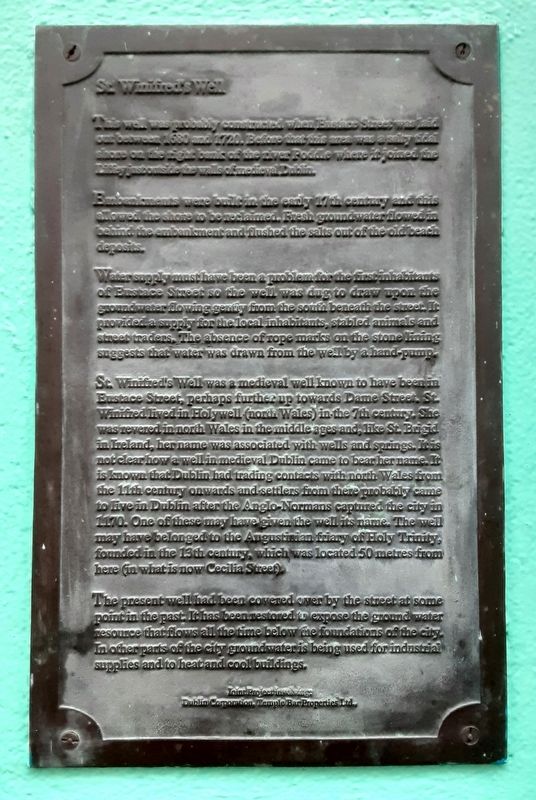
This well was probably constructed when Eustace Street was laid out between 1680 and 1720. Before that this area was a salty tidal shore on the right bank of the river Poddle where it joined the Liffey just outside the walls of medieval Dublin.
Embankments were built in the early 17th century and this allowed the shore to be reclaimed. Fresh groundwater flowed in behind the embankment and flushed the salts out of the old beach deposits.
Water supply must have been a problem for the first inhabitants of Eustace Street so the well was dug to draw upon the groundwater flowing gently from the south beneath the street. It provided a supply for the local inhabitants, stabled animals and street traders. The absence of rope marks on the stone lining suggests that water was drawn from the well by a hand-pump.
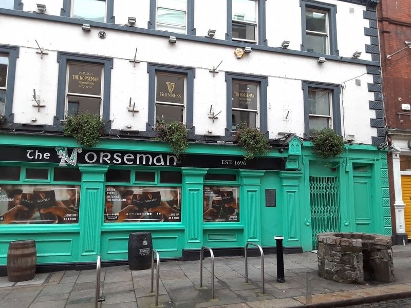
St. Winifred's Well was a medieval well known to have been in Eustace Street, perhaps further up towards Dame Street. St. Winifred lived in Holywell (north Wales) in the 7th century. She was revered in north Wales in the middle ages and, like St. Brigid in Ireland, her name was associated with wells and springs. It is not clear how a well in medieval Dublin came to bear her name. It is known that Dublin had trading contacts with north Wales from the 11th century onwards and settlers from there probably came to live in Dublin after the Anglo-Normans captured the city in 1170. One of these may have given the well its name. The well may have belonged to the Augustinian friary of Holy Trinity, founded in the 13th century, which was located 50 metres from here (in what is now Cecilia Street).
The present well had been covered over by the street at some point in the past. It has been restored to expose the ground water resource that flows all the time below the foundations of the city. In other parts of the city groundwater is being used for industrial supplies and to heat and cool buildings.
Dublin Corporation, Temple Bar Properties Ltd.
Erected by Dublin Corporation and Temple Bar Properties Ltd.
Topics. This historical marker is listed in these topic lists: Settlements & Settlers • Waterways & Vessels. A significant historical year for this entry is 1680.
Location. 53° 20.719′ N, 6° 15.888′ W. Marker is in Dublin, Leinster, in County Dublin. It is in Temple Bar. Marker is at the intersection of Eustace Street and Eustace Street, on the right when traveling north on Eustace Street. Touch for map. Marker is at or near this postal address: 28E Essex Street East, Dublin, Leinster D02 F729, Ireland. Touch for directions.
Other nearby markers. At least 8 other markers are within walking distance of this marker. Sergeant Stephen Kelly and Constable Patrick Keena (a few steps from this marker); The Norseman (a few steps from this marker); Sir William Temple (within shouting distance of this marker); Frederick Douglass (within shouting distance of this marker); Liffey Bridge (about 150 meters away, measured in a direct line); Castle Hall (approx. 0.3 kilometers away); First Performance of Handel's Messiah (approx. 0.3 kilometers away); Veronica Guerin (approx. 0.3 kilometers away). Touch for a list and map of all markers in Dublin.
Also see . . . Saint Winifred at Wikipedia. (Submitted on February 15, 2024, by William Fischer, Jr. of Scranton, Pennsylvania.)
Credits. This page was last revised on February 15, 2024. It was originally submitted on February 15, 2024, by William Fischer, Jr. of Scranton, Pennsylvania. This page has been viewed 54 times since then. Photos: 1, 2. submitted on February 15, 2024, by William Fischer, Jr. of Scranton, Pennsylvania.

