East Bank in Nashville in Davidson County, Tennessee — The American South (East South Central)
Nashville Bridge Company
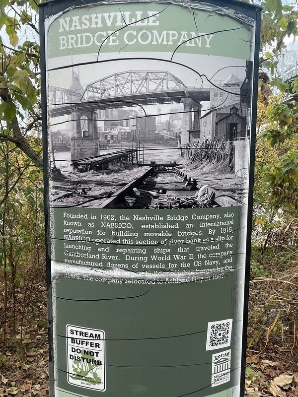
Photographed by Darren Jefferson Clay, October 29, 2023
1. Nashville Bridge Company Marker
Erected by Metro Parks Nashville.
Topics. This historical marker is listed in this topic list: Bridges & Viaducts. A significant historical year for this entry is 1902.
Location. 36° 9.756′ N, 86° 46.269′ W. Marker is in Nashville, Tennessee, in Davidson County. It is in East Bank. It can be reached from Victory Avenue near S 1st Street. The marker is located along the riverfront trail in Cumberland Park. Touch for map. Marker is at or near this postal address: 2 Victory Ave, Nashville TN 37213, United States of America. Touch for directions.

Regionally, this marker is in Middle Tennessee. It is also in the American South and specifically in the Upper
this page online
Other nearby markers. At least 8 other markers are within walking distance of this marker: Shelby Street Bridge (within shouting distance of this marker); Surrender of Nashville East Bank of the Cumberland (about 700 feet away, measured in a direct line); Demonbreum's Cave (about 700 feet away); Gateway Bridge (approx. 0.2 miles away); Cumberland River Floods (approx. 0.2 miles away); Sampson W. Keeble (approx. 0.2 miles away); 100 Second Avenue (approx. ¼ mile away); The First Peoples (approx. ¼ mile away). Touch for a list and map of all markers in Nashville.

Photographed by Darren Jefferson Clay, October 29, 2023
2. Nashville Bridge Company Marker
Credits. This page was last revised on February 17, 2024. It was originally submitted on February 16, 2024, by Darren Jefferson Clay of Duluth, Georgia. This page has been viewed 544 times since then and 92 times this year. Photos: 1, 2. submitted on February 16, 2024, by Darren Jefferson Clay of Duluth, Georgia. • James Hulse was the editor who published this page.
