Confederation Park B in Hamilton, Ontario — Central Canada (North America)
The Shipwrecks of Confederation Park
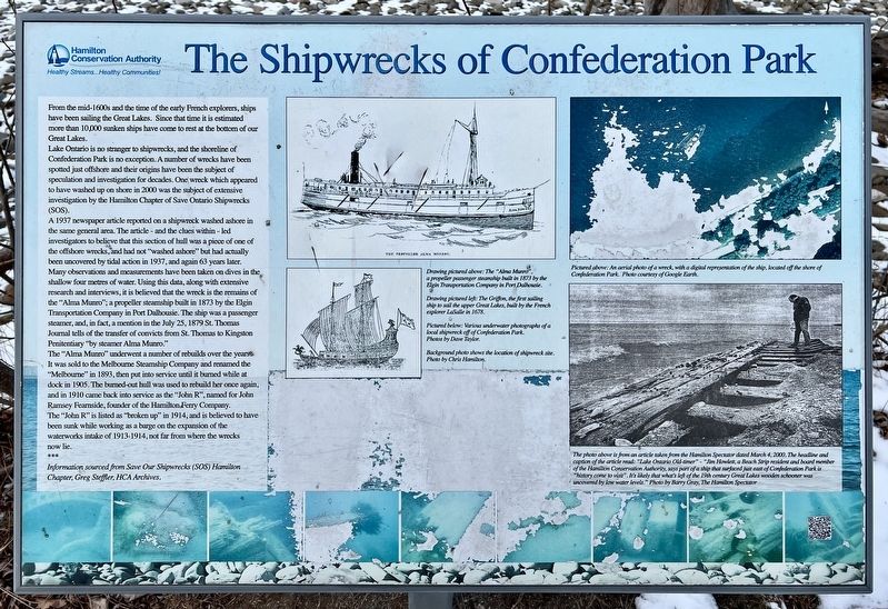
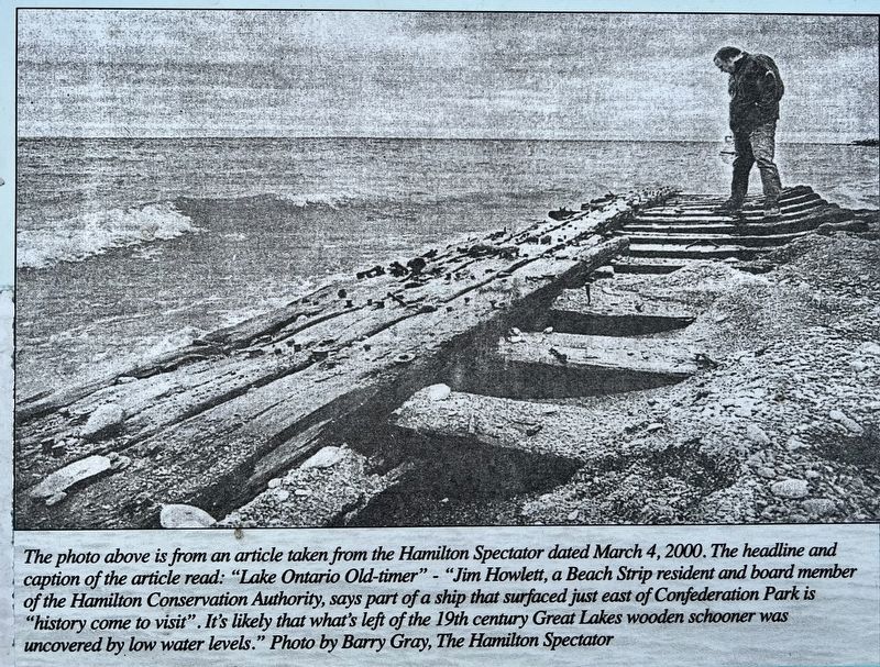
Lake Ontario is no stranger to shipwrecks, and the shoreline of Confederation Park is no exception. A number of wrecks have been spotted just offshore and their origins have been the subject of speculation and investigation for decades. One wreck which appeared to have washed up on shore in 2000 was the subject of extensive investigation by the Hamilton Chapter of Save Ontario Shipwrecks (SOS).
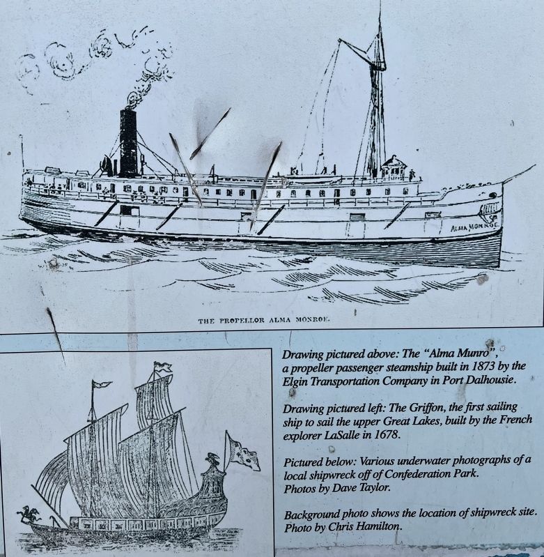
A 1937 newspaper article reported on a shipwreck washed ashore in the same general area. The article - and the clues within - led investigators to believe that this section of hull was a piece of one of the offshore wrecks, and had not "washed ashore" but had actually been uncovered by tidal action in 1937, and again 63 years later. Many observations and measurements have been taken on dives in the shallow four metres of water. Using this data, along with extensive research and interviews, it is believed that the wreck is the remains of the "Alma Munro"; a propeller steamship built in 1873 by the Elgin Transportation Company in Port Dalhousie. The ship was a passenger steamer, and, in fact, a mention in the July 25, 1879 St. Thomas Journal tells of the transfer of convicts from St. Thomas to Kingston Penitentiary "by steamer Alma Munro."
The "Alma Munro" underwent a number of rebuilds over the years. It was sold to the Melbourne Steamship Company and renamed the "Melbourne" in 1893, then put into service until it burned while at dock in 1905. The burned-out hull was used to rebuild her once again, and in 1910 came back into service as the "John R" , named for John Ramsey Fearnside, founder of the Hamilton Ferry Company.
The "John R" is listed as "broken up" in 1914, and is believed to have been sunk while working as a barge on the expansion of the waterworks intake of 1913-1914, not far from where the wrecks now lie.
***
Information sourced from Save Our Shipwrecks (SOS) Hamilton Chapter, Greg Steffler, HCA Archives.
Erected by Hamilton Conservation Authority.
Topics. This historical marker is listed in this topic list: Waterways & Vessels. A significant historical date for this entry is July 25, 1879.
Location. 43° 14.703′ N, 79° 44.485′ W. Marker is in Hamilton, Ontario. It is in Confederation Park B. Marker is on Waterfront Trail, on the right when traveling north. The marker location on the Waterfront Trail is accessible from the Confederation Park parking lot, off the Lake Ave. North entrance from Confederation Drive (approx. 450 metres). Touch for map. Marker is at or near this postal address: Waterfront Trail, Hamilton ON L8E L8E, Canada. Touch for directions.
Other nearby markers. At least 8 other markers are within 5 kilometers of this marker, measured as the crow flies. Discovery of Hamilton and Scourge (approx. one kilometer away); Hamilton - Scourge Project (approx. one kilometer away); Hamilton & Scourge (approx. one kilometer away); Government House (King’s Head Inn) (approx. 2.6 kilometers away); The Hamilton Waterworks/ La Station de Pompage de Hamilton (approx. 2.8 kilometers away); Augustus Jones (C. 1757-1836) (approx. 3.3 kilometers away); The Battlefield of Stoney Creek (approx. 3.5 kilometers away); Jimmy Howard (approx. 3.5 kilometers away). Touch for a list and map of all markers in Hamilton.
Credits. This page was last revised on February 21, 2024. It was originally submitted on February 20, 2024, by Tim Boyd of Hamilton, Ontario. This page has been viewed 62 times since then. Photos: 1, 2, 3, 4. submitted on February 20, 2024, by Tim Boyd of Hamilton, Ontario. • Andrew Ruppenstein was the editor who published this page.


