Near Kennesaw in Cobb County, Georgia — The American South (South Atlantic)
Eyes for the Armies
| — | Kennesaw Mountain National Battlefield Park | — |
September 26, 2023
1. Eyes for the Armies Marker
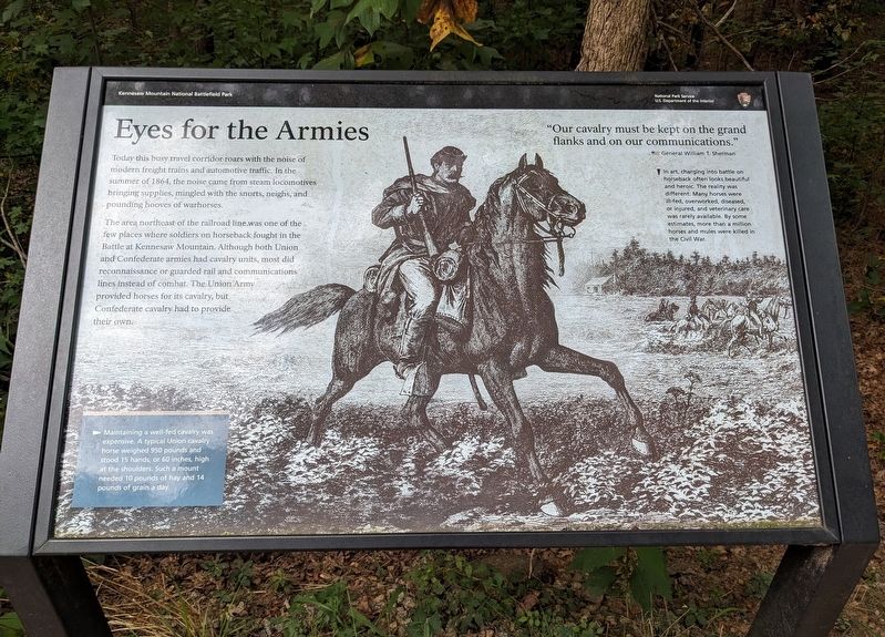
The area northeast of the railroad line was one of the few places where soldiers on horseback fought in the Battle at Kennesaw Mountain. Although both Union and Confederate armies had cavalry units, most did reconnaissance or guarded rail and communications lines instead of combat. The Union Army provided horses for its cavalry, but Confederate cavalry had to provide their own.
"Our cavalry must be kept on the grand flanks and on our communications."
— General William T. Sherman
(caption) In art, charging into battle on horseback often looks beautiful and heroic. The reality was different: Many horses were ill-fed, overworked, diseased, or injured, and veterinary care was rarely available. By some estimates, more than a million horses and mules were killed in the Civil War.
(caption) Maintaining a well-fed cavalry was expensive. A typical Union cavalry horse weighed 950 pounds and stood 15 hands, or 60 inches, high at the shoulders. Such a mount needed 10 pounds of hay and 14 pounds of grain a day.
Erected by National
this page online
Topics. This historical marker is listed in these topic lists: Animals • Railroads & Streetcars • War, US Civil. A significant historical year for this entry is 1864.
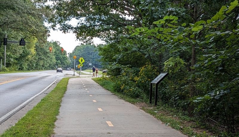
Location. 33° 59.084′ N, 84° 34.699′ W. Marker is near Kennesaw, Georgia, in Cobb County. It is on Old 41 Highway NW west of Stilesboro Road NW, on the right when traveling east. Touch for map. Marker is in this post office area: Kennesaw GA 30152, United States of America. Touch for directions.

Regionally, this marker is in Georgia’s Piedmont and in Metro Atlanta. It is also in the American South and specifically in the Deep South. Globally, it is in North America, the Western Hemisphere, the Western World, and the Anglosphere. Historically, it finds itself in what was once the original Cherokee Nation, the territory of the Mississippian Culture, one of the original Thirteen Colonies, one of the Confederate States of America, and the Antebellum South.
Other nearby markers. At least 8 other markers are within walking distance of this marker: Peachtree Trail (within shouting distance of this
September 26, 2023
2. Eyes for the Armies Marker
Another marker is no longer nearby. Clash at Kennesaw (was about 600 feet away but has been replaced with another marker now near it).
Also see . . . Kennesaw Mountain National Battlefield Park. National Park Service (Submitted on February 22, 2024.)
Credits. This page was last revised on February 22, 2024. It was originally submitted on February 21, 2024. This page has been viewed 308 times since then and 35 times this year. Photos: 1, 2. submitted on February 21, 2024. • Bernard Fisher was the editor who published this page.
