West Pennsboro Township near Carlisle in Cumberland County, Pennsylvania — The American Northeast (Mid-Atlantic)
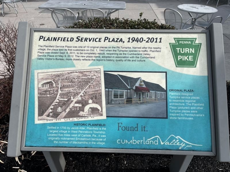
Plainfield Service Plaza, 1940-2011
Penna Turnpike
— Found it. Cumberland Valley PA —

Photographed By Devry Becker Jones (CC0), February 24, 2024
1. Plainfield Service Plaza, 1940-2011 Marker
The Plainfield Service Plaza was one of 10 original plazas on the PA Turnpike. Named after the nearby village, the plaza saw its first customers on Oct. 1, 1940 when the Turnpike opened to traffic. Plainfield Plaza was closed Sept. 6, 2011, to be completely rebuilt, reopening as the Cumberland Valley Service Plaza on May 9, 2012. The new plaza name, adopted in association with the Cumberland Valley Visitor's Bureau, more closely reflects the region's history, qualify of life and culture.
[Captions:]
Historic Plainfield: Settled in 1793 by Jacob Alter, Plainfield is the largest village in West Pennsboro Township. Located five miles west of Carlisle, Pa., it was originally nicknamed Smoketown because of the number of blacksmiths in the village.
Original Plaza: Planners designed Turnpike service plazas to resemble regional architecture. The Plainfield Plaza (pictured) and other Turnpike plazas were inspired by Pennsylvania's stone farmhouses.
Topics. This historical marker is listed in these topic lists: Architecture • Industry & Commerce • Roads & Vehicles • Settlements & Settlers. A significant historical date for this entry is May 9, 2012.
Location. 40° 12.317′ N, 77° 17.276′ W. Marker is near Carlisle, Pennsylvania, in Cumberland County. It is in West Pennsboro Township. Marker is on Pennsylvania Turnpike (Interstate 76) east of Cumberland Highway (Pennsylvania Route 997), on the right when traveling east. The marker stands on the grounds of the Cumberland Valley Service Plaza. Touch for map. Marker is in this post office area: Carlisle PA 17015, United States of America. Touch for directions.
Other nearby markers. At least 8 other markers are within 5 miles of this marker, measured as the crow flies. 9/11 Memorial (approx. 2˝ miles away); Veterans Memorial (approx. 2.6 miles away); Frederick Watts (1801-1889) (approx. 2.9 miles away); Joseph Ritner (approx. 3.6 miles away); Forbes Road (approx. 4 miles away); Carlisle (approx. 4 miles away); Gettysburg Campaign (approx. 4˝ miles away); The Charles Nisbet Campus of Dickinson College (approx. 4.8 miles away). Touch for a list and map of all markers in Carlisle.

Photographed By Devry Becker Jones (CC0), February 24, 2024
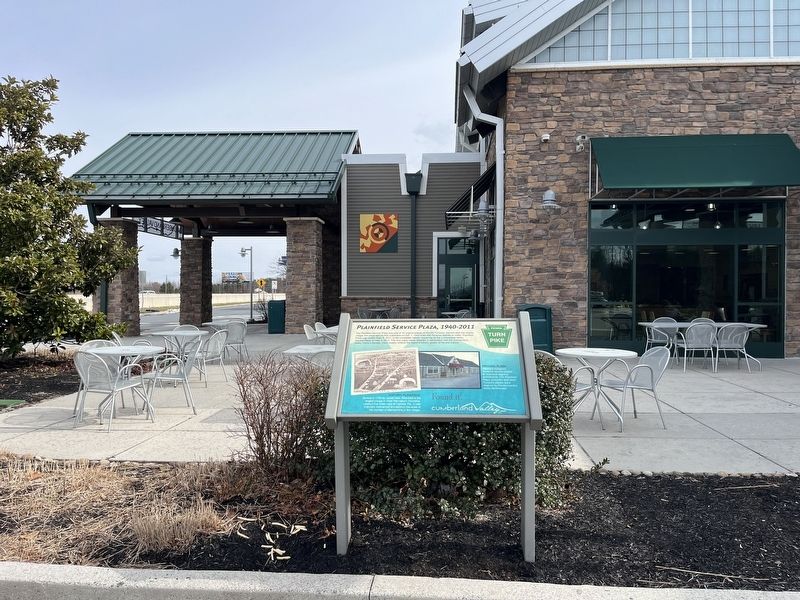
2. Plainfield Service Plaza, 1940-2011 Marker
Credits. This page was last revised on February 24, 2024. It was originally submitted on February 24, 2024, by Devry Becker Jones of Washington, District of Columbia. This page has been viewed 34 times since then. Photos: 1, 2. submitted on February 24, 2024, by Devry Becker Jones of Washington, District of Columbia.