Natchez in Natchitoches Parish, Louisiana — The American South (West South Central)
Cook's Cabin to Fishing Camp
Photographed by Cajun Scrambler, July 2, 2023
1. Cook's Cabin to Fishing Camp Marker
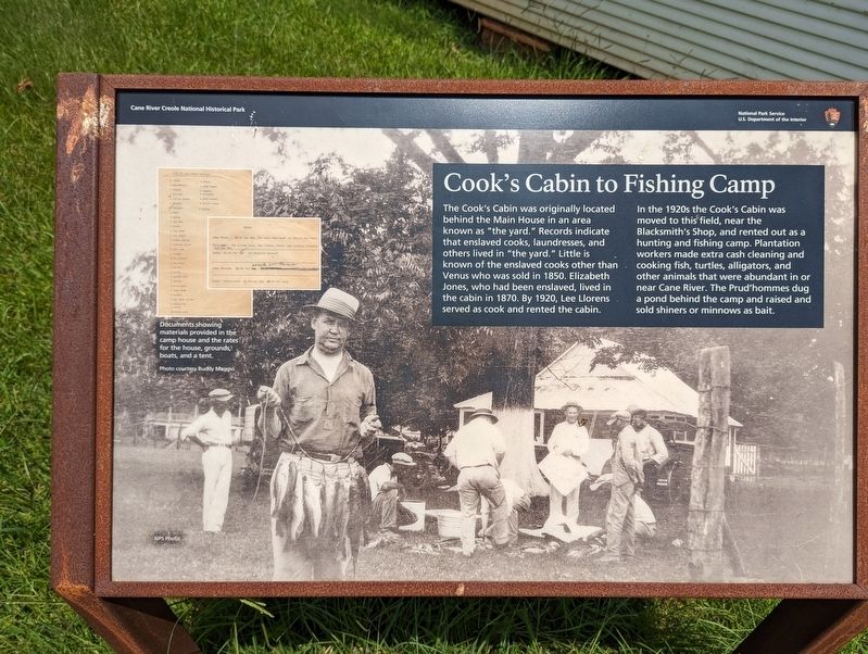
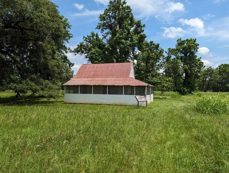
The Cook's Cabin was originally located behind the Main House in an area known as "the yard." Records indicate that enslaved cooks, laundresses, and others lived in "the yard." Little is known of the enslaved cooks other than Venus who was sold in 1850. Elizabeth Jones, who had been enslaved, lived in the cabin in 1870. By 1920, Lee Llorens served as cook and rented the cabin.
In the 1920s the Cook's Cabin was moved to this field, near the Blacksmith's Shop, and rented out as a hunting and fishing camp. Plantation workers made extra cash cleaning and cooking fish, turtles, alligators, and other animals that were abundant in or near Cane River. The Prud'hommes dug a pond behind the camp and raised and sold shiners or minnows as bait.
Erected by National Park Sevice.
Topics. This historical marker is listed in this topic list: Settlements & Settlers.
Location. 31° 39.98′ N, 93° 0.106′ W. Marker is in Natchez, Louisiana, in Natchitoches Parish. It can be reached from the intersection of State Highway 494 and State Highway 119. Touch for map. Marker
this page online

Regionally, this marker is in Central Louisiana. It is also in the American South, specifically in the Deep South, and in the Piney Woods. Globally, it is in North America, a Gulf of Mexico state, the Western Hemisphere, the Western World, and the Anglosphere. Historically, it finds itself in what was once New Spain, the Viceroyalty of New France, the territory of the Mississippian Culture, the Louisiana Purchase, one of the Confederate States of America, and the Antebellum South.
Other nearby markers. At least 8 other markers are within walking distance of this marker: How Do You Say Pecan (within shouting distance of this marker); Working Iron (within shouting distance of this marker); A Canopied Path (about 300 feet away, measured in a direct line); The Oak Allée & Bottle Garden (about 300 feet away); Creole Architecture (about 300 feet away); The Enslaved Nanny's Room (about 400 feet away); Merchandise and Mail (about 500 feet away); The Sound of Time (about 500 feet away). Touch for a list and map of all markers in
Photographed by Cajun Scrambler, July 2, 2023
2. Cook's Cabin to Fishing Camp Marker
More about this marker. Located on the grounds of the Oakland Plantation, part of the Cane River Creole National Historic Park
Credits. This page was last revised on February 25, 2024. It was originally submitted on February 25, 2024, by Cajun Scrambler of Assumption, Louisiana. This page has been viewed 153 times since then and 37 times this year. Photos: 1, 2. submitted on February 25, 2024, by Cajun Scrambler of Assumption, Louisiana.
