Greenwood Township near Millerstown in Perry County, Pennsylvania — The American Northeast (Mid-Atlantic)
Millerstown Transportation
A Transportation Hub
— Perry County Bicentennial 1820-2020 —
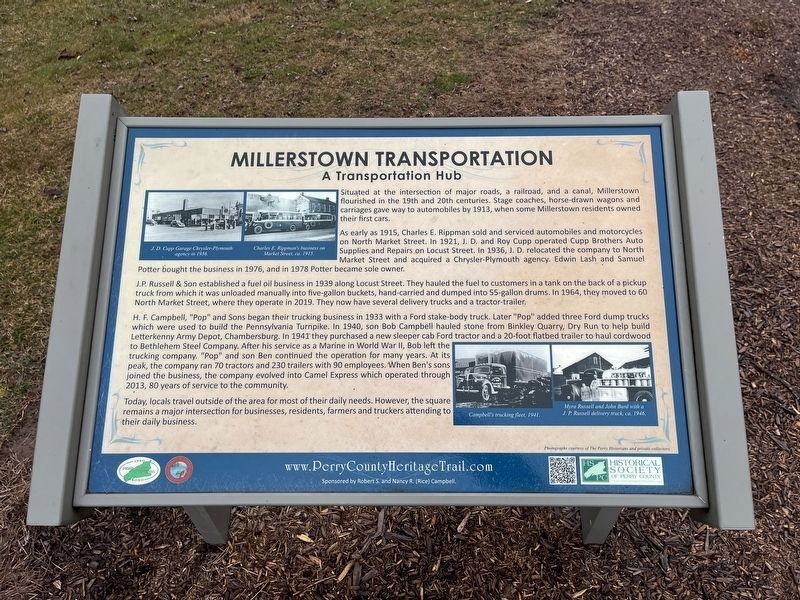
Situated at the intersection of major roads, a railroad, and a canal, Millerstown flourished in the 19th and 20th centuries. Stage coaches, horse-drawn wagons and carriages gave way to automobiles by 1913, when some Millerstown residents owned their first cars.
As early as 1915, Charles E. Rippman sold and serviced automobiles and motorcycles on North Market Street. In 1921, J. D. and Roy Cupp operated Cupp Brothers Auto Supplies and Repairs on Locust Street. In 1936, J. D. relocated the company to North Market Street and acquired a Chrysler-Plymouth agency. Edwin Lash and Samuel Potter bought the business in 1976 and, and in 1978 Potter became sole owner.
J.P. Russell & Son established a fuel oil business in 1939 along Locust Street. They hauled the fuel to customers in a tank on the back of a pickup truck from which it was unloaded manually into five-gallon buckets, hand-carried and dumped into 55-gallon drums. In 1964, they moved to 60 North Market Street, where they operate in 2019. They now have several delivery trucks and a tractor-trailer.
H. F. Campbell, "Pop" and Sons began their trucking business in 1933 with a Ford stake-body truck. Later "Pop" added three Ford dump trucks which were used to build the Pennsylvania Turnpike. In 1940, son Bob Campbell hauled stone from Binkley Quarry, Dry Run to help build to Bethlehem Steel Company. AFter his service as a Marine in World War II, Bob left the trucking company. "Pop" and son Ben continued the operation for many years. At its peak, the company ran 70 tractors and 230 trailers with 90 employees. When Ben's sons joined the business, the company evolved into Camel Express which operated through 2013, 80 years of service to the community.
Today, locals travel outside of the area for most of their daily needs. However, the square remains a major intersection for businesses, residents, farmers and truckers attending to their daily business.
Erected 2019 by Borough of Millerstown; Historical Society of Perry County.
Topics and series. This historical marker is listed in these topic lists: Industry & Commerce • Roads & Vehicles. In addition, it is included in the Perry County Heritage Trail in Pennsylvania. series list. A significant historical year for this entry is 1913.
Location. 40° 32.24′ N, 77° 8.819′ W. Marker is near Millerstown, Pennsylvania, in Perry County. It is in Greenwood Township. Marker is on West Juniata Parkway (County Road 1015) north of Perry Valley Road, on the right when traveling south. The marker stands on the grounds of Millerstown Area Community Park. Touch for map. Marker is in this post office area: Millerstown PA 17062, United States of America. Touch for directions.
Other nearby markers. At least 8 other markers
Credits. This page was last revised on February 25, 2024. It was originally submitted on February 25, 2024, by Devry Becker Jones of Washington, District of Columbia. This page has been viewed 41 times since then. Photos: 1, 2. submitted on February 25, 2024, by Devry Becker Jones of Washington, District of Columbia.

