
Near Pleasant Plains in Sangamon County, Illinois — The American Midwest (Great Lakes)
Clayville Tavern
Photographed by Larry Senalik, August 7, 2009
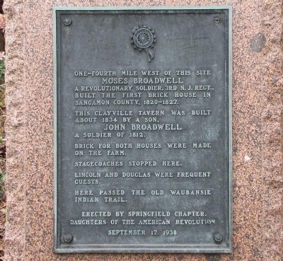
1. Clayville Tavern Marker
Moses Broadwell
A revolutionary soldier, 3rd N.J. Regt., built the first brick house in Sangamon County, 1820-1827.
This Clayville Tavern was built about 1834 by a son, John Broadwell, a soldier of 1812. Brick for both houses were made on the farm.
Stagecoaches stopped here.
Lincoln and Douglas were frequent guests.
Here passed the old Waubansie Indian Trail.
Erected 1938 by Springfield Chapter, Daughters of the American Revolution (DAR).
Topics and series. This historical marker is listed in these topic lists: Industry & Commerce • Settlements & Settlers. In addition, it is included in the Daughters of the American Revolution (DAR) series list. A significant historical date for this entry is September 17, 1988.
Location. 39° 52.009′ N, 89° 53.793′ W. Marker is near Pleasant Plains, Illinois, in Sangamon County. It is on Illinois Route 125 close to Clayville Road. Touch for map. Marker is in this post office area: Pleasant Plains IL 62677, United States of America. Touch for directions.

Regionally, this marker is in Central Illinois and in Greater Springfield. It is
this page online
Other nearby markers. At least 8 other markers are within 6 miles of this marker, measured as the crow flies: Clayville (a few steps from this marker); Peter Cartwright (approx. 1.2 miles away); Mentor Graham (approx. 5.9 miles away); The Wayside Hawthorn (approx. 6 miles away); New Salem (approx. 6 miles away); Sangamon River (approx. 6 miles away); Historic Tree (approx. 6 miles away); Prairie Land (approx. 6 miles away). Touch for a list and map of all markers in Pleasant Plains.
Another marker is no longer nearby. Lincoln’s Store Partner (was approx. 4.9 miles away but has been confirmed missing).
Also see . . . Clayville Historical Site. Website homepage (Submitted on January 1, 2011, by Larry Senalik of Pleasant Plains, Illinois.)
Photographed by Larry Senalik, August 7, 2009
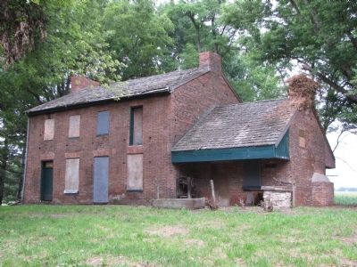
2. Clayville Tavern
Photographed by Larry Senalik, July 3, 2010
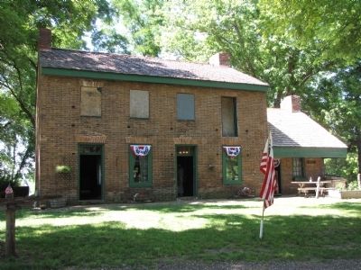
3. Clayville Tavern
As it appeared on July 3, 2010. A new roof has been installed.
Credits. This page was last revised on February 2, 2026. It was originally submitted on December 27, 2010, by Larry Senalik of Pleasant Plains, Illinois. This page has been viewed 1,145 times since then and 31 times this year. Last updated on February 26, 2024, by Carolyn Sanders of Plano, Texas. Photos: 1, 2, 3. submitted on December 27, 2010, by Larry Senalik of Pleasant Plains, Illinois. • Devry Becker Jones was the editor who published this page.
